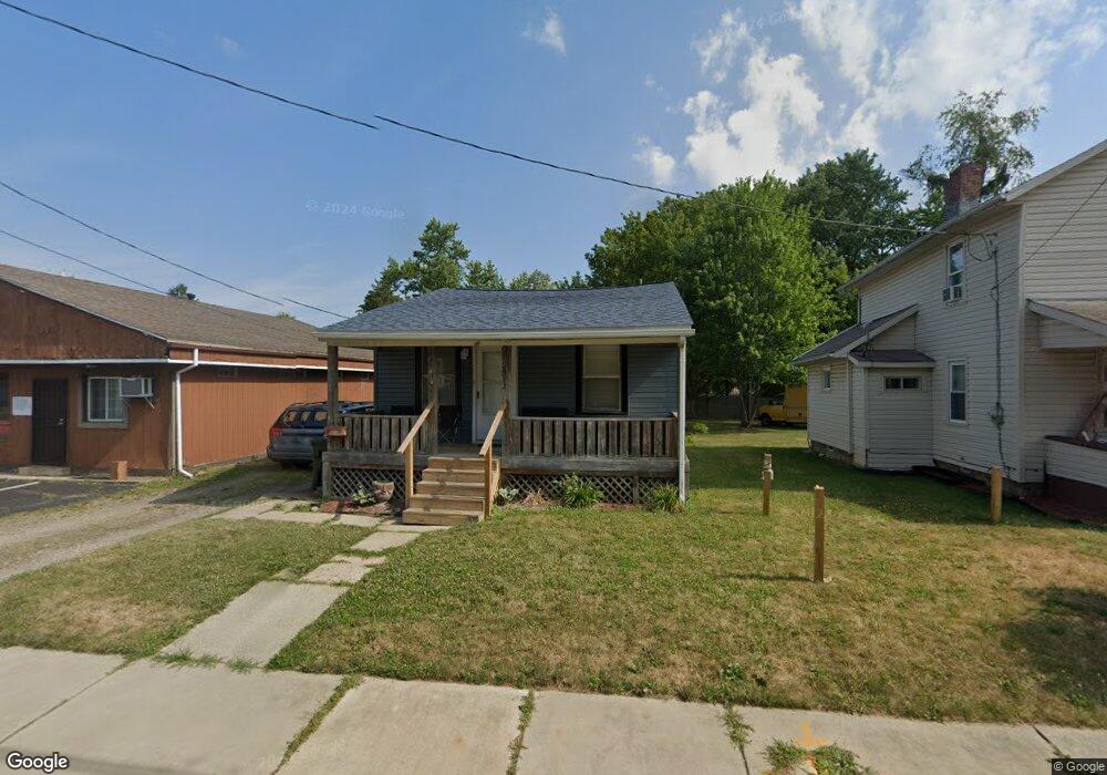
2013 25th St NE Canton, OH 44705
Fairmount NeighborhoodEstimated Value: $50,000 - $70,000
2
Beds
1
Bath
680
Sq Ft
$87/Sq Ft
Est. Value
About This Home
This home is located at 2013 25th St NE, Canton, OH 44705 and is currently estimated at $59,354, approximately $87 per square foot. 2013 25th St NE is a home located in Stark County with nearby schools including Belle Stone Elementary School, Early Learning Center @ Schreiber, and Youtz Intermediate School.
Ownership History
Date
Name
Owned For
Owner Type
Purchase Details
Closed on
Dec 10, 2022
Sold by
Hudy Vickie L
Bought by
Ruffin Holdings Llc
Current Estimated Value
Purchase Details
Closed on
Feb 28, 2014
Sold by
Chase Leslie J
Bought by
Dalton Vickie L
Purchase Details
Closed on
Nov 6, 2013
Sold by
Showe Samuel K
Bought by
Chase Leslie J
Purchase Details
Closed on
Aug 10, 1999
Sold by
Marzano Michael J
Bought by
Chrislip Brian Scott
Purchase Details
Closed on
Jun 17, 1999
Sold by
Marando Shirley and Wendling Katherine
Bought by
Marzano Michael
Create a Home Valuation Report for This Property
The Home Valuation Report is an in-depth analysis detailing your home's value as well as a comparison with similar homes in the area
Home Values in the Area
Average Home Value in this Area
Purchase History
| Date | Buyer | Sale Price | Title Company |
|---|---|---|---|
| Ruffin Holdings Llc | -- | -- | |
| Dalton Vickie L | $18,000 | None Available | |
| Chase Leslie J | $16,000 | None Available | |
| Chrislip Brian Scott | $4,000 | -- | |
| Marzano Michael | $5,500 | -- |
Source: Public Records
Tax History Compared to Growth
Tax History
| Year | Tax Paid | Tax Assessment Tax Assessment Total Assessment is a certain percentage of the fair market value that is determined by local assessors to be the total taxable value of land and additions on the property. | Land | Improvement |
|---|---|---|---|---|
| 2025 | $348 | $14,500 | $3,050 | $11,450 |
| 2024 | -- | $14,500 | $3,050 | $11,450 |
| 2023 | $604 | $9,450 | $2,240 | $7,210 |
| 2022 | $565 | $9,450 | $2,240 | $7,210 |
| 2021 | $571 | $9,450 | $2,240 | $7,210 |
| 2020 | $520 | $7,710 | $1,860 | $5,850 |
| 2019 | $456 | $7,710 | $1,860 | $5,850 |
| 2018 | $459 | $7,710 | $1,860 | $5,850 |
| 2017 | $481 | $7,360 | $2,000 | $5,360 |
| 2016 | $483 | $7,360 | $2,000 | $5,360 |
| 2015 | $486 | $7,360 | $2,000 | $5,360 |
| 2014 | $438 | $6,230 | $2,100 | $4,130 |
| 2013 | $213 | $6,230 | $2,100 | $4,130 |
Source: Public Records
Map
Nearby Homes
- 2322 21st St NE
- 2315 Maple Ave NE
- 0 Dover Ave NE
- 2100 Maple Ave NE
- 1638 Warrick Place NE
- 2510 Gross Ave NE
- 1607 20th St NE
- 1742 Taft Ave NE
- 1513 22nd St NE
- 2028 Saint Elmo Ave NE
- 2005 17th St NE
- 2211 17th St NE
- 2216 17th St NE
- 3022 Taft Ave NE
- 1607 18th St NE
- 1321 Warrick Place NE
- 1602 18th St NE
- 1220 25th St NE
- 2219 Rowland Ave NE
- 0 Rowland Ave NE Unit 5089960
- 2019 25th St NE
- 2502 Harrisburg Rd NE
- 2021 25th St NE
- 2516 Harrisburg Rd NE
- 2516 Harrisburg Rd NE
- 2020 26th St NE
- 2424 Harrisburg Rd NE
- 2100 26th St NE
- 2520 Harrisburg Rd NE
- 2106 26th St NE
- 2031 25th St NE
- 2014 25th St NE
- 2524 Harrisburg Rd NE
- 2114 26th St NE
- 2114 26th St NE
- 2022 25th St NE
- 2024 25th St NE
- 2408 Harrisburg Rd NE
- 2105 25th St NE
- 2501 Harrisburg Rd NE