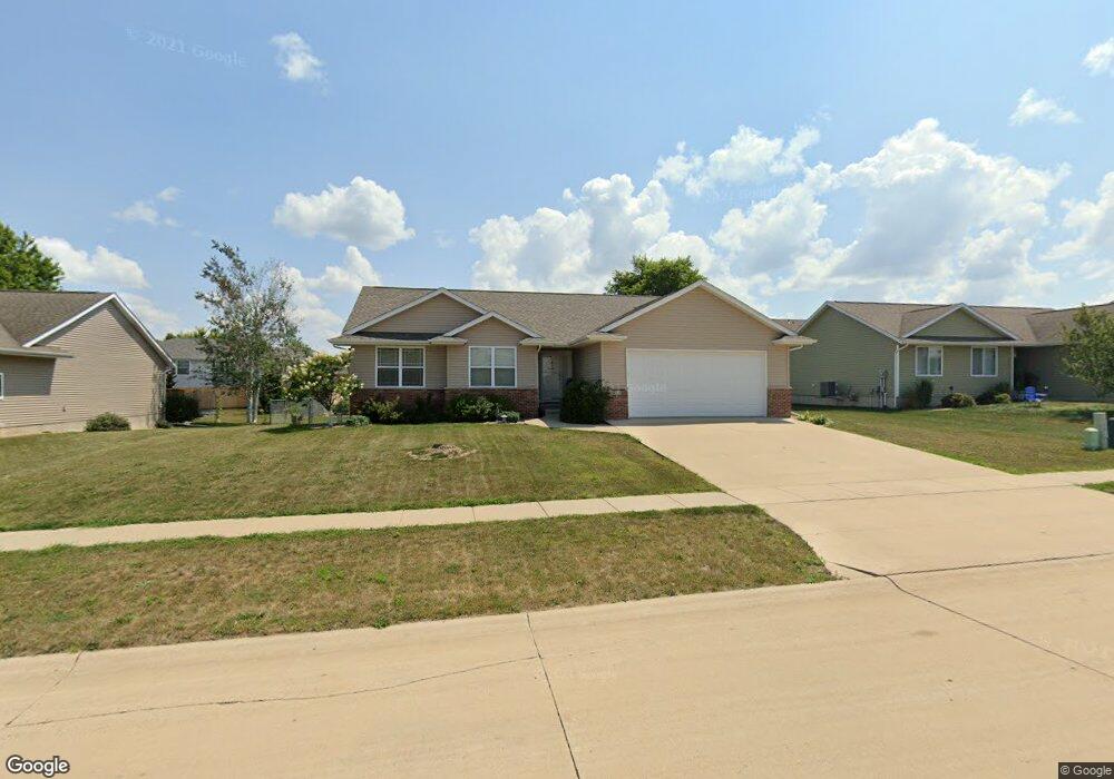
2013 49th St Marion, IA 52302
Estimated Value: $306,512 - $321,000
3
Beds
2
Baths
1,644
Sq Ft
$192/Sq Ft
Est. Value
About This Home
This home is located at 2013 49th St, Marion, IA 52302 and is currently estimated at $315,378, approximately $191 per square foot. 2013 49th St is a home located in Linn County with nearby schools including Linn Grove Elementary School, Excelsior Middle School, and Linn-Mar High School.
Ownership History
Date
Name
Owned For
Owner Type
Purchase Details
Closed on
Oct 21, 2010
Sold by
Dietz Debra K
Bought by
Vokt Willard M and Vokt Patricia A
Current Estimated Value
Purchase Details
Closed on
Mar 22, 2006
Sold by
Jpm Enterprises Inc
Bought by
Dietz Debra K
Home Financials for this Owner
Home Financials are based on the most recent Mortgage that was taken out on this home.
Original Mortgage
$64,900
Interest Rate
6.38%
Mortgage Type
Fannie Mae Freddie Mac
Create a Home Valuation Report for This Property
The Home Valuation Report is an in-depth analysis detailing your home's value as well as a comparison with similar homes in the area
Home Values in the Area
Average Home Value in this Area
Purchase History
| Date | Buyer | Sale Price | Title Company |
|---|---|---|---|
| Vokt Willard M | $194,500 | None Available | |
| Dietz Debra K | $189,500 | None Available |
Source: Public Records
Mortgage History
| Date | Status | Borrower | Loan Amount |
|---|---|---|---|
| Previous Owner | Dietz Debra K | $64,900 |
Source: Public Records
Tax History Compared to Growth
Tax History
| Year | Tax Paid | Tax Assessment Tax Assessment Total Assessment is a certain percentage of the fair market value that is determined by local assessors to be the total taxable value of land and additions on the property. | Land | Improvement |
|---|---|---|---|---|
| 2025 | $4,548 | $288,900 | $36,400 | $252,500 |
| 2024 | $4,950 | $268,000 | $36,400 | $231,600 |
| 2023 | $4,950 | $268,000 | $36,400 | $231,600 |
| 2022 | $4,714 | $235,300 | $36,400 | $198,900 |
| 2021 | $4,390 | $235,300 | $36,400 | $198,900 |
| 2020 | $4,390 | $206,700 | $36,400 | $170,300 |
| 2019 | $4,274 | $201,200 | $43,200 | $158,000 |
| 2018 | $4,102 | $201,200 | $43,200 | $158,000 |
| 2017 | $4,200 | $200,900 | $43,200 | $157,700 |
| 2016 | $4,056 | $191,300 | $34,500 | $156,800 |
| 2015 | $4,041 | $191,300 | $34,500 | $156,800 |
| 2014 | $3,854 | $191,300 | $34,500 | $156,800 |
| 2013 | $3,676 | $191,300 | $34,500 | $156,800 |
Source: Public Records
Map
Nearby Homes
- 2054 Shortgrass Place
- 1810 50th St Unit 1810
- 2176 49th St Unit 2176
- 2200 50th St
- 4681 Vasey Ave
- 1570 50th St Unit 1570
- 4663 Pintail Ct Unit 4663
- 4390 Mcgowan Blvd
- 1510 50th St Unit 1510
- 4315 Snowgoose Dr
- 2605 Greenway Ct Unit 2605
- 2370 Spoonbill Dr
- 4501 Surrey Ct
- 4413 Surrey Ct
- 2130 Rosewood Ridge Dr
- 1935 Oak Creek Dr
- 1350 44th Unit C St
- 4903 Foxtail Ct
- 5865 Robinwood Ln
- 4210 Windemere Way
- 2005 49th St
- 2053 49th St
- 2010 50th St
- 1992 50th St Unit 1992
- 1990 50th St Unit 1990
- 1992 50th St
- 2012 49th St
- 1975 49th St
- 2050 50th St
- 2016 49th St Unit 2016
- 1972 50th St Unit 1972
- 1970 50th St Unit 1970
- 2093 49th St
- 2000 49th St
- 2090 50th St
- 1945 49th St
- 1952 50th St Unit 1952
- 1950 50th St Unit 1950
- 2056 49th St Unit 2056
- 2052 Shortgrass Place Unit 2052