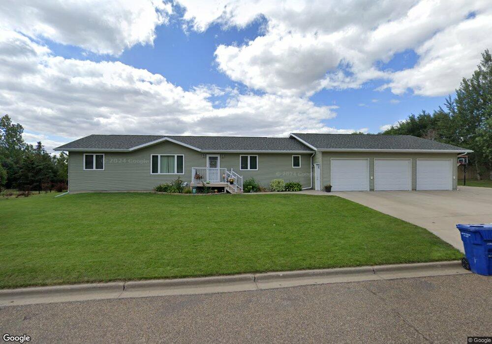
2013 5th Ave NE Beulah, ND 58523
Estimated Value: $254,000 - $467,700
--
Bed
--
Bath
--
Sq Ft
9.5
Acres
About This Home
This home is located at 2013 5th Ave NE, Beulah, ND 58523 and is currently estimated at $364,175. 2013 5th Ave NE is a home with nearby schools including Beulah Elementary School, Beulah Middle School, and Beulah High School.
Ownership History
Date
Name
Owned For
Owner Type
Purchase Details
Closed on
May 21, 2009
Sold by
Dschaak Samuel S and Dschaak Alexandra K
Bought by
Dschaak Samuel S and Dschaak Alexandra K
Current Estimated Value
Purchase Details
Closed on
May 30, 2008
Sold by
City Of Beulah
Bought by
Dschaak Samuel S and Dschaak Alexandra K
Create a Home Valuation Report for This Property
The Home Valuation Report is an in-depth analysis detailing your home's value as well as a comparison with similar homes in the area
Home Values in the Area
Average Home Value in this Area
Purchase History
| Date | Buyer | Sale Price | Title Company |
|---|---|---|---|
| Dschaak Samuel S | -- | None Available | |
| Dschaak Samuel S | -- | None Available |
Source: Public Records
Tax History Compared to Growth
Tax History
| Year | Tax Paid | Tax Assessment Tax Assessment Total Assessment is a certain percentage of the fair market value that is determined by local assessors to be the total taxable value of land and additions on the property. | Land | Improvement |
|---|---|---|---|---|
| 2024 | $4,400 | $177,760 | $19,510 | $158,250 |
| 2023 | $1,940 | $167,795 | $19,510 | $148,285 |
| 2022 | $1,940 | $144,440 | $19,510 | $124,930 |
| 2021 | $1,940 | $142,810 | $17,880 | $124,930 |
| 2020 | $1,940 | $146,885 | $17,880 | $129,005 |
| 2019 | -- | $146,885 | $17,880 | $129,005 |
| 2018 | -- | $153,675 | $17,880 | $135,795 |
| 2017 | -- | $171,465 | $17,880 | $153,585 |
| 2016 | -- | $167,140 | $17,880 | $149,260 |
| 2015 | -- | $0 | $0 | $0 |
| 2013 | -- | $0 | $0 | $0 |
Source: Public Records
Map
Nearby Homes
- 418 16th St NE
- 1607 Central Ave N
- 1709 Blackstone Loop E
- 1423 2nd Ave NW
- 1124 Chestnut Ln
- 1113 Chestnut Ln
- 900 10th St NE
- 206 10th St NE
- 1100 Central Ave N
- 301 5th St NW
- 204 3rd St NW
- 420 N Dakota 49
- 308 3rd St NW
- 798 County Road 21
- 600 12th Ave NE
- 707 3rd St NW
- 421 W Main St
- 537 2nd Ave SE
- 678 60th Ave SW
- 209 13th Ave SW
- 2019 5th Ave NE
- 508 19th St NE
- 2012 5th Ave NE
- 2006 5th Ave NE
- 2018 5th Ave NE
- 2014 4th Ave NE
- 600 19th St NE
- 2000 4th Ave NE
- 2100 4th Ave NE
- 2024 5th Ave NE
- 2200 4th Ave NE
- 2007 4th Ave NE
- 1907 5th Ave NE
- 2019 6th Ave NE
- 606 19th St NE
- 2206 5th Ave NE
- 2013 6th Ave NE
- 1906 5th Ave NE
- 2206 4th Ave NE
- 2207 5th Ave NE