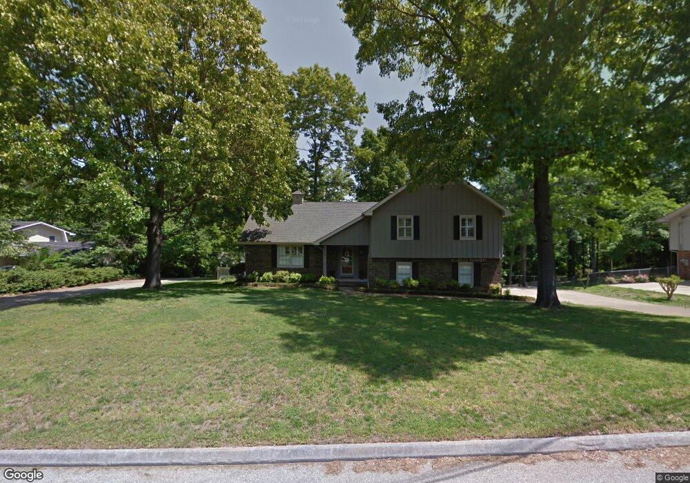
2013 Rock Bluff Rd Unit 432 Hixson, TN 37343
Estimated Value: $376,995 - $423,000
--
Bed
3
Baths
2,021
Sq Ft
$195/Sq Ft
Est. Value
About This Home
This home is located at 2013 Rock Bluff Rd Unit 432, Hixson, TN 37343 and is currently estimated at $394,999, approximately $195 per square foot. 2013 Rock Bluff Rd Unit 432 is a home located in Hamilton County with nearby schools including McConnell Elementary School, Loftis Middle School, and Hixson High School.
Ownership History
Date
Name
Owned For
Owner Type
Purchase Details
Closed on
Oct 25, 2021
Sold by
Kuenzli Sandra M
Bought by
Kuenzli Sandra M and Markee John B
Current Estimated Value
Home Financials for this Owner
Home Financials are based on the most recent Mortgage that was taken out on this home.
Original Mortgage
$231,300
Outstanding Balance
$196,627
Interest Rate
2.88%
Mortgage Type
New Conventional
Estimated Equity
$198,372
Purchase Details
Closed on
Apr 18, 2019
Sold by
Charna Todd and Charna Kathryn
Bought by
Kuenzli Sandra M
Home Financials for this Owner
Home Financials are based on the most recent Mortgage that was taken out on this home.
Original Mortgage
$192,000
Interest Rate
4.4%
Mortgage Type
New Conventional
Purchase Details
Closed on
Feb 13, 2017
Sold by
Ellison Kevin C and Ellison Allison M
Bought by
Charna Todd and Charna Kathryn
Home Financials for this Owner
Home Financials are based on the most recent Mortgage that was taken out on this home.
Original Mortgage
$183,600
Interest Rate
4.2%
Mortgage Type
New Conventional
Purchase Details
Closed on
Jul 15, 2011
Sold by
Gould Clifford M and Gould Beth P
Bought by
Ellison Kevin C and Ellison Allison M
Home Financials for this Owner
Home Financials are based on the most recent Mortgage that was taken out on this home.
Original Mortgage
$175,437
Interest Rate
4.57%
Mortgage Type
FHA
Purchase Details
Closed on
Aug 18, 2004
Sold by
Brunasso Anne G and Thomas Anne
Bought by
Gould Clifford M and Gould Beth P
Home Financials for this Owner
Home Financials are based on the most recent Mortgage that was taken out on this home.
Original Mortgage
$126,800
Interest Rate
5.96%
Mortgage Type
Unknown
Purchase Details
Closed on
Mar 3, 1995
Sold by
Lindsey James C and Lindsey Nancy A
Bought by
Brunasso Anne G
Create a Home Valuation Report for This Property
The Home Valuation Report is an in-depth analysis detailing your home's value as well as a comparison with similar homes in the area
Home Values in the Area
Average Home Value in this Area
Purchase History
| Date | Buyer | Sale Price | Title Company |
|---|---|---|---|
| Kuenzli Sandra M | -- | Title365 | |
| Kuenzli Sandra M | $240,000 | Chattanooga Title Inc | |
| Charna Todd | $216,000 | Stewart Title Guaranty Co | |
| Ellison Kevin C | $180,000 | Northgate Title Escrow Inc | |
| Gould Clifford M | $158,500 | Northgate Title Escrow Inc | |
| Brunasso Anne G | $112,500 | -- |
Source: Public Records
Mortgage History
| Date | Status | Borrower | Loan Amount |
|---|---|---|---|
| Open | Kuenzli Sandra M | $231,300 | |
| Closed | Kuenzli Sandra M | $192,000 | |
| Previous Owner | Charna Todd | $183,600 | |
| Previous Owner | Ellison Kevin C | $175,437 | |
| Previous Owner | Gould Clifford M | $126,800 | |
| Closed | Gould Clifford M | $23,775 |
Source: Public Records
Tax History Compared to Growth
Tax History
| Year | Tax Paid | Tax Assessment Tax Assessment Total Assessment is a certain percentage of the fair market value that is determined by local assessors to be the total taxable value of land and additions on the property. | Land | Improvement |
|---|---|---|---|---|
| 2024 | $1,115 | $49,825 | $0 | $0 |
| 2023 | $1,124 | $49,825 | $0 | $0 |
| 2022 | $1,124 | $49,825 | $0 | $0 |
| 2021 | $1,124 | $49,825 | $0 | $0 |
| 2020 | $1,105 | $39,650 | $0 | $0 |
| 2019 | $1,105 | $39,650 | $0 | $0 |
| 2018 | $1,105 | $39,650 | $0 | $0 |
| 2017 | $1,105 | $39,650 | $0 | $0 |
| 2016 | $1,250 | $0 | $0 | $0 |
| 2015 | $1,250 | $44,875 | $0 | $0 |
| 2014 | $1,250 | $0 | $0 | $0 |
Source: Public Records
Map
Nearby Homes
- 1926 Rock Bluff Rd
- 6507 Shallow Mar Ln
- 2112 River Bluff Dr
- 1826 Rock Bluff Rd Unit 5
- 6517 Shelter Cove Dr
- 1924 Bay Pointe Dr
- 6572 Fairview Rd
- 6512 Fairview Rd
- 2051 Paige Meadows Ct
- 0 Ridge Lake Rd Unit RTC2805180
- 0 Ridge Lake Rd Unit 1509241
- 5701 Topsail Greens Dr
- 000 Hixson Pike
- 1657 Destiny Dr
- 7111 River Run Dr
- 1663 Destiny Dr
- 1689 Destiny Dr
- 1669 Destiny Dr
- 1681 Destiny Dr
- 1693 Destiny Dr
- 2013 Rock Bluff Rd Unit 4
- 2015 Rock Bluff Rd Unit 4
- 2015 Rock Bluff Rd Unit 432
- 2007 Rock Bluff Rd
- 2011 Rock Bluff Rd Unit 4
- 6603 River Winds Ln
- 2009 Rock Bluff Rd
- 2009 Rock Bluff Rd Unit 432
- 2003 Rock Bluff Rd
- 2003 Rock Bluff Rd Unit 432
- 2003 Rock Bluff Rd Unit 160
- 2012 Rock Bluff Rd
- 2014 Rock Bluff Rd
- 6605 River Winds Ln
- 2008 Rock Bluff Rd
- 2016 Rock Bluff Rd
- 2004 Rock Bluff Rd
- 6607 River Winds Ln
- 2001 Rock Bluff Rd
- 2020 Rock Bluff Rd