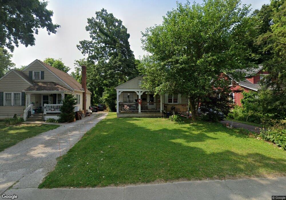
2013 W Galbraith Rd Cincinnati, OH 45239
Estimated Value: $162,000 - $184,078
2
Beds
1
Bath
978
Sq Ft
$175/Sq Ft
Est. Value
About This Home
This home is located at 2013 W Galbraith Rd, Cincinnati, OH 45239 and is currently estimated at $171,020, approximately $174 per square foot. 2013 W Galbraith Rd is a home located in Hamilton County with nearby schools including North College Hill Elementary School, North College Hill Middle School, and North College Hill High School.
Ownership History
Date
Name
Owned For
Owner Type
Purchase Details
Closed on
May 7, 2007
Sold by
Hermann Jean
Bought by
Turnbolt Nathaniel and Turnbolt Diedra
Current Estimated Value
Home Financials for this Owner
Home Financials are based on the most recent Mortgage that was taken out on this home.
Original Mortgage
$80,000
Outstanding Balance
$47,781
Interest Rate
6.2%
Mortgage Type
Unknown
Estimated Equity
$123,239
Purchase Details
Closed on
Apr 22, 2005
Sold by
Estate Of Ronald G Hermann
Bought by
Hermann Jean I
Create a Home Valuation Report for This Property
The Home Valuation Report is an in-depth analysis detailing your home's value as well as a comparison with similar homes in the area
Home Values in the Area
Average Home Value in this Area
Purchase History
| Date | Buyer | Sale Price | Title Company |
|---|---|---|---|
| Turnbolt Nathaniel | $80,000 | None Available | |
| Hermann Jean I | -- | None Available |
Source: Public Records
Mortgage History
| Date | Status | Borrower | Loan Amount |
|---|---|---|---|
| Open | Turnbolt Nathaniel | $80,000 |
Source: Public Records
Tax History
| Year | Tax Paid | Tax Assessment Tax Assessment Total Assessment is a certain percentage of the fair market value that is determined by local assessors to be the total taxable value of land and additions on the property. | Land | Improvement |
|---|---|---|---|---|
| 2025 | $2,387 | $45,956 | $15,159 | $30,797 |
| 2024 | $2,329 | $45,956 | $15,159 | $30,797 |
| 2023 | $2,349 | $45,956 | $15,159 | $30,797 |
| 2022 | $2,057 | $28,732 | $13,822 | $14,910 |
| 2021 | $2,014 | $28,732 | $13,822 | $14,910 |
| 2020 | $1,766 | $28,732 | $13,822 | $14,910 |
| 2019 | $1,734 | $25,204 | $12,124 | $13,080 |
| 2018 | $1,735 | $25,204 | $12,124 | $13,080 |
| 2017 | $1,642 | $25,204 | $12,124 | $13,080 |
| 2016 | $1,752 | $28,606 | $14,116 | $14,490 |
| 2015 | $1,755 | $28,606 | $14,116 | $14,490 |
| 2014 | $1,753 | $28,606 | $14,116 | $14,490 |
| 2013 | $1,932 | $32,509 | $16,041 | $16,468 |
Source: Public Records
Map
Nearby Homes
- 6941 Mulberry St
- 6943 Mulberry St
- 6931 Gloria Dr
- 6948 Mulberry St
- 6942 Gloria Dr
- 6822 Betts Ave
- 2033 Sundale Ave
- 7010 Noble Ct
- 6715 Betts Ave
- 6961 La Boiteaux Ave
- 1850 Bising Ave
- 1913 Sterling Ave
- 2030 Emerson Ave
- 6505 Simpson Ave
- 1806 Sterling Ave
- 1936 Cordova Ave
- 1701 Goodman Ave
- 1830 Cordova Ave
- 1714 Waltham Ave
- 2268 Deblin Dr
- 2011 W Galbraith Rd
- 2009 W Galbraith Rd
- 6535 Lois Dr
- 2017 W Galbraith Rd
- 2005 W Galbraith Rd
- 2012 W Galbraith Rd
- 2014 W Galbraith Rd
- 2010 W Galbraith Rd
- 2016 W Galbraith Rd
- 2019 W Galbraith Rd
- 2008 W Galbraith Rd
- 2003 Galbraith Rd
- 2018 W Galbraith Rd
- 2006 W Galbraith Rd
- 2020 W Galbraith Rd
- 2021 W Galbraith Rd
- 6907 Lois Dr
- 2004 W Galbraith Rd
- 6908 Lois Dr
- 2022 W Galbraith Rd