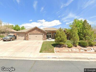
2013 Westcliff Dr Saint George, UT 84790
Estimated Value: $599,200 - $728,000
4
Beds
3
Baths
2,287
Sq Ft
$295/Sq Ft
Est. Value
About This Home
This home is located at 2013 Westcliff Dr, Saint George, UT 84790 and is currently estimated at $674,800, approximately $295 per square foot. 2013 Westcliff Dr is a home located in Washington County with nearby schools including Little Valley School, Sunrise Ridge Intermediate School, and Desert Hills Middle School.
Ownership History
Date
Name
Owned For
Owner Type
Purchase Details
Closed on
Mar 27, 2007
Sold by
Masek George and Masek Shelly Ann
Bought by
Imes Sharlene
Current Estimated Value
Home Financials for this Owner
Home Financials are based on the most recent Mortgage that was taken out on this home.
Original Mortgage
$309,600
Outstanding Balance
$193,186
Interest Rate
6.29%
Mortgage Type
New Conventional
Estimated Equity
$481,614
Purchase Details
Closed on
Dec 16, 2005
Sold by
Masek George
Bought by
Masek George and Masek Shelly Ann
Home Financials for this Owner
Home Financials are based on the most recent Mortgage that was taken out on this home.
Original Mortgage
$304,000
Interest Rate
6.36%
Mortgage Type
New Conventional
Purchase Details
Closed on
Oct 11, 2005
Sold by
Darke Stephen B
Bought by
Camelot Funding Llc and Vj Investment Holdings Lp
Create a Home Valuation Report for This Property
The Home Valuation Report is an in-depth analysis detailing your home's value as well as a comparison with similar homes in the area
Home Values in the Area
Average Home Value in this Area
Purchase History
| Date | Buyer | Sale Price | Title Company |
|---|---|---|---|
| Imes Sharlene | -- | Sun West Title | |
| Masek George | -- | First Title Of Utah | |
| Masek George | -- | First Title Of Utah | |
| Camelot Funding Llc | -- | First Title Of Utah |
Source: Public Records
Mortgage History
| Date | Status | Borrower | Loan Amount |
|---|---|---|---|
| Open | Imes Sharlene | $309,600 | |
| Previous Owner | Masek George | $304,000 |
Source: Public Records
Tax History Compared to Growth
Tax History
| Year | Tax Paid | Tax Assessment Tax Assessment Total Assessment is a certain percentage of the fair market value that is determined by local assessors to be the total taxable value of land and additions on the property. | Land | Improvement |
|---|---|---|---|---|
| 2023 | $2,157 | $322,245 | $93,500 | $228,745 |
| 2022 | $2,190 | $307,780 | $79,750 | $228,030 |
| 2021 | $1,926 | $403,600 | $125,000 | $278,600 |
| 2020 | $1,753 | $346,000 | $105,000 | $241,000 |
| 2019 | $1,728 | $333,100 | $105,000 | $228,100 |
| 2018 | $1,674 | $166,595 | $0 | $0 |
| 2017 | $1,628 | $157,300 | $0 | $0 |
| 2016 | $1,633 | $145,970 | $0 | $0 |
| 2015 | $1,648 | $141,350 | $0 | $0 |
| 2014 | $1,614 | $139,260 | $0 | $0 |
Source: Public Records
Map
Nearby Homes
- 2013 Westcliff Dr
- 2001 E West Cliff Dr
- 2025 Westcliff Dr
- 2001 Westcliff Dr
- 2025 E West Cliff Dr
- 2056 E Circle Ridge Dr
- 2068 E Circle Ridge Dr
- 2056 Circle Ridge Dr S
- 1989 E West Cliff Dr
- 1989 E West Cliff
- 1989 Westcliff Dr
- 2044 E Tombstone Ln Unit 5
- 2044 E Tombstone Ln
- 2044 Circle Ridge Dr S
- 2044 E Circle Ridge Dr
- 2037 Westcliff Dr
- 2037 E West Cliff
- 2080 E Circle Ridge Dr
- 2006 Westcliff Dr
- 2030 Westcliff Dr