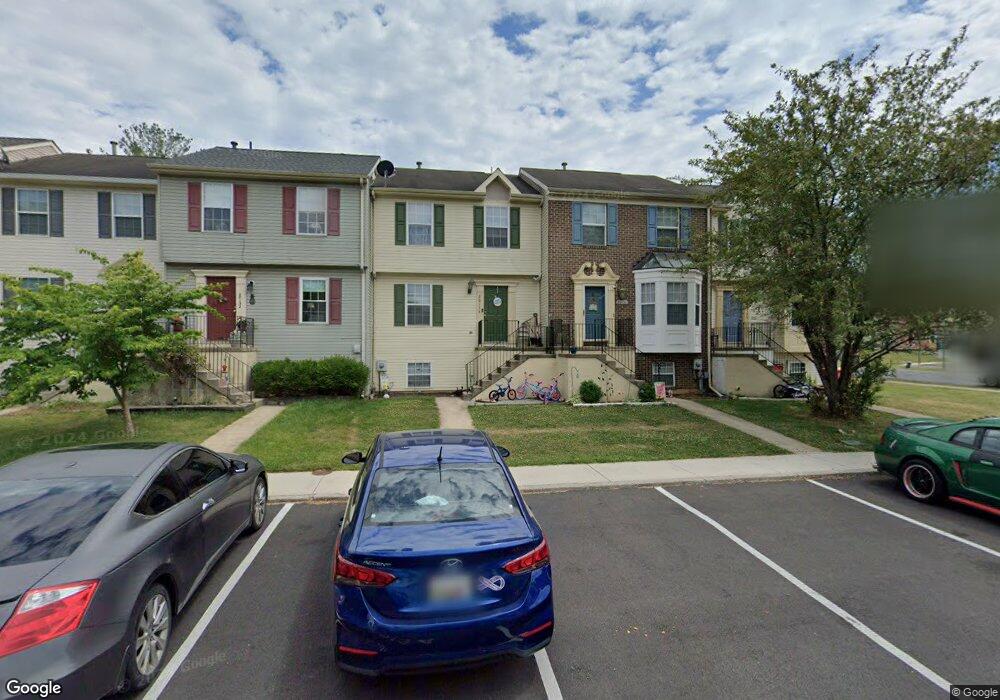
20136 Daniels Cir Hagerstown, MD 21742
Estimated Value: $223,000 - $234,000
3
Beds
2
Baths
1,128
Sq Ft
$203/Sq Ft
Est. Value
About This Home
This home is located at 20136 Daniels Cir, Hagerstown, MD 21742 and is currently estimated at $228,855, approximately $202 per square foot. 20136 Daniels Cir is a home located in Washington County with nearby schools including Ruth Ann Monroe Primary School, Eastern Elementary School, and E. Russell Hicks Middle School.
Ownership History
Date
Name
Owned For
Owner Type
Purchase Details
Closed on
Aug 1, 2008
Sold by
Shari Albani
Bought by
Bank Deutsche National Trust Co
Current Estimated Value
Purchase Details
Closed on
Jul 21, 2008
Sold by
Bank Deutsche National Trust Co
Bought by
Morgan Bonnard J and Morgan Peggy R
Purchase Details
Closed on
Jul 14, 2008
Sold by
Shari Albani
Bought by
Bank Deutsche National Trust Co
Purchase Details
Closed on
Jul 29, 2005
Sold by
Stup Michael C
Bought by
Shari Albani and Joseph Strickler
Purchase Details
Closed on
Jul 15, 2005
Sold by
Stup Michael C
Bought by
Shari Albani and Joseph Strickler
Purchase Details
Closed on
Feb 5, 2004
Sold by
Stup Michael C
Bought by
Stup Michael C and Cathleen Giancoli
Purchase Details
Closed on
Jun 3, 1998
Sold by
Stup Michael C and Stup Tracy L
Bought by
Stup Michael C
Create a Home Valuation Report for This Property
The Home Valuation Report is an in-depth analysis detailing your home's value as well as a comparison with similar homes in the area
Home Values in the Area
Average Home Value in this Area
Purchase History
| Date | Buyer | Sale Price | Title Company |
|---|---|---|---|
| Bank Deutsche National Trust Co | $157,000 | -- | |
| Morgan Bonnard J | $139,900 | -- | |
| Morgan Bonnard J | $139,900 | -- | |
| Bank Deutsche National Trust Co | $157,000 | -- | |
| Shari Albani | $186,000 | -- | |
| Shari Albani | $186,000 | -- | |
| Stup Michael C | -- | -- | |
| Stup Michael C | -- | -- |
Source: Public Records
Mortgage History
| Date | Status | Borrower | Loan Amount |
|---|---|---|---|
| Closed | Shari Albani | -- |
Source: Public Records
Tax History Compared to Growth
Tax History
| Year | Tax Paid | Tax Assessment Tax Assessment Total Assessment is a certain percentage of the fair market value that is determined by local assessors to be the total taxable value of land and additions on the property. | Land | Improvement |
|---|---|---|---|---|
| 2025 | $1,441 | $163,500 | $0 | $0 |
| 2024 | $1,441 | $139,200 | $25,000 | $114,200 |
| 2023 | $1,323 | $127,167 | $0 | $0 |
| 2022 | $1,192 | $115,133 | $0 | $0 |
| 2021 | $1,093 | $103,100 | $25,000 | $78,100 |
| 2020 | $1,061 | $100,500 | $0 | $0 |
| 2019 | $1,038 | $97,900 | $0 | $0 |
| 2018 | $1,010 | $95,300 | $25,000 | $70,300 |
| 2017 | $1,010 | $95,300 | $0 | $0 |
| 2016 | -- | $95,300 | $0 | $0 |
| 2015 | $1,160 | $106,800 | $0 | $0 |
| 2014 | $1,160 | $99,400 | $0 | $0 |
Source: Public Records
Map
Nearby Homes
- 20129 Kellys Ln
- 20057 Rosebank Way
- 11302 Robinwood Dr
- 20036 Rosebank Way
- 20040 Rosebank Way
- 20023 Rosebank Way
- 20033 Rosebank Way
- 20035 Rosebank Way
- 20039 Rosebank Way
- 20025 Rosebank Way
- LOT 5A Rosebank Way
- LOT 5B Rosebank Way
- 20102 Teakwood Dr
- 20314 Parkwood Ct
- 20207 Huntington Ct
- 20203 Huntington Ct
- 11025 Eastwood Dr
- 20112 Oneals Place
- 20204 Plumwood Dr
- 11029 Plumwood Cir
- 20134 Daniels Cir
- 20132 Daniels Cir
- 20130 Daniels Cir
- 20140 Daniels Cir
- 20128 Daniels Cir
- 20142 Daniels Cir
- 20144 Daniels Cir
- 20326 Kellys Ln
- 20146 Daniels Cir
- 20328 Kellys Ln
- 20330 Kellys Ln
- 20129 Daniels Cir
- 20148 Daniels Cir
- 20127 Daniels Cir
- 20116 Daniels Cir
- 20332 Kellys Ln
- 20125 Daniels Cir
- 20118 Daniels Cir
- 20120 Daniels Cir
- 20123 Daniels Cir