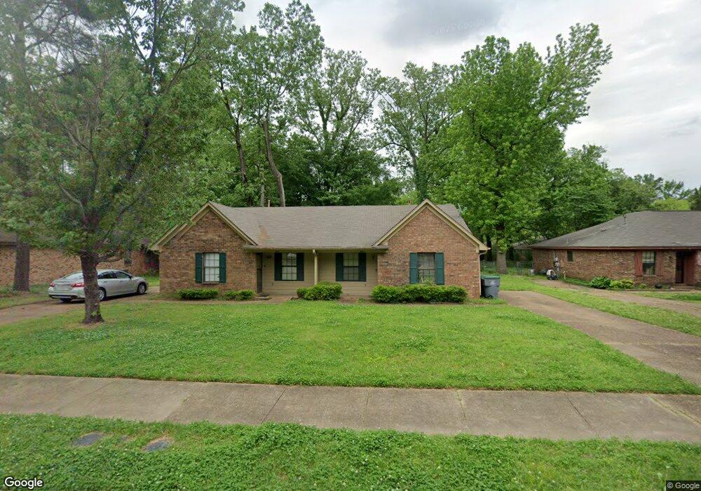
2014 Dawson Ln Memphis, TN 38134
Estimated Value: $177,000 - $191,242
4
Beds
4
Baths
2,260
Sq Ft
$81/Sq Ft
Est. Value
About This Home
This home is located at 2014 Dawson Ln, Memphis, TN 38134 and is currently estimated at $182,811, approximately $80 per square foot. 2014 Dawson Ln is a home located in Shelby County with nearby schools including Shelby Oaks Elementary School, Kate Bond Middle School, and Kingsbury High School.
Ownership History
Date
Name
Owned For
Owner Type
Purchase Details
Closed on
Nov 1, 2022
Sold by
Larry Jay Litzky And Antonio Dias Trust
Bought by
Smith Karen
Current Estimated Value
Home Financials for this Owner
Home Financials are based on the most recent Mortgage that was taken out on this home.
Original Mortgage
$112,500
Outstanding Balance
$108,849
Interest Rate
6.7%
Mortgage Type
Balloon
Estimated Equity
$73,962
Purchase Details
Closed on
May 30, 2013
Sold by
Litzky Larry J
Bought by
Litzky Larry Jay and Dias Antonio
Purchase Details
Closed on
Feb 13, 2006
Sold by
Mcswain Family Lp
Bought by
Litzky Larry J
Home Financials for this Owner
Home Financials are based on the most recent Mortgage that was taken out on this home.
Original Mortgage
$84,000
Interest Rate
6.14%
Mortgage Type
Fannie Mae Freddie Mac
Purchase Details
Closed on
Dec 31, 1998
Sold by
Mcswain William B and Mcswain Eleanor J
Bought by
Mcswain Family Lp
Create a Home Valuation Report for This Property
The Home Valuation Report is an in-depth analysis detailing your home's value as well as a comparison with similar homes in the area
Home Values in the Area
Average Home Value in this Area
Purchase History
| Date | Buyer | Sale Price | Title Company |
|---|---|---|---|
| Smith Karen | $150,000 | -- | |
| Litzky Larry Jay | -- | None Available | |
| Litzky Larry J | $105,000 | None Available | |
| Mcswain Family Lp | -- | -- |
Source: Public Records
Mortgage History
| Date | Status | Borrower | Loan Amount |
|---|---|---|---|
| Open | Smith Karen | $112,500 | |
| Previous Owner | Litzky Larry J | $84,000 |
Source: Public Records
Tax History Compared to Growth
Tax History
| Year | Tax Paid | Tax Assessment Tax Assessment Total Assessment is a certain percentage of the fair market value that is determined by local assessors to be the total taxable value of land and additions on the property. | Land | Improvement |
|---|---|---|---|---|
| 2025 | $1,452 | $64,640 | $10,000 | $54,640 |
| 2024 | $1,452 | $42,840 | $8,520 | $34,320 |
| 2023 | $2,610 | $42,840 | $8,520 | $34,320 |
| 2022 | $2,610 | $42,840 | $8,520 | $34,320 |
| 2021 | $1,478 | $42,840 | $8,520 | $34,320 |
| 2020 | $2,171 | $29,960 | $8,520 | $21,440 |
| 2019 | $958 | $29,960 | $8,520 | $21,440 |
| 2018 | $958 | $29,960 | $8,520 | $21,440 |
| 2017 | $980 | $29,960 | $8,520 | $21,440 |
| 2016 | $1,259 | $28,800 | $0 | $0 |
| 2014 | $1,259 | $28,800 | $0 | $0 |
Source: Public Records
Map
Nearby Homes
- 6321 Ashton Rd
- 0 Summer Ave Unit 10200827
- 0 Summer Ave Unit 10195870
- 0 Summer Ave Unit 10195869
- 2331 Eveningview Dr
- 6014 Raleigh Lagrange Rd
- 2233 Woodfield Park Rd
- 2205 Oldfield Dr
- 2392 Gardenbrook Dr
- 2180 Henrietta Rd
- 2281 Belin Dr
- 2097 Mcgehee Cove
- 2305 Belin Dr
- 1472 Kinilwood St
- 6969 Tulip Trail Dr
- 7012 Daneman Dr
- 6989 Cherry Blossom Dr
- 1461 Phillips Rd
- 5981 Diplomat Place
- 2426 Lacosta Dr
- 2020 Dawson Ln
- 2002 Dawson Ln
- 2009 Goldbrier Ln
- 2017 Goldbrier Ln
- 1996 Dawson Ln Unit 1996
- 2030 Dawson Ln Unit 2032
- 2030 Dawson Ln
- 1999 Goldbrier Ln
- 2023 Goldbrier Ln
- 2011 Dawson Ln
- 2001 Dawson Ln
- 1994 Dawson Ln Unit 1996
- 1994 Dawson Ln Unit 1994
- 2021 Dawson Ln
- 1991 Goldbrier Ln
- 2031 Goldbrier Ln
- 2031 Dawson Ln
- 2040 Dawson Ln
- 6400 Raleigh Lagrange Rd
- 1977 Goldbrier Ln