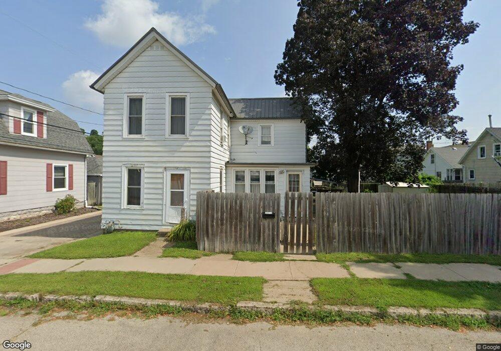
2014 Dock St Dubuque, IA 52001
Estimated Value: $156,000 - $169,000
3
Beds
3
Baths
1,548
Sq Ft
$105/Sq Ft
Est. Value
About This Home
This home is located at 2014 Dock St, Dubuque, IA 52001 and is currently estimated at $162,064, approximately $104 per square foot. 2014 Dock St is a home located in Dubuque County with nearby schools including Marshall Elementary School, Thomas Jefferson Middle School, and Hempstead High School.
Ownership History
Date
Name
Owned For
Owner Type
Purchase Details
Closed on
Sep 21, 2006
Sold by
Droessler Kurtis D and Droessler Ashley L
Bought by
Rupp David P and Schroeder Gina L
Current Estimated Value
Home Financials for this Owner
Home Financials are based on the most recent Mortgage that was taken out on this home.
Original Mortgage
$88,000
Outstanding Balance
$52,617
Interest Rate
6.59%
Mortgage Type
New Conventional
Estimated Equity
$109,447
Create a Home Valuation Report for This Property
The Home Valuation Report is an in-depth analysis detailing your home's value as well as a comparison with similar homes in the area
Home Values in the Area
Average Home Value in this Area
Purchase History
| Date | Buyer | Sale Price | Title Company |
|---|---|---|---|
| Rupp David P | $88,000 | None Available |
Source: Public Records
Mortgage History
| Date | Status | Borrower | Loan Amount |
|---|---|---|---|
| Open | Rupp David P | $88,000 |
Source: Public Records
Tax History Compared to Growth
Tax History
| Year | Tax Paid | Tax Assessment Tax Assessment Total Assessment is a certain percentage of the fair market value that is determined by local assessors to be the total taxable value of land and additions on the property. | Land | Improvement |
|---|---|---|---|---|
| 2025 | $1,854 | $138,100 | $21,100 | $117,000 |
| 2024 | $1,854 | $135,000 | $18,900 | $116,100 |
| 2023 | $1,800 | $135,000 | $18,900 | $116,100 |
| 2022 | $1,759 | $111,490 | $13,320 | $98,170 |
| 2021 | $1,761 | $111,490 | $13,320 | $98,170 |
| 2020 | $1,706 | $101,000 | $13,320 | $87,680 |
| 2019 | $1,700 | $101,000 | $13,320 | $87,680 |
| 2018 | $1,673 | $96,310 | $12,430 | $83,880 |
| 2017 | $1,568 | $96,310 | $12,430 | $83,880 |
| 2016 | $1,536 | $86,070 | $12,430 | $73,640 |
| 2015 | $1,464 | $86,070 | $12,430 | $73,640 |
| 2014 | $1,194 | $73,580 | $12,430 | $61,150 |
Source: Public Records
Map
Nearby Homes
- 1305 Rhomberg Ave
- 1229 Rhomberg Ave
- 1223 Lincoln Ave
- 1510 Garfield Ave
- 0 Thomas Place Unit 151876
- 1 Lindberg Terrace
- 1620 Justin Ln
- 932 Merz St
- 1902 Rhomberg Ave
- 2524 Stafford St
- 2413 Stafford St
- 719 E 22nd St
- 625 Rhomberg Ave
- 619 Lincoln Ave
- 614 Lincoln Ave
- 2520 Queen St
- 2525 Elm St
- 2518 Washington St
- 811 Lawther St
- TBD Elm St
- 1403 Rhomberg Ave
- 1405 Rhomberg Ave
- 2016 Dock St
- 1407 Rhomberg Ave
- 1327 Rhomberg Ave
- 1404 Lincoln Ave
- 1408 Lincoln Ave
- 1402 Lincoln Ave
- 1409 Rhomberg Ave
- 1324 Lincoln Ave
- 1323 Rhomberg Ave
- 1410 Lincoln Ave
- 1411 Rhomberg Ave
- 1412 Lincoln Ave
- 1320 Lincoln Ave
- 1319 Rhomberg Ave
- 1415 Rhomberg Ave
- 1316 Lincoln Ave
- 1414 Lincoln Ave
- 1315 Rhomberg Ave