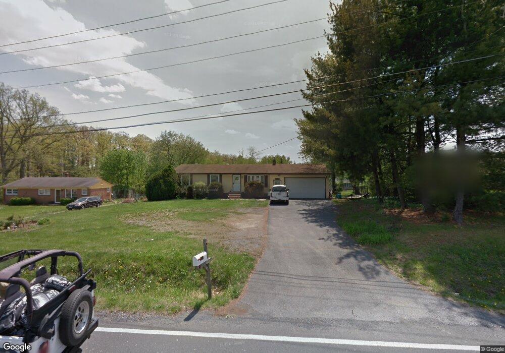
2014 Senseny Rd Winchester, VA 22602
Estimated Value: $313,000 - $337,964
3
Beds
1
Bath
1,056
Sq Ft
$305/Sq Ft
Est. Value
About This Home
This home is located at 2014 Senseny Rd, Winchester, VA 22602 and is currently estimated at $322,491, approximately $305 per square foot. 2014 Senseny Rd is a home located in Frederick County with nearby schools including Admiral Richard E. Byrd Middle School, Millbrook High School, and Sharon's Centre.
Ownership History
Date
Name
Owned For
Owner Type
Purchase Details
Closed on
Sep 17, 2001
Sold by
Keefer Timmy
Bought by
Galano Albert J
Current Estimated Value
Home Financials for this Owner
Home Financials are based on the most recent Mortgage that was taken out on this home.
Original Mortgage
$129,240
Outstanding Balance
$50,397
Interest Rate
6.99%
Estimated Equity
$272,094
Create a Home Valuation Report for This Property
The Home Valuation Report is an in-depth analysis detailing your home's value as well as a comparison with similar homes in the area
Home Values in the Area
Average Home Value in this Area
Purchase History
| Date | Buyer | Sale Price | Title Company |
|---|---|---|---|
| Galano Albert J | $143,600 | -- |
Source: Public Records
Mortgage History
| Date | Status | Borrower | Loan Amount |
|---|---|---|---|
| Open | Galano Albert J | $129,240 |
Source: Public Records
Tax History Compared to Growth
Tax History
| Year | Tax Paid | Tax Assessment Tax Assessment Total Assessment is a certain percentage of the fair market value that is determined by local assessors to be the total taxable value of land and additions on the property. | Land | Improvement |
|---|---|---|---|---|
| 2025 | $1,378 | $287,128 | $93,000 | $194,128 |
| 2024 | $620 | $243,000 | $77,000 | $166,000 |
| 2023 | $1,239 | $243,000 | $77,000 | $166,000 |
| 2022 | $1,244 | $203,900 | $72,000 | $131,900 |
| 2021 | $1,244 | $203,900 | $72,000 | $131,900 |
| 2020 | $1,146 | $187,900 | $72,000 | $115,900 |
| 2019 | $1,146 | $187,900 | $72,000 | $115,900 |
| 2018 | $1,077 | $176,600 | $72,000 | $104,600 |
| 2017 | $1,060 | $176,600 | $72,000 | $104,600 |
| 2016 | $965 | $160,900 | $59,500 | $101,400 |
| 2015 | $901 | $160,900 | $59,500 | $101,400 |
| 2014 | $459 | $154,400 | $59,500 | $94,900 |
Source: Public Records
Map
Nearby Homes
- 2003 Senseny Rd
- 0 Grocery Ave Unit VAFV2015654
- 151 Mccormick Cir Unit 203
- 151 Mccormick Cir Unit 201
- 140 Mccormick Cir Unit 403
- 111 Meadowview Ct
- 0 7 Building Lots In Shawneeland Unit VAFV2032844
- 128 Teaberry Dr
- 111 Pawn Ct
- Carlisle Plan at Abrams Pointe
- Somerset Plan at Abrams Pointe
- Rockford Plan at Abrams Pointe
- Avalon Plan at Abrams Pointe
- 161 Williamson Rd
- Birmingham Plan at Abrams Pointe
- Drexel Plan at Abrams Pointe
- 106 Foxglove Dr
- 101 Abrams Pointe Blvd
- Melody Plan at Abrams Pointe
- 114 Harold Ct
- 2004 Senseny Rd
- 2024 Senseny Rd
- 125 Greenwood Ave
- 1994 Senseny Rd
- 123 Greenwood Ave
- 2015 Senseny Rd
- 2019 Senseny Rd
- 2034 Senseny Rd
- 2009 Senseny Rd
- 2025 Senseny Rd
- 121 Greenwood Ave
- 2031 Senseny Rd
- 1986 Senseny Rd
- 2037 Senseny Rd
- 1997 Senseny Rd
- 119 Greenwood Ave
- 138 Maloy Dr
- 1978 Senseny Rd
- 124 Greenwood Ave
- 117 Greenwood Ave