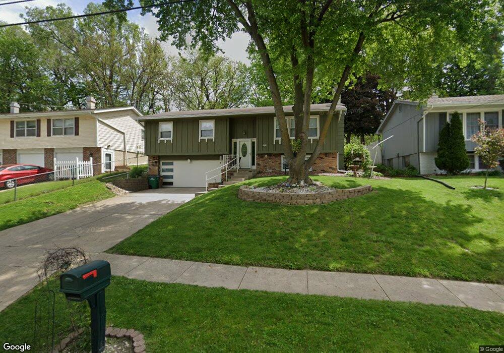
2015 64th St Windsor Heights, IA 50324
Estimated Value: $231,000 - $272,000
4
Beds
1
Bath
1,132
Sq Ft
$222/Sq Ft
Est. Value
About This Home
This home is located at 2015 64th St, Windsor Heights, IA 50324 and is currently estimated at $251,072, approximately $221 per square foot. 2015 64th St is a home located in Polk County with nearby schools including Hillis Elementary School, Merrill Middle School, and Roosevelt High School.
Ownership History
Date
Name
Owned For
Owner Type
Purchase Details
Closed on
Oct 17, 2011
Sold by
Graziano Kimberly R and Robertson Stephen Louis
Bought by
Munoz Joseph Nick and Munoz Diane
Current Estimated Value
Home Financials for this Owner
Home Financials are based on the most recent Mortgage that was taken out on this home.
Original Mortgage
$132,000
Outstanding Balance
$90,116
Interest Rate
4.12%
Mortgage Type
VA
Estimated Equity
$160,956
Create a Home Valuation Report for This Property
The Home Valuation Report is an in-depth analysis detailing your home's value as well as a comparison with similar homes in the area
Home Values in the Area
Average Home Value in this Area
Purchase History
| Date | Buyer | Sale Price | Title Company |
|---|---|---|---|
| Munoz Joseph Nick | $131,500 | None Available |
Source: Public Records
Mortgage History
| Date | Status | Borrower | Loan Amount |
|---|---|---|---|
| Open | Munoz Joseph Nick | $132,000 |
Source: Public Records
Tax History
| Year | Tax Paid | Tax Assessment Tax Assessment Total Assessment is a certain percentage of the fair market value that is determined by local assessors to be the total taxable value of land and additions on the property. | Land | Improvement |
|---|---|---|---|---|
| 2025 | $3,460 | $224,000 | $50,700 | $173,300 |
| 2024 | $3,460 | $210,600 | $46,900 | $163,700 |
| 2023 | $3,518 | $210,600 | $46,900 | $163,700 |
| 2022 | $3,488 | $170,600 | $39,000 | $131,600 |
| 2021 | $3,424 | $170,600 | $39,000 | $131,600 |
| 2020 | $3,562 | $154,800 | $35,400 | $119,400 |
| 2019 | $3,534 | $154,800 | $35,400 | $119,400 |
| 2018 | $3,452 | $142,400 | $31,800 | $110,600 |
| 2017 | $3,164 | $142,400 | $31,800 | $110,600 |
| 2016 | $2,994 | $127,700 | $28,200 | $99,500 |
| 2015 | $2,994 | $127,700 | $28,200 | $99,500 |
| 2014 | $3,000 | $132,000 | $28,600 | $103,400 |
Source: Public Records
Map
Nearby Homes
- 6312 Franklin Ave
- 6414 Northwest Dr
- 2002 60th St
- 6200 Holcomb Ave
- 5920 Hickman Rd
- 2325 61st St
- 1917 59th St
- 1617 61st St
- 6120 College Ave
- 2610 Westover Blvd
- 5722 Lincoln Ave
- 6017 Crown Ln
- 5722 Franklin Ave
- 2623 63rd St
- 2218 70th St
- 1506 64th St
- 2250 70th St
- 2107 Merklin Way
- 2616 59th St
- 1819 57th St
- 2011 64th St
- 2002 63rd St
- 2021 64th St
- 2007 64th St
- 6400 & 6402 Lincoln Ave
- 1938 63rd St
- 6400 Lincoln Ave
- 2004 63rd St Unit 1
- 2004 63rd St Unit 3
- 2004 63rd St Unit 5
- 2004 63rd St Unit 7
- 2004 63rd St Unit 2
- 2004 63rd St Unit 4
- 2004 63rd St Unit 6
- 2004 63rd St Unit 8
- 2004 63rd St
- 2004 63rd St
- 2010 64th St
- 2001 64th St
- 2006 64th St
Your Personal Tour Guide
Ask me questions while you tour the home.