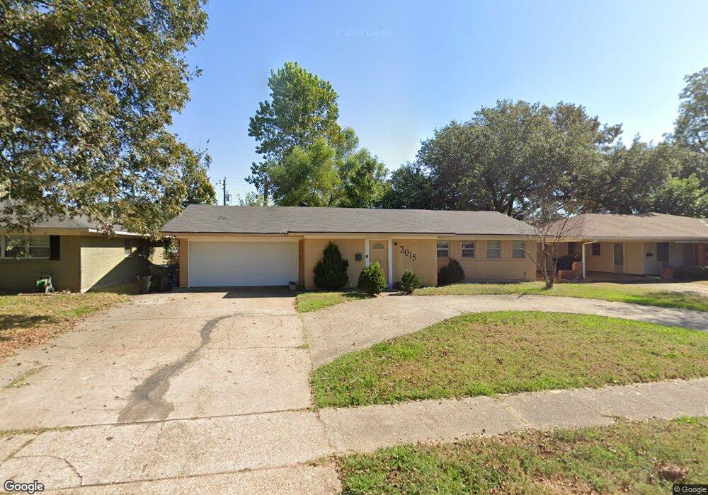
2015 Bermuda St Shreveport, LA 71105
Broadmoor/Anderson Island/Shreve Isle NeighborhoodEstimated Value: $25,000 - $54,000
2
Beds
1
Bath
936
Sq Ft
$45/Sq Ft
Est. Value
About This Home
This home is located at 2015 Bermuda St, Shreveport, LA 71105 and is currently estimated at $42,169, approximately $45 per square foot. 2015 Bermuda St is a home located in Caddo Parish with nearby schools including Fairfield Magnet School, Judson Fundamental Elementary School, and Eden Gardens Fundamental Elementary School.
Ownership History
Date
Name
Owned For
Owner Type
Purchase Details
Closed on
Jul 23, 2014
Sold by
Federal National Mortgage Association
Bought by
Jancor Investments Llc
Current Estimated Value
Purchase Details
Closed on
Jun 12, 2014
Sold by
Seterus Inc
Bought by
Federal National Mortgage Association and Fannie Mae
Purchase Details
Closed on
May 14, 2014
Sold by
Miller David Harold and Miller Sonya
Bought by
Jpmorgan Chase Bank Na
Create a Home Valuation Report for This Property
The Home Valuation Report is an in-depth analysis detailing your home's value as well as a comparison with similar homes in the area
Home Values in the Area
Average Home Value in this Area
Purchase History
| Date | Buyer | Sale Price | Title Company |
|---|---|---|---|
| Jancor Investments Llc | $10,500 | Multiple | |
| Federal National Mortgage Association | $12,000 | None Available | |
| Jpmorgan Chase Bank Na | -- | None Available |
Source: Public Records
Tax History Compared to Growth
Tax History
| Year | Tax Paid | Tax Assessment Tax Assessment Total Assessment is a certain percentage of the fair market value that is determined by local assessors to be the total taxable value of land and additions on the property. | Land | Improvement |
|---|---|---|---|---|
| 2024 | $355 | $2,276 | $525 | $1,751 |
| 2023 | $359 | $2,251 | $500 | $1,751 |
| 2022 | $359 | $2,251 | $500 | $1,751 |
| 2021 | $353 | $2,251 | $500 | $1,751 |
| 2020 | $353 | $2,251 | $500 | $1,751 |
| 2019 | $366 | $2,266 | $500 | $1,766 |
| 2018 | $292 | $2,266 | $500 | $1,766 |
| 2017 | $372 | $2,266 | $500 | $1,766 |
| 2015 | $302 | $2,330 | $500 | $1,830 |
| 2014 | $304 | $2,330 | $500 | $1,830 |
| 2013 | -- | $2,330 | $500 | $1,830 |
Source: Public Records
Map
Nearby Homes
- 1923 Bermuda St
- 2045 Horton Ave
- 1919 Audubon Place
- 636 Pelican Place
- 1810 Captain Shreve Dr
- 2049 River Rd
- 2005 E Kings Hwy
- 2013 E Kings Hwy
- 502 Mockingbird Ln
- 1836 Bryan Place
- 1615 Captain Shreve Dr
- 142 Lynn Ave
- 1601 Captain Shreve Dr
- 306 Oriole Ln
- 5822 River Rd
- 156 Charles Ave
- 147 Pennsylvania Ave
- 5108 Dixie Garden Dr
- 5707 Anniston Ave
- 163 Charles Ave
- 2015 Bermuda St
- 2015 Bermuda St
- 2015 Bermuda St
- 2015 Bermuda St
- 2015 Bermuda St
- 2015 Bermuda St
- 2015 Bermuda St
- 2015 Bermuda St
- 2015 Bermuda St
- 2015 Bermuda St
- 2015 Bermuda St
- 2015 Bermuda St
- 2015 Bermuda St
- 2015 Bermuda St
- 2015 Bermuda St
- 2015 Bermuda St
- 2015 Bermuda St
- 2015 Bermuda St
- 2009 Bermuda St
- 2005 Bermuda St