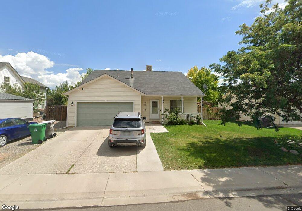
2015 Biron Rd Montrose, CO 81401
Estimated Value: $419,000 - $435,000
3
Beds
2
Baths
1,720
Sq Ft
$248/Sq Ft
Est. Value
About This Home
This home is located at 2015 Biron Rd, Montrose, CO 81401 and is currently estimated at $426,239, approximately $247 per square foot. 2015 Biron Rd is a home located in Montrose County with nearby schools including Johnson Elementary School, Centennial Middle School, and Montrose High School.
Ownership History
Date
Name
Owned For
Owner Type
Purchase Details
Closed on
Aug 29, 2014
Sold by
Marston Mark A and Marston Elizabeth
Bought by
Mcbride Tabathia L and Mcbride La Vernie E
Current Estimated Value
Home Financials for this Owner
Home Financials are based on the most recent Mortgage that was taken out on this home.
Original Mortgage
$165,000
Outstanding Balance
$126,365
Interest Rate
4.15%
Mortgage Type
VA
Estimated Equity
$299,874
Purchase Details
Closed on
Aug 5, 2005
Sold by
Jensen David W and Jensen Kimberly M
Bought by
Marston Mark A and Marston Elizabeth
Home Financials for this Owner
Home Financials are based on the most recent Mortgage that was taken out on this home.
Original Mortgage
$174,325
Interest Rate
6.62%
Mortgage Type
Adjustable Rate Mortgage/ARM
Purchase Details
Closed on
May 30, 2000
Sold by
Pearl Crest Inc
Bought by
Jensen David W and Jensen Kimberly M
Create a Home Valuation Report for This Property
The Home Valuation Report is an in-depth analysis detailing your home's value as well as a comparison with similar homes in the area
Home Values in the Area
Average Home Value in this Area
Purchase History
| Date | Buyer | Sale Price | Title Company |
|---|---|---|---|
| Mcbride Tabathia L | $165,000 | Land Title Guarantee Co | |
| Marston Mark A | $183,500 | Security Title | |
| Jensen David W | $112,500 | -- |
Source: Public Records
Mortgage History
| Date | Status | Borrower | Loan Amount |
|---|---|---|---|
| Open | Mcbride Tabathia L | $165,000 | |
| Previous Owner | Marston Mark A | $174,325 |
Source: Public Records
Tax History Compared to Growth
Tax History
| Year | Tax Paid | Tax Assessment Tax Assessment Total Assessment is a certain percentage of the fair market value that is determined by local assessors to be the total taxable value of land and additions on the property. | Land | Improvement |
|---|---|---|---|---|
| 2024 | $1,627 | $22,570 | $3,170 | $19,400 |
| 2023 | $1,627 | $27,230 | $3,820 | $23,410 |
| 2022 | $1,288 | $18,450 | $2,780 | $15,670 |
| 2021 | $1,327 | $18,990 | $2,860 | $16,130 |
| 2020 | $1,133 | $16,670 | $2,470 | $14,200 |
| 2019 | $1,292 | $16,670 | $2,470 | $14,200 |
| 2018 | $1,078 | $13,080 | $1,990 | $11,090 |
| 2017 | $1,078 | $13,080 | $1,990 | $11,090 |
| 2016 | $1,080 | $13,210 | $2,010 | $11,200 |
| 2015 | $889 | $13,210 | $2,010 | $11,200 |
| 2014 | $729 | $11,570 | $2,010 | $9,560 |
Source: Public Records
Map
Nearby Homes
- 1987 Sara E Ln
- 2869 Cimarron St
- 2710 Cirque Way
- 3004 Silver Fox Dr
- 2398 W Fox Park St
- 3208 Wheat Grass Dr
- 2717 Peyton Dr
- TBD Lot 3 E Oak Grove Rd
- TBD Lot 2 E Oak Grove Rd
- 3208 Ravens Crest Dr
- 2700 Peyton Dr
- 2796 Matie Ln
- 1833 Estates Dr Unit A
- 3161 Silver Fox Dr
- 2648 Virginia Ln
- 2132 Patriot Ct
- 1708 American Way
- 2224 American Way
- 1764 Freedom Way
- Lot 23 Glen Eagle Dr