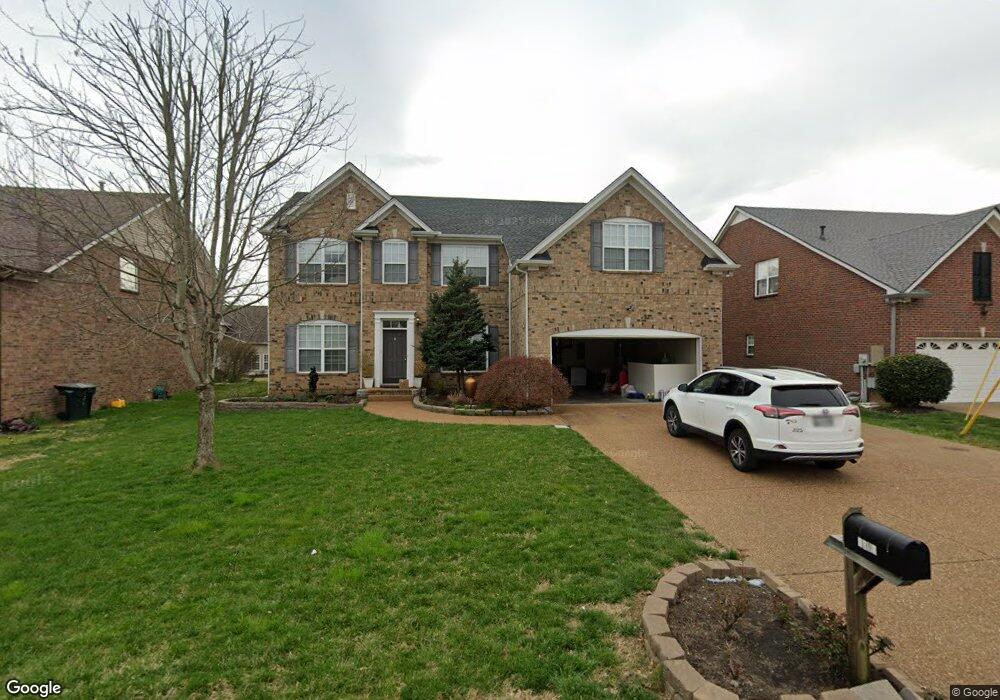
2015 Cairns Dr E Mount Juliet, TN 37122
Estimated Value: $553,782 - $613,000
--
Bed
3
Baths
3,230
Sq Ft
$181/Sq Ft
Est. Value
About This Home
This home is located at 2015 Cairns Dr E, Mount Juliet, TN 37122 and is currently estimated at $585,696, approximately $181 per square foot. 2015 Cairns Dr E is a home located in Wilson County with nearby schools including Mt. Juliet Elementary School, Mt. Juliet Middle School, and Green Hill High School.
Ownership History
Date
Name
Owned For
Owner Type
Purchase Details
Closed on
Jan 20, 2012
Sold by
Truong Tam
Bought by
Huynh Len Thi
Current Estimated Value
Purchase Details
Closed on
Dec 7, 2004
Sold by
Beazer Homes Corporation
Bought by
Tam Truong
Home Financials for this Owner
Home Financials are based on the most recent Mortgage that was taken out on this home.
Original Mortgage
$195,000
Interest Rate
5.57%
Purchase Details
Closed on
Nov 29, 2004
Bought by
Truong Tam
Home Financials for this Owner
Home Financials are based on the most recent Mortgage that was taken out on this home.
Original Mortgage
$195,000
Interest Rate
5.57%
Purchase Details
Closed on
Jan 28, 2003
Bought by
Beazer Homes Corp Dba Phillips Builders
Create a Home Valuation Report for This Property
The Home Valuation Report is an in-depth analysis detailing your home's value as well as a comparison with similar homes in the area
Home Values in the Area
Average Home Value in this Area
Purchase History
| Date | Buyer | Sale Price | Title Company |
|---|---|---|---|
| Huynh Len Thi | -- | -- | |
| Tam Truong | $234,450 | -- | |
| Truong Tam | $234,500 | -- | |
| Beazer Homes Corp Dba Phillips Builders | $253,300 | -- |
Source: Public Records
Mortgage History
| Date | Status | Borrower | Loan Amount |
|---|---|---|---|
| Previous Owner | Beazer Homes Corp Dba Phillips Builders | $195,000 | |
| Previous Owner | Beazer Homes Corp Dba Phillips Builders | $195,000 |
Source: Public Records
Tax History Compared to Growth
Tax History
| Year | Tax Paid | Tax Assessment Tax Assessment Total Assessment is a certain percentage of the fair market value that is determined by local assessors to be the total taxable value of land and additions on the property. | Land | Improvement |
|---|---|---|---|---|
| 2024 | $2,016 | $105,600 | $18,750 | $86,850 |
| 2022 | $2,016 | $105,600 | $18,750 | $86,850 |
| 2021 | $2,132 | $105,600 | $18,750 | $86,850 |
| 2020 | $2,159 | $105,600 | $18,750 | $86,850 |
| 2019 | $266 | $80,125 | $16,250 | $63,875 |
| 2018 | $2,151 | $80,125 | $16,250 | $63,875 |
| 2017 | $2,151 | $80,125 | $16,250 | $63,875 |
| 2016 | $2,151 | $80,125 | $16,250 | $63,875 |
| 2015 | $2,220 | $80,125 | $16,250 | $63,875 |
| 2014 | $1,871 | $67,522 | $0 | $0 |
Source: Public Records
Map
Nearby Homes
- 2032 Cairns Dr E
- 3012 Brisbane Dr
- 3009 Cairns Dr W
- 2001 Alice Springs Ct
- 1327 Sydney Terrace
- 2532 Edinburgh St
- 703 Greer Ct
- 1518 Yarmouth Ln
- 1078 Willoughby Station Blvd
- 1 Adelaide Ct
- 4009 Wellington Ct
- 3013 Melbourne Ct E
- 476 Brownstone St
- 478 Brownstone St
- 460 Brownstone St
- 1100 Sydney Terrace
- 1408 Tasmania Ct
- 4309 Minette Ct
- 1454 Brighton Cir
- 1 Covington Ct
- 2013 Cairns Dr E
- 2017 Cairns Dr E
- 2011 Cairns Dr E
- 3034 Brisbane Dr
- 2019 Cairns Dr E
- 3032 Brisbane Dr
- 3036 Brisbane Dr
- 2016 Cairns Dr E
- 2018 Cairns Dr E
- 3030 Brisbane Dr
- 3038 Brisbane Dr
- 2014 Cairns Dr E
- 2009 Cairns Dr E
- 2020 Cairns Dr E
- 2021 Cairns Dr E
- 3028 Brisbane Dr
- 2012 Cairns Dr E
- 2022 Cairns Dr E
- 2007 Cairns Dr E
- 2023 Cairns Dr E