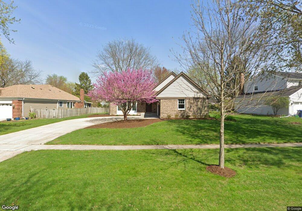
2015 Dorset Dr Wheaton, IL 60189
Stonehedge NeighborhoodEstimated Value: $485,497 - $687,000
4
Beds
2
Baths
1,580
Sq Ft
$379/Sq Ft
Est. Value
About This Home
This home is located at 2015 Dorset Dr, Wheaton, IL 60189 and is currently estimated at $598,374, approximately $378 per square foot. 2015 Dorset Dr is a home located in DuPage County with nearby schools including Whittier Elementary School, Edison Middle School, and Wheaton Warrenville South High School.
Ownership History
Date
Name
Owned For
Owner Type
Purchase Details
Closed on
Aug 9, 1996
Sold by
Tiernan Thomas and Tiernan Deborah Lynn Tama
Bought by
Pierce Charles T and Pierce Holly C
Current Estimated Value
Home Financials for this Owner
Home Financials are based on the most recent Mortgage that was taken out on this home.
Original Mortgage
$207,000
Outstanding Balance
$15,340
Interest Rate
7.5%
Estimated Equity
$583,034
Purchase Details
Closed on
Jun 25, 1996
Sold by
American National Bk & Tr Co Of Chicago
Bought by
Tiernan Thomas A and Tama Tiernan Deborah L
Home Financials for this Owner
Home Financials are based on the most recent Mortgage that was taken out on this home.
Original Mortgage
$207,000
Outstanding Balance
$15,340
Interest Rate
7.5%
Estimated Equity
$583,034
Create a Home Valuation Report for This Property
The Home Valuation Report is an in-depth analysis detailing your home's value as well as a comparison with similar homes in the area
Home Values in the Area
Average Home Value in this Area
Purchase History
| Date | Buyer | Sale Price | Title Company |
|---|---|---|---|
| Pierce Charles T | $236,000 | -- | |
| Tiernan Thomas A | -- | -- |
Source: Public Records
Mortgage History
| Date | Status | Borrower | Loan Amount |
|---|---|---|---|
| Open | Pierce Charles T | $207,000 |
Source: Public Records
Tax History
| Year | Tax Paid | Tax Assessment Tax Assessment Total Assessment is a certain percentage of the fair market value that is determined by local assessors to be the total taxable value of land and additions on the property. | Land | Improvement |
|---|---|---|---|---|
| 2024 | $10,507 | $171,021 | $51,778 | $119,243 |
| 2023 | $10,098 | $157,420 | $47,660 | $109,760 |
| 2022 | $9,887 | $148,770 | $45,040 | $103,730 |
| 2021 | $9,855 | $145,240 | $43,970 | $101,270 |
| 2020 | $9,824 | $143,890 | $43,560 | $100,330 |
| 2019 | $9,600 | $140,090 | $42,410 | $97,680 |
| 2018 | $8,989 | $130,110 | $39,960 | $90,150 |
| 2017 | $8,855 | $125,310 | $38,490 | $86,820 |
| 2016 | $8,736 | $120,300 | $36,950 | $83,350 |
| 2015 | $8,669 | $114,770 | $35,250 | $79,520 |
| 2014 | $7,824 | $102,500 | $34,740 | $67,760 |
| 2013 | $7,623 | $102,800 | $34,840 | $67,960 |
Source: Public Records
Map
Nearby Homes
- 25W773 Sunnyridge Ct
- 2S671 Arrowhead Dr
- 141 Loretto Ct
- 2631 Weatherbee Ln
- 1127 Hibbard Rd
- 30 Danada Dr
- 1605 Burning Trail
- 1620 Hemstock Ave
- 1601 W Wiesbrook Rd
- 1612 Stonebridge Trail
- Lot 1 Foothill Dr
- 2099 Creekside Dr Unit 1-4
- 1028 Lodalia Ct
- 1420 Stonebridge Trail Unit 1-3
- 2043 Spring Green Dr
- 1533 S County Farm Rd Unit 1-4
- 1219 Golf Ln
- 2110 Weatherbee Ln
- 1442 Stonebridge Cir Unit I8
- 1462 Stonebridge Cir Unit F10
- 2007 Dorset Dr
- 2025 Dorset Dr
- 2006 Berkshire Place
- 2010 Berkshire Place
- 2001 Dorset Dr
- 2033 Dorset Dr
- 2002 Berkshire Place
- 2012 Dorset Dr
- 2014 Berkshire Place
- 2018 Dorset Dr
- 2006 Dorset Dr
- 1993 Dorset Dr
- 2039 Dorset Dr
- 2024 Dorset Dr
- 2000 Dorset Dr
- 1984 Berkshire Place
- 2030 Dorset Dr
- 2018 Berkshire Place
- 1992 Dorset Dr
- 2047 Dorset Dr
Your Personal Tour Guide
Ask me questions while you tour the home.