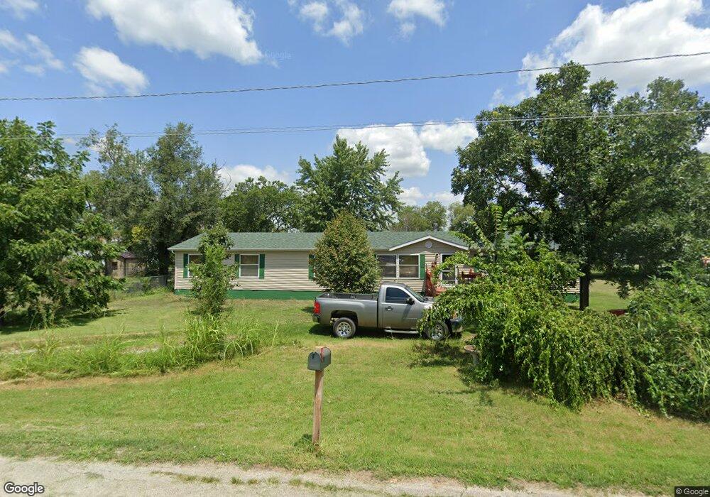
2015 E 1st St Fort Scott, KS 66701
Estimated Value: $97,000 - $157,619
3
Beds
2
Baths
2,052
Sq Ft
$65/Sq Ft
Est. Value
About This Home
This home is located at 2015 E 1st St, Fort Scott, KS 66701 and is currently estimated at $134,405, approximately $65 per square foot. 2015 E 1st St is a home located in Bourbon County with nearby schools including Winfield Scott Elementary School, Eugene Ware Elementary School, and Fort Scott Middle School.
Ownership History
Date
Name
Owned For
Owner Type
Purchase Details
Closed on
Oct 1, 2000
Bought by
Bolden William L and Bolden Nancy J
Current Estimated Value
Home Financials for this Owner
Home Financials are based on the most recent Mortgage that was taken out on this home.
Original Mortgage
$67,000
Outstanding Balance
$24,364
Interest Rate
7.88%
Mortgage Type
New Conventional
Estimated Equity
$110,041
Create a Home Valuation Report for This Property
The Home Valuation Report is an in-depth analysis detailing your home's value as well as a comparison with similar homes in the area
Home Values in the Area
Average Home Value in this Area
Purchase History
| Date | Buyer | Sale Price | Title Company |
|---|---|---|---|
| Bolden William L | $4,750 | -- |
Source: Public Records
Mortgage History
| Date | Status | Borrower | Loan Amount |
|---|---|---|---|
| Open | Bolden William L | $67,000 |
Source: Public Records
Tax History Compared to Growth
Tax History
| Year | Tax Paid | Tax Assessment Tax Assessment Total Assessment is a certain percentage of the fair market value that is determined by local assessors to be the total taxable value of land and additions on the property. | Land | Improvement |
|---|---|---|---|---|
| 2025 | -- | $11,646 | $400 | $11,246 |
| 2024 | $2,327 | $13,025 | $394 | $12,631 |
| 2023 | $2,188 | $11,924 | $407 | $11,517 |
| 2022 | $0 | $11,780 | $382 | $11,398 |
| 2021 | $2,148 | $11,024 | $382 | $10,642 |
| 2020 | $2,028 | $10,352 | $414 | $9,938 |
| 2019 | $2,016 | $10,201 | $414 | $9,787 |
| 2018 | $1,949 | $9,893 | $351 | $9,542 |
| 2017 | $1,959 | $9,888 | $351 | $9,537 |
| 2016 | -- | $9,966 | $371 | $9,595 |
| 2015 | -- | $9,814 | $371 | $9,443 |
| 2014 | -- | $10,115 | $371 | $9,744 |
Source: Public Records
Map
Nearby Homes
- 1828 E Pine St
- 1804 E Oak St
- 1638 E Oak St
- 1629 E Oak St
- 1254 240th St
- 124 N Grant St
- 109 N Lincoln St
- 1213 240th St
- 1308 240th St
- 0 S Madison St Unit HMS2558732
- 622 S Little St
- 602 S Barbee St
- 709 E 1st St
- 223 S Hill St
- 606 S Hill St
- 820 S Margrave St
- 1724 Williams St
- 523 S Judson St
- 1301 S Ransom St
- 603 S Judson St
- 0 Locust Rd
- 2349 Locust Rd
- 2002 E 1st St
- 1953 E 1st St
- 2116 E 1st St
- 111 Garrison St
- 1914 E Wall St
- 1951 E 1st St
- 1950 E 1st St
- 204 Goodlander St
- 2360 Locust Rd
- 117 McCleverty St
- 210 Garrison St
- 1850 E Wall St
- 1837 E 1st St
- 2135 54 Hwy
- 116 McCleverty St
- 1825 E 1st St
- 301 Garrison St
- 120 McCleverty St