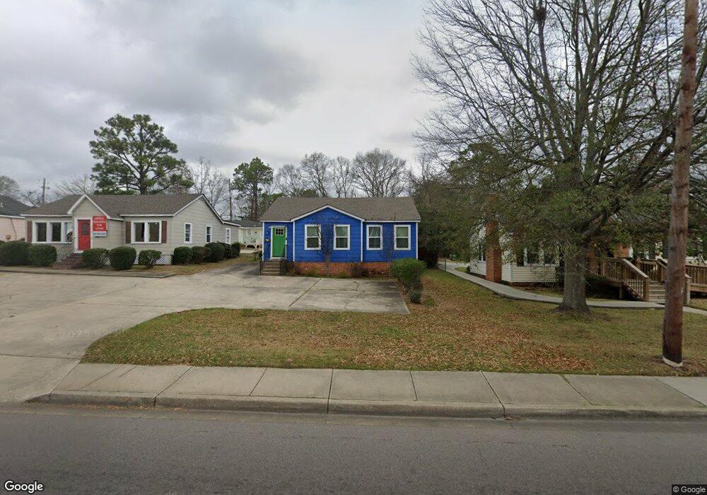
2015 Hardy St Hattiesburg, MS 39401
The Heights-Avenues NeighborhoodEstimated Value: $151,469 - $178,000
--
Bed
2
Baths
1,357
Sq Ft
$123/Sq Ft
Est. Value
About This Home
This home is located at 2015 Hardy St, Hattiesburg, MS 39401 and is currently estimated at $166,867, approximately $122 per square foot. 2015 Hardy St is a home located in Forrest County with nearby schools including Woodley Elementary School, N.R. Burger Middle School, and Hattiesburg High School.
Ownership History
Date
Name
Owned For
Owner Type
Purchase Details
Closed on
Jan 23, 2025
Sold by
Edwards Osborn Farnell
Bought by
Adamaiyah Properties Llc
Current Estimated Value
Purchase Details
Closed on
Jun 18, 2024
Sold by
Newman Richard J and Newman Suzan G
Bought by
Adhamiya Properties Llc
Purchase Details
Closed on
Dec 4, 2020
Sold by
Wells Gavin L
Bought by
Wells And Butler Premier Living Llc
Purchase Details
Closed on
Mar 26, 2010
Sold by
Cranford Daniel
Bought by
Wells Gavin L
Create a Home Valuation Report for This Property
The Home Valuation Report is an in-depth analysis detailing your home's value as well as a comparison with similar homes in the area
Home Values in the Area
Average Home Value in this Area
Purchase History
| Date | Buyer | Sale Price | Title Company |
|---|---|---|---|
| Adamaiyah Properties Llc | -- | None Listed On Document | |
| Adamaiyah Properties Llc | -- | None Listed On Document | |
| Adhamiya Properties Llc | -- | None Listed On Document | |
| Wells And Butler Premier Living Llc | -- | -- | |
| Wells Gavin L | -- | -- |
Source: Public Records
Tax History Compared to Growth
Tax History
| Year | Tax Paid | Tax Assessment Tax Assessment Total Assessment is a certain percentage of the fair market value that is determined by local assessors to be the total taxable value of land and additions on the property. | Land | Improvement |
|---|---|---|---|---|
| 2024 | $2,918 | $15,833 | $0 | $0 |
| 2023 | $2,918 | $105,550 | $0 | $0 |
| 2022 | $2,912 | $15,767 | $0 | $0 |
| 2021 | $2,912 | $15,767 | $0 | $0 |
| 2020 | $2,933 | $15,542 | $0 | $0 |
| 2019 | $2,833 | $15,542 | $0 | $0 |
| 2018 | $2,933 | $16,034 | $0 | $0 |
| 2017 | $2,913 | $16,034 | $0 | $0 |
| 2016 | $2,720 | $15,077 | $0 | $0 |
| 2015 | $2,677 | $15,077 | $0 | $0 |
| 2014 | $2,616 | $15,077 | $0 | $0 |
Source: Public Records
Map
Nearby Homes
- 109 N 20th Ave
- 201 N 21st Ave
- 113 S 22nd Ave
- 209 S 21st Ave
- 312 N 20th Ave
- 309 Kimball Ave
- 401 Kimball Ave
- 1811 Eva St
- 315 N 19th Ave
- 907 Wedgewood Dr
- 317 S 24th Ave
- 331 Emerson Dr
- 1917 Brooklane Dr
- 1805 Mamie St
- 1803 Mable St
- 309 Dixie Ave
- 802 Myrtle St
- 610 S 22nd Ave
- 1810 1st Terrace
- 1403 Concart St
- 2017 Hardy St
- 2013 Hardy St
- 103 N 21st Ave
- 102 N 20th Ave
- 105 N 21st Ave Unit A
- 2018 Hardy St
- 2020 Hardy St
- 106 N 20th Ave
- 121 N 20th Ave
- 102 N 21st Ave
- 107 N 21st Ave
- 107 N 21st Ave
- 2100 Hardy St
- 104 N 21st Ave
- 101 N 20th Ave
- 110 N 20th Ave
- 109 N 21st Ave
- 107 N 20th Ave
- 2107 Hardy St
- 108 N 21st Ave