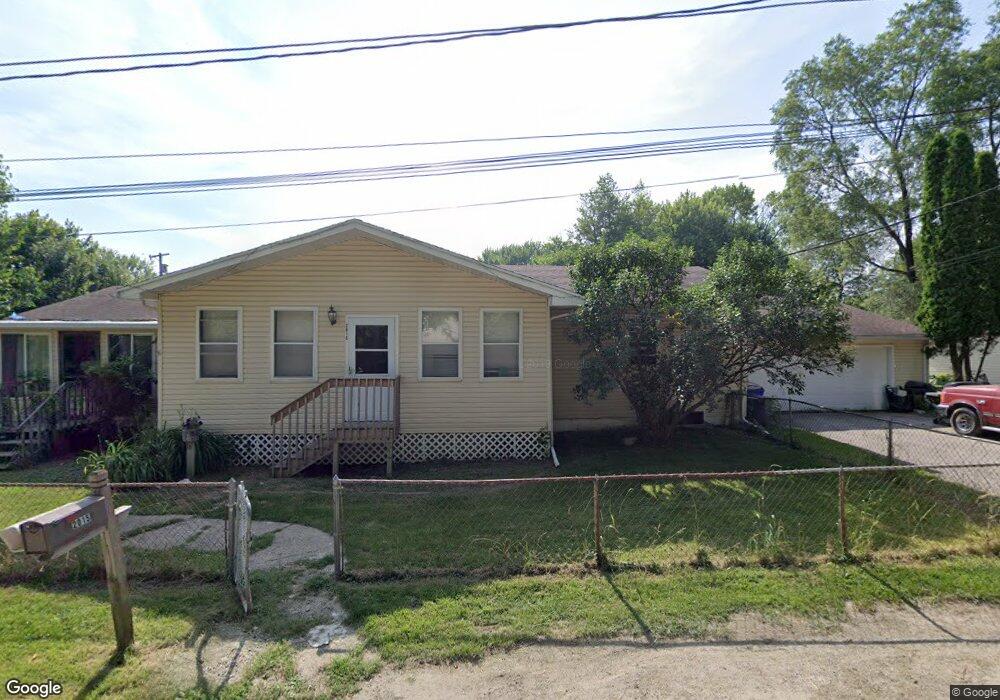
2015 High Dr SE Cedar Rapids, IA 52403
Cedar Valley NeighborhoodEstimated Value: $239,407 - $270,000
3
Beds
2
Baths
1,512
Sq Ft
$169/Sq Ft
Est. Value
About This Home
This home is located at 2015 High Dr SE, Cedar Rapids, IA 52403 and is currently estimated at $256,102, approximately $169 per square foot. 2015 High Dr SE is a home located in Linn County with nearby schools including Erskine Elementary School, McKinley STEAM Academy, and George Washington High School.
Ownership History
Date
Name
Owned For
Owner Type
Purchase Details
Closed on
Nov 21, 2003
Sold by
Us Bank Na
Bought by
Norman Thomas C and Norman Cherie B
Current Estimated Value
Home Financials for this Owner
Home Financials are based on the most recent Mortgage that was taken out on this home.
Original Mortgage
$62,266
Outstanding Balance
$28,887
Interest Rate
6.01%
Mortgage Type
Unknown
Estimated Equity
$227,215
Purchase Details
Closed on
Apr 23, 1999
Sold by
Wachal Joseph F
Bought by
Wachal Joseph F
Purchase Details
Closed on
Jun 26, 1998
Sold by
Schmidt Gary E and Schmidt Carrie L
Bought by
Allen Belinda L
Home Financials for this Owner
Home Financials are based on the most recent Mortgage that was taken out on this home.
Original Mortgage
$94,950
Interest Rate
7.62%
Create a Home Valuation Report for This Property
The Home Valuation Report is an in-depth analysis detailing your home's value as well as a comparison with similar homes in the area
Home Values in the Area
Average Home Value in this Area
Purchase History
| Date | Buyer | Sale Price | Title Company |
|---|---|---|---|
| Norman Thomas C | $77,500 | All American Escrow & Title | |
| Wachal Joseph F | -- | -- | |
| Allen Belinda L | $99,500 | -- |
Source: Public Records
Mortgage History
| Date | Status | Borrower | Loan Amount |
|---|---|---|---|
| Open | Norman Thomas C | $62,266 | |
| Previous Owner | Allen Belinda L | $94,950 | |
| Closed | Norman Thomas C | $15,567 |
Source: Public Records
Tax History
| Year | Tax Paid | Tax Assessment Tax Assessment Total Assessment is a certain percentage of the fair market value that is determined by local assessors to be the total taxable value of land and additions on the property. | Land | Improvement |
|---|---|---|---|---|
| 2025 | $3,054 | $232,700 | $29,200 | $203,500 |
| 2024 | $3,716 | $207,900 | $26,000 | $181,900 |
| 2023 | $3,716 | $190,000 | $22,700 | $167,300 |
| 2022 | $3,156 | $185,100 | $22,700 | $162,400 |
| 2021 | $3,334 | $161,300 | $22,700 | $138,600 |
| 2020 | $3,334 | $159,700 | $13,000 | $146,700 |
| 2019 | $2,922 | $144,100 | $13,000 | $131,100 |
Source: Public Records
Map
Nearby Homes
- 0 Rompot St SE
- 1440 Parkwood Dr SE
- 1635 31st St SE
- 1437 30th St SE
- 1737 14th Ave SE
- 2262 C St SW
- Lot 38 Kestrel Dr SE
- Lot 51 Kestrel Dr SE
- Lot 48 Kestrel Dr SE
- Lot 43 Kestrel Dr SE
- Lot 44 Kestrel Dr SE
- Lot 46 Kestrel Dr SE
- Lot 53 Kestrel Dr SE
- Lot 49 Kestrel Dr SE
- Lot 50 Kestrel Dr SE
- Lot 52 Kestrel Dr SE
- 1121 23rd St SE
- 3115 Peregrine Ct SE
- 1158 28th St SE
- 1241 30th St SE
- 2232 Pine Ave SE
- 2224 Pine Ave SE
- 2010 High Dr SE
- 2045 High Dr SE
- LOT 96* Pine Ave SE
- 2020 High Dr SE
- 2036 High Dr SE
- 2212 Pine Ave SE
- 2002 High Dr SE
- 2209 Pine Ave SE
- 2204 Pine Ave SE
- 2040 Riverview St SE
- 2065 High Dr SE
- 2076 High Dr SE
- 2075 High Dr SE
- 2005 Riverview St SE
- 2066 Riverview St SE
- 2017 Riverview St SE
- 2023 Riverview St SE
- 2011 Riverview St SE
Your Personal Tour Guide
Ask me questions while you tour the home.