Estimated Value: $714,000 - $785,000
5
Beds
5
Baths
4,181
Sq Ft
$179/Sq Ft
Est. Value
About This Home
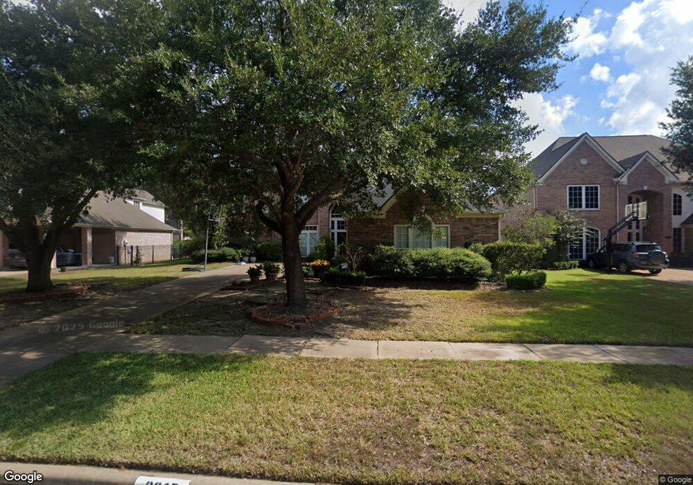
This home is located at 2015 Lytham Ln, Katy, TX 77450 and is currently estimated at $748,680, approximately $179 per square foot. 2015 Lytham Ln is a home located in Harris County with nearby schools including James E Williams Elementary School, Rodger & Ellen Beck Junior High, and Cinco Ranch High School.
Ownership History
Date
Name
Owned For
Owner Type
Purchase Details
Closed on
Jul 12, 2006
Sold by
Hird Kirk B and Hird Jenny L
Bought by
Kang Jaspreet S and Kang Simritia
Current Estimated Value
Purchase Details
Closed on
Aug 7, 1997
Sold by
Perry Homes
Bought by
Hird Kirk B and Hird Jenny L
Home Financials for this Owner
Home Financials are based on the most recent Mortgage that was taken out on this home.
Original Mortgage
$160,000
Interest Rate
7.59%
Purchase Details
Closed on
Apr 7, 1997
Sold by
Cinco Ranch East Development Inc
Bought by
Perry Homes
Create a Home Valuation Report for This Property
The Home Valuation Report is an in-depth analysis detailing your home's value as well as a comparison with similar homes in the area
Home Values in the Area
Average Home Value in this Area
Purchase History
| Date | Buyer | Sale Price | Title Company |
|---|---|---|---|
| Kang Jaspreet S | -- | Houston Title | |
| Hird Kirk B | -- | Chicago Title Insurance Co | |
| Kang Jaspreet S | -- | -- | |
| Perry Homes | -- | Chicago Title Co |
Source: Public Records
Mortgage History
| Date | Status | Borrower | Loan Amount |
|---|---|---|---|
| Previous Owner | Kang Jaspreet S | $160,000 |
Source: Public Records
Tax History
| Year | Tax Paid | Tax Assessment Tax Assessment Total Assessment is a certain percentage of the fair market value that is determined by local assessors to be the total taxable value of land and additions on the property. | Land | Improvement |
|---|---|---|---|---|
| 2025 | $6,843 | $714,361 | $112,632 | $603,691 |
| 2024 | $6,843 | $649,419 | $14,563 | $634,856 |
| 2023 | $6,638 | $590,381 | $0 | $595,885 |
| 2022 | $8,335 | $536,710 | $0 | $589,450 |
| 2021 | $10,756 | $456,114 | $62,985 | $393,129 |
| 2020 | $10,270 | $458,052 | $66,300 | $391,752 |
| 2019 | $11,824 | $496,700 | $78,000 | $418,700 |
| 2018 | $12,149 | $509,680 | $78,000 | $431,680 |
| 2017 | $12,313 | $515,510 | $78,000 | $437,510 |
| 2016 | $12,224 | $511,750 | $78,000 | $433,750 |
| 2015 | $8,574 | $481,370 | $78,000 | $403,370 |
| 2014 | $7,948 | $437,610 | $78,000 | $359,610 |
Source: Public Records
Map
Nearby Homes
- 2206 Winberie Ct
- 2214 Winberie Ct
- 2010 Briarchester Dr
- 2123 White Eagle Ln
- 2130 White Eagle Ln
- 2118 Wild Dunes Cir
- 22807 Two Rivers Ln
- 2110 Wild Dunes Cir
- 1811 Fieldbriar Dr
- 22411 Stormcroft Ln
- 22002 Treesdale Ln
- 22523 Wildwood Grove Dr
- 22210 Treesdale Ln
- 22726 Blue Canyon Dr
- 2014 Edendale Cir
- 22706 Moonlit Lake Ct
- 22310 Kent Falls Dr
- 2023 Garden Terrace Dr
- 2811 Autumn Lake Dr
- 22027 Eagle Meadow Dr
- 2019 Lytham Ln
- 2011 Lytham Ln
- 1915 Lytham Ln
- 2103 Lytham Ln
- 2014 Lytham Ln
- 2010 Lytham Ln
- 2102 Lytham Ln
- 2107 Lytham Ln
- 2006 Lytham Ln
- 2006 Lytham Ln
- 2002 Lytham Ln
- 2106 Lytham Ln
- 2031 Royal Downs Dr
- 2027 Royal Downs Dr
- 1914 Lytham Ln
- 2115 Lytham Ln
- 2107 Royal Adelaide Dr
- 1910 Lytham Ln
- 2023 Royal Downs Dr
- 2110 Lytham Ln
Your Personal Tour Guide
Ask me questions while you tour the home.