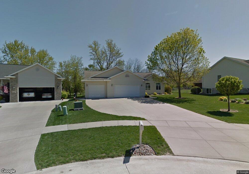
2015 Milligan Ct SW Cedar Rapids, IA 52404
Estimated Value: $265,000 - $347,000
3
Beds
3
Baths
1,625
Sq Ft
$190/Sq Ft
Est. Value
About This Home
This home is located at 2015 Milligan Ct SW, Cedar Rapids, IA 52404 and is currently estimated at $308,359, approximately $189 per square foot. 2015 Milligan Ct SW is a home located in Linn County with nearby schools including Junction City Elementary School, Perryville Elementary School, and Van Buren Elementary School.
Ownership History
Date
Name
Owned For
Owner Type
Purchase Details
Closed on
Jun 30, 2009
Sold by
Claes Robert J and Claes Loretta M
Bought by
Claes Robert J and Claes Loretta M
Current Estimated Value
Purchase Details
Closed on
Dec 29, 1999
Sold by
Claes Robert J
Bought by
Claes Robert J and Loretta M Buresh Revocable Trust
Purchase Details
Closed on
Sep 29, 1999
Sold by
Milligan Daniel D and Milligan Jackie I
Bought by
Claes Robert
Create a Home Valuation Report for This Property
The Home Valuation Report is an in-depth analysis detailing your home's value as well as a comparison with similar homes in the area
Home Values in the Area
Average Home Value in this Area
Purchase History
| Date | Buyer | Sale Price | Title Company |
|---|---|---|---|
| Claes Robert J | -- | None Available | |
| Claes Robert J | -- | -- | |
| Claes Robert | $25,500 | -- |
Source: Public Records
Tax History Compared to Growth
Tax History
| Year | Tax Paid | Tax Assessment Tax Assessment Total Assessment is a certain percentage of the fair market value that is determined by local assessors to be the total taxable value of land and additions on the property. | Land | Improvement |
|---|---|---|---|---|
| 2025 | $4,460 | $309,200 | $46,100 | $263,100 |
| 2024 | $5,002 | $290,100 | $40,500 | $249,600 |
| 2023 | $5,002 | $278,100 | $38,700 | $239,400 |
| 2022 | $4,650 | $249,400 | $38,700 | $210,700 |
| 2021 | $4,960 | $236,800 | $35,000 | $201,800 |
| 2020 | $4,960 | $236,700 | $29,500 | $207,200 |
| 2019 | $4,426 | $217,100 | $29,500 | $187,600 |
| 2018 | $4,298 | $217,100 | $29,500 | $187,600 |
| 2017 | $4,251 | $203,300 | $29,500 | $173,800 |
| 2016 | $4,251 | $203,300 | $29,500 | $173,800 |
| 2015 | $4,391 | $209,667 | $29,478 | $180,189 |
| 2014 | $4,206 | $209,667 | $29,478 | $180,189 |
| 2013 | $4,110 | $209,667 | $29,478 | $180,189 |
Source: Public Records
Map
Nearby Homes
- 2105 Milligan Ct SW
- 2025 18th St SW
- 2150 Rockford Rd SW
- 1960 Rockford Rd SW Unit 45
- 1801 Shady Grove Rd SW
- 2126 Snapdragon Cir SW
- 1913 Holly Meadow Ave SW
- 1806 Holly Meadow Ave SW
- 1824 Holly Meadow Ave SW
- 1812 Holly Meadow Ave SW
- 1818 Holly Meadow Ave SW
- 2207 Shady Grove Rd SW
- Remington - Cedar Rapids Plan at Whispering Pines
- Copeland Plan at Whispering Pines
- Meadowbrook - Cedar Rapids Plan at Stags Leap Estates
- Caldwell Plan at Stags Leap Estates
- Concord - Cedar Rapids Plan at Stags Leap Estates
- Yuma Expanded Plan at Whispering Pines
- Becker II Plan at Kirkwood Village - Kirk Wood Village
- Meadowbrook - Cedar Rapids Plan at Whispering Pines
- 2021 Milligan Ct SW
- 2009 Milligan Ct SW
- 1925 Milligan Ct SW
- 2022 Milligan Ct SW
- 2010 Milligan Ct SW
- 2102 Milligan Ct SW
- 1920 Milligan Ct SW
- 2026 18th St SW
- 2020 18th St SW
- 2100 18th St SW
- 2108 Milligan Ct SW
- 2117 Milligan Ct SW
- 2014 18th St SW
- 2017 Balsam Dr SW
- 2025 Balsam Dr SW
- 2011 Balsam Dr SW
- 2008 18th St SW
- 2102 18th St SW
- 2101 Balsam Dr SW
- 2114 Milligan Ct SW