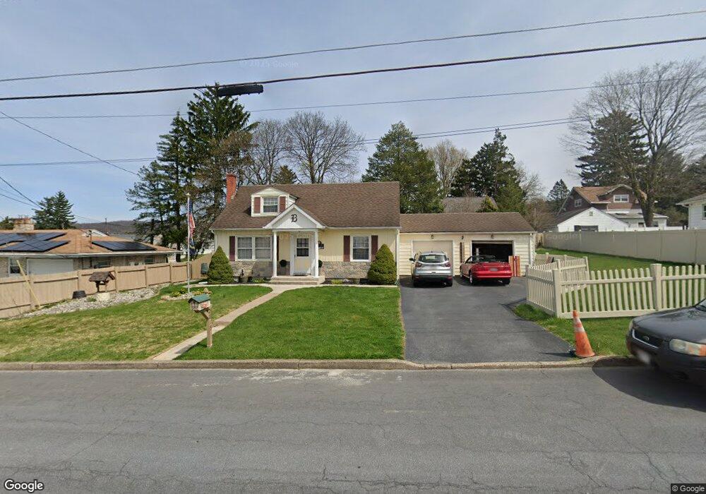
2015 S Albert St Unit 2023 Allentown, PA 18103
Southside NeighborhoodEstimated Value: $286,000 - $322,610
4
Beds
2
Baths
1,188
Sq Ft
$252/Sq Ft
Est. Value
About This Home
This home is located at 2015 S Albert St Unit 2023, Allentown, PA 18103 and is currently estimated at $299,403, approximately $252 per square foot. 2015 S Albert St Unit 2023 is a home located in Lehigh County with nearby schools including Hiram W Dodd Elementary School, South Mountain Middle School, and Louis E. Dieruff High School.
Ownership History
Date
Name
Owned For
Owner Type
Purchase Details
Closed on
Aug 6, 2003
Sold by
Berke Barbara and Novak Barbara
Bought by
Berke Martin L and Berke Barbara R
Current Estimated Value
Home Financials for this Owner
Home Financials are based on the most recent Mortgage that was taken out on this home.
Original Mortgage
$85,000
Outstanding Balance
$36,994
Interest Rate
5.46%
Mortgage Type
Purchase Money Mortgage
Estimated Equity
$262,409
Purchase Details
Closed on
Apr 25, 1997
Sold by
Eckenrode Thomas M and Simons Laura M
Bought by
Novak Barbara
Purchase Details
Closed on
Apr 28, 1993
Sold by
Robinson Dennis L
Bought by
Eckenrode Thomas M and Simons Laura M
Purchase Details
Closed on
Nov 6, 1978
Bought by
Robinson Dennis L
Create a Home Valuation Report for This Property
The Home Valuation Report is an in-depth analysis detailing your home's value as well as a comparison with similar homes in the area
Home Values in the Area
Average Home Value in this Area
Purchase History
| Date | Buyer | Sale Price | Title Company |
|---|---|---|---|
| Berke Martin L | -- | -- | |
| Novak Barbara | $95,000 | -- | |
| Eckenrode Thomas M | $104,500 | -- | |
| Robinson Dennis L | $43,000 | -- |
Source: Public Records
Mortgage History
| Date | Status | Borrower | Loan Amount |
|---|---|---|---|
| Open | Berke Martin L | $85,000 |
Source: Public Records
Tax History Compared to Growth
Tax History
| Year | Tax Paid | Tax Assessment Tax Assessment Total Assessment is a certain percentage of the fair market value that is determined by local assessors to be the total taxable value of land and additions on the property. | Land | Improvement |
|---|---|---|---|---|
| 2025 | $5,091 | $144,800 | $32,500 | $112,300 |
| 2024 | $5,091 | $144,800 | $32,500 | $112,300 |
| 2023 | $5,091 | $144,800 | $32,500 | $112,300 |
| 2022 | $4,926 | $144,800 | $112,300 | $32,500 |
| 2021 | $4,835 | $144,800 | $32,500 | $112,300 |
| 2020 | $4,719 | $144,800 | $32,500 | $112,300 |
| 2019 | $4,649 | $144,800 | $32,500 | $112,300 |
| 2018 | $4,285 | $144,800 | $32,500 | $112,300 |
| 2017 | $4,184 | $144,800 | $32,500 | $112,300 |
| 2016 | -- | $144,800 | $32,500 | $112,300 |
| 2015 | -- | $144,800 | $32,500 | $112,300 |
| 2014 | -- | $144,800 | $32,500 | $112,300 |
Source: Public Records
Map
Nearby Homes
- 121 Woodcrest Cir
- 2429 S Front St
- 2421 S Wood St
- 206 208 W Emaus Ave
- 1865 Chapel Ave
- 102 W Brookdale St
- 1852 S 2nd St
- 148 W Brookdale St
- 2441 S 4th St
- 203 W Brookdale St
- 316 W Mountain Rd
- 135 W Wabash St
- 320 E Paoli St
- 2416 S Alice St Unit 2418
- 2347 S Law St Unit 2349
- 127 E Lynnwood St
- 566 W Emaus Ave
- 566 588 W Emaus Ave
- 2331 S Filbert St
- 2401 S Church St
- 2025 S Albert St Unit 2027
- 2007 S Albert St Unit 2013
- 2018 S Aubrey St Unit 2024
- 2031 S Albert St
- 2008 S Aubrey St Unit 2016
- 2026 S Aubrey St Unit 2032
- 2001 S Albert St
- 2033 S Albert St Unit 2035
- 2022 S Albert St
- 2002 S Aubrey St Unit 2006
- 2026 S Albert St
- 2038 S Aubrey St Unit 2042
- 2037 S Albert St Unit 2041
- 2015 S Aubrey St
- 2013 S Aubrey St Unit 2017
- 25 E Coleman St
- 2023 S Aubrey St Unit 2027
- 9 E Martin St
- 0 E Coleman St
- 21 E Coleman St