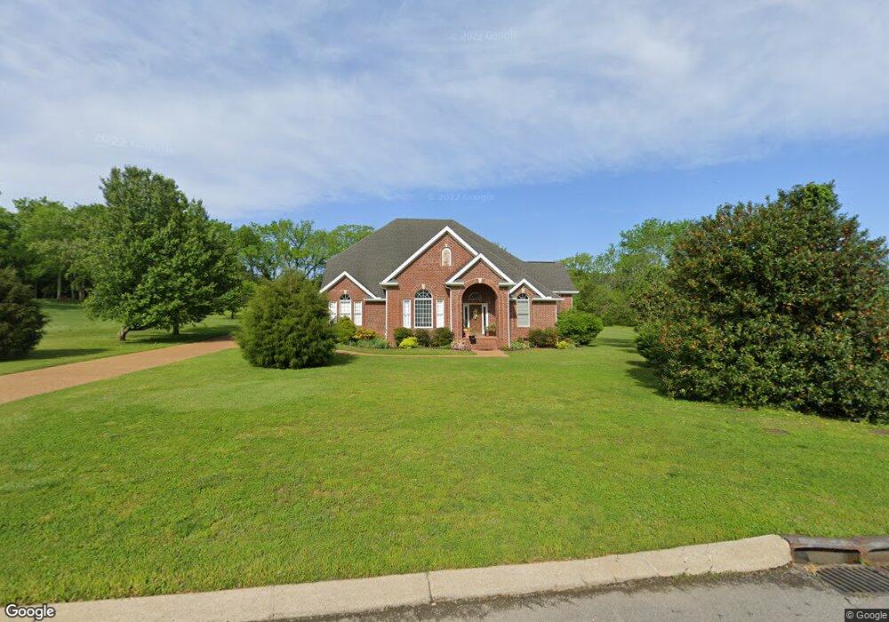
2015 Shoreline Dr Mount Juliet, TN 37122
Estimated Value: $1,417,646 - $1,829,000
--
Bed
4
Baths
5,016
Sq Ft
$320/Sq Ft
Est. Value
About This Home
This home is located at 2015 Shoreline Dr, Mount Juliet, TN 37122 and is currently estimated at $1,603,215, approximately $319 per square foot. 2015 Shoreline Dr is a home located in Wilson County with nearby schools including West Elementary School, West Wilson Middle School, and Mt. Juliet High School.
Ownership History
Date
Name
Owned For
Owner Type
Purchase Details
Closed on
Sep 18, 2006
Sold by
Guth Richard V
Bought by
Carr William W
Current Estimated Value
Home Financials for this Owner
Home Financials are based on the most recent Mortgage that was taken out on this home.
Original Mortgage
$210,000
Outstanding Balance
$124,317
Interest Rate
6.41%
Estimated Equity
$1,478,898
Purchase Details
Closed on
May 15, 2006
Bought by
Carr William W and Carr Barbara Y
Purchase Details
Closed on
Oct 26, 2005
Sold by
Bron Launsby
Bought by
Guth Richard V
Purchase Details
Closed on
Oct 18, 2005
Bought by
Guth Richard B
Purchase Details
Closed on
Sep 26, 2002
Sold by
Depriest William T
Bought by
Bron Launsby
Purchase Details
Closed on
Dec 31, 1986
Bought by
Depriest William T
Create a Home Valuation Report for This Property
The Home Valuation Report is an in-depth analysis detailing your home's value as well as a comparison with similar homes in the area
Home Values in the Area
Average Home Value in this Area
Purchase History
| Date | Buyer | Sale Price | Title Company |
|---|---|---|---|
| Carr William W | $670,000 | -- | |
| Carr William W | $670,000 | -- | |
| Guth Richard V | $650,000 | -- | |
| Guth Richard B | $650,000 | -- | |
| Bron Launsby | $82,000 | -- | |
| Depriest William T | -- | -- |
Source: Public Records
Mortgage History
| Date | Status | Borrower | Loan Amount |
|---|---|---|---|
| Open | Depriest William T | $210,000 |
Source: Public Records
Tax History Compared to Growth
Tax History
| Year | Tax Paid | Tax Assessment Tax Assessment Total Assessment is a certain percentage of the fair market value that is determined by local assessors to be the total taxable value of land and additions on the property. | Land | Improvement |
|---|---|---|---|---|
| 2024 | $4,071 | $213,275 | $41,250 | $172,025 |
| 2022 | $4,071 | $213,275 | $41,250 | $172,025 |
| 2021 | $4,071 | $213,275 | $41,250 | $172,025 |
| 2020 | $5,164 | $213,275 | $41,250 | $172,025 |
| 2019 | $5,159 | $204,825 | $41,250 | $163,575 |
| 2018 | $5,159 | $204,825 | $41,250 | $163,575 |
| 2017 | $5,159 | $204,825 | $41,250 | $163,575 |
| 2016 | $5,159 | $204,825 | $41,250 | $163,575 |
| 2015 | $5,265 | $204,825 | $41,250 | $163,575 |
| 2014 | $3,808 | $148,148 | $0 | $0 |
Source: Public Records
Map
Nearby Homes
- 210 Kortney Marie Place
- 209 Kortney Marie Place
- 141 Kathryn Adele Ln
- 95 Short Dr
- 128 Crestview Dr
- 66 Crestview Dr
- 4896 Benders Ferry Rd
- 1210 Windsor Dr
- 19 Harbor Dr
- 1082 Bradley Rd
- 4635 Benders Ferry Rd
- 341 Sunset Island Trail
- 0 Windsor Dr
- 1104 Port William Ct
- 1003 Beacon Ct
- 1471 Dickerson Bay Dr
- 0 Bradley Rd
- 1420 Dickerson Bay Dr
- 1449 Dickerson Bay Dr
- 0 Creighton Ln
- 2013 Shoreline Dr
- 2017 Shoreline Dr
- 2014 Shoreline Dr
- 2019 Shoreline Dr
- 23 Shoreline Dr
- 2011 Shoreline Dr
- 2016 Shoreline Dr
- 2010 Shoreline Dr
- 2021 Shoreline Dr
- 2009 Shoreline Dr
- 2018 Shoreline Dr
- 2023 Shoreline Dr
- 2020 Shoreline Dr
- 2025 Shoreline Dr
- 2007 Shoreline Dr
- 2022 Shoreline Dr
- 2027 Shoreline Dr
- 2006 Shoreline Dr
- 2029 Shoreline Dr
- 2005 Shoreline Dr