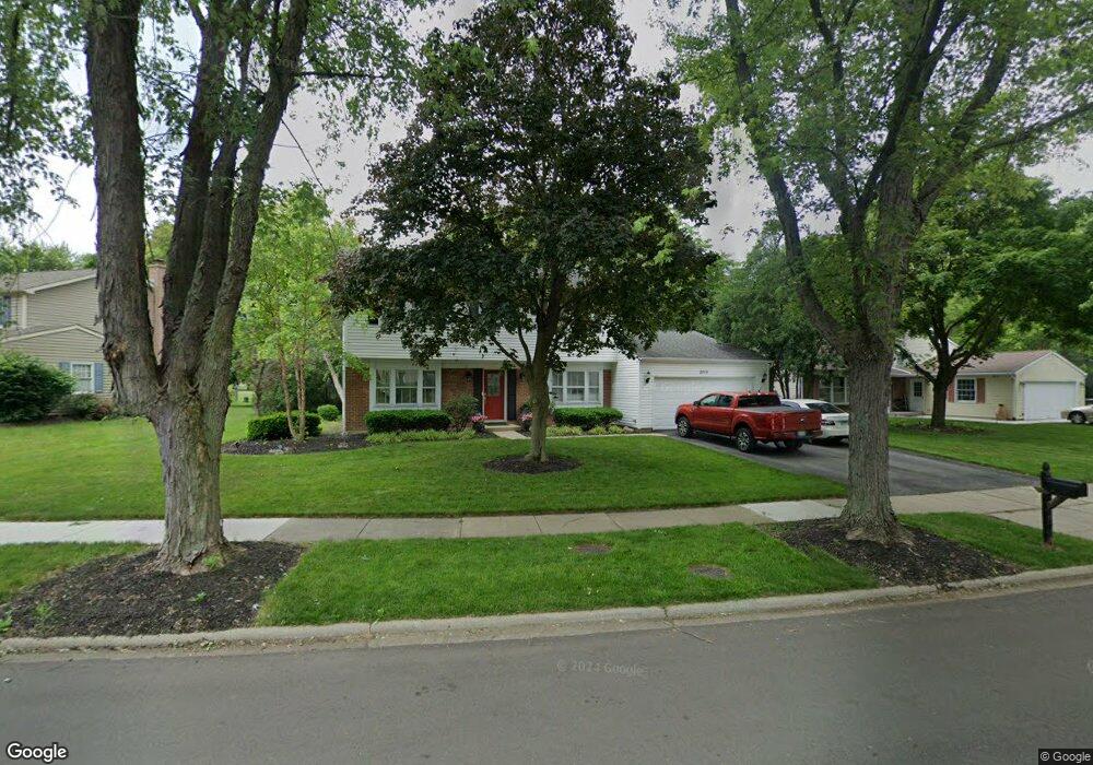
2015 Springside Dr Naperville, IL 60565
Old Farm NeighborhoodEstimated Value: $460,000 - $523,000
--
Bed
1
Bath
2,020
Sq Ft
$248/Sq Ft
Est. Value
About This Home
This home is located at 2015 Springside Dr, Naperville, IL 60565 and is currently estimated at $500,365, approximately $247 per square foot. 2015 Springside Dr is a home located in DuPage County with nearby schools including Kingsley Elementary School, Lincoln Jr. High School, and Naperville Central High School.
Ownership History
Date
Name
Owned For
Owner Type
Purchase Details
Closed on
Jan 16, 2020
Sold by
Doyle Leo J and Doyle Melissa J
Bought by
Doyle Leo J and Doyle Melissa J
Current Estimated Value
Purchase Details
Closed on
Apr 19, 2005
Sold by
Hoesch Sidney Rane and Loven Vicky
Bought by
Doyle Leo J and Doyle Melissa J
Home Financials for this Owner
Home Financials are based on the most recent Mortgage that was taken out on this home.
Original Mortgage
$227,766
Outstanding Balance
$119,666
Interest Rate
6.06%
Mortgage Type
FHA
Estimated Equity
$380,699
Purchase Details
Closed on
Sep 12, 2002
Sold by
Gunter Betty Jean
Bought by
Gunter Betty J and Betty J Gunter Trust
Create a Home Valuation Report for This Property
The Home Valuation Report is an in-depth analysis detailing your home's value as well as a comparison with similar homes in the area
Home Values in the Area
Average Home Value in this Area
Purchase History
| Date | Buyer | Sale Price | Title Company |
|---|---|---|---|
| Doyle Leo J | -- | None Available | |
| Doyle Leo J | $264,000 | -- | |
| Gunter Betty J | -- | -- |
Source: Public Records
Mortgage History
| Date | Status | Borrower | Loan Amount |
|---|---|---|---|
| Open | Doyle Leo J | $227,766 |
Source: Public Records
Tax History Compared to Growth
Tax History
| Year | Tax Paid | Tax Assessment Tax Assessment Total Assessment is a certain percentage of the fair market value that is determined by local assessors to be the total taxable value of land and additions on the property. | Land | Improvement |
|---|---|---|---|---|
| 2024 | $7,956 | $145,871 | $69,895 | $75,976 |
| 2023 | $7,611 | $133,130 | $63,790 | $69,340 |
| 2022 | $7,445 | $121,030 | $57,990 | $63,040 |
| 2021 | $7,170 | $116,460 | $55,800 | $60,660 |
| 2020 | $7,016 | $114,370 | $54,800 | $59,570 |
| 2019 | $6,807 | $109,420 | $52,430 | $56,990 |
| 2018 | $6,466 | $104,210 | $49,930 | $54,280 |
| 2017 | $6,333 | $100,700 | $48,250 | $52,450 |
| 2016 | $6,202 | $97,060 | $46,510 | $50,550 |
| 2015 | $6,156 | $91,400 | $43,800 | $47,600 |
| 2014 | $5,911 | $85,420 | $40,930 | $44,490 |
| 2013 | $5,823 | $85,630 | $41,030 | $44,600 |
Source: Public Records
Map
Nearby Homes
- 2167 Countryside Cir
- 303 Cedarbrook Rd
- 221 Hampshire Ct Unit 201D
- 2337 Worthing Dr Unit 102A
- 1921 Wisteria Ct Unit 3
- 2132 Berkley Ct Unit 201A
- 47 Glencoe Ct Unit 102D
- 23 Glencoe Ct Unit 202B
- 445 Travelaire Ave
- 343 Danbury Dr Unit 6B
- 240 Westbrook Cir
- 284 Westbrook Cir
- 302 Carriage Hill Rd
- 2279 Kaskaskia Ct
- 2206 Gleneagles Dr
- 213 Winding Creek Dr
- 1751 S Washington St Unit 1
- 2471 Kingsley Dr
- 1443 Meander Dr
- 2421 River Woods Dr
- 2013 Springside Dr
- 2019 Springside Dr
- 2012 Springside Dr
- 2023 Springside Dr
- 2005 Springside Dr
- 218 Longridge Ct
- 2006 Springside Dr
- 2025 Springside Dr
- 215 Longridge Ct
- 2022 Springside Dr
- 2024 Springside Dr
- 2003 Springside Dr
- 214 Longridge Ct
- 2002 Springside Dr
- 2027 Springside Dr
- 2026 Springside Dr
- 211 Longridge Ct
- 2001 Springside Dr
- 2028 Springside Dr
- 210 Longridge Ct