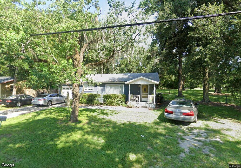
2015 SW 10th Rd Ocala, FL 34471
Southeast Ocala NeighborhoodEstimated Value: $156,000 - $211,000
3
Beds
2
Baths
1,036
Sq Ft
$177/Sq Ft
Est. Value
About This Home
This home is located at 2015 SW 10th Rd, Ocala, FL 34471 and is currently estimated at $183,103, approximately $176 per square foot. 2015 SW 10th Rd is a home located in Marion County with nearby schools including Saddlewood Elementary School, Liberty Middle School, and West Port High School.
Ownership History
Date
Name
Owned For
Owner Type
Purchase Details
Closed on
Sep 5, 2023
Sold by
Vanlue Deborah Kelly and Vanlue Jeffery Alexander
Bought by
Jeffery And Deborah Vanlue Revocable Trust and Vanlue
Current Estimated Value
Purchase Details
Closed on
Sep 20, 2004
Sold by
Luv Enterprises Inc
Bought by
Vanlue Jeffrey A and Vanlue Deborah
Purchase Details
Closed on
Jan 23, 2003
Sold by
Vanlue Jeffrey A
Bought by
Luv Enterprises Inc
Create a Home Valuation Report for This Property
The Home Valuation Report is an in-depth analysis detailing your home's value as well as a comparison with similar homes in the area
Home Values in the Area
Average Home Value in this Area
Purchase History
| Date | Buyer | Sale Price | Title Company |
|---|---|---|---|
| Jeffery And Deborah Vanlue Revocable Trust | $100 | None Listed On Document | |
| Jeffery And Deborah Vanlue Revocable Trust | $100 | None Listed On Document | |
| Vanlue Jeffrey A | $100,000 | -- | |
| Luv Enterprises Inc | -- | -- |
Source: Public Records
Tax History Compared to Growth
Tax History
| Year | Tax Paid | Tax Assessment Tax Assessment Total Assessment is a certain percentage of the fair market value that is determined by local assessors to be the total taxable value of land and additions on the property. | Land | Improvement |
|---|---|---|---|---|
| 2024 | $2,294 | $92,237 | -- | -- |
| 2023 | $2,200 | $83,852 | $0 | $0 |
| 2022 | $1,962 | $76,229 | $0 | $0 |
| 2021 | $1,627 | $69,645 | $25,030 | $44,615 |
| 2020 | $1,171 | $65,722 | $25,030 | $40,692 |
| 2019 | $1,110 | $64,586 | $25,030 | $39,556 |
| 2018 | $1,015 | $61,426 | $25,030 | $36,396 |
| 2017 | $780 | $42,239 | $12,515 | $29,724 |
| 2016 | $897 | $47,975 | $0 | $0 |
| 2015 | $894 | $47,072 | $0 | $0 |
| 2014 | $932 | $52,744 | $0 | $0 |
Source: Public Records
Map
Nearby Homes
- 2109 SW 7th Place
- 2114 SW 7th St
- 530 SW 23rd Ave
- 1732 SW 6th St
- 1707 SW 7th St
- 519 SW 19th Ave
- 0 SW 16th St Unit MFRO6323003
- 2029 SW 5th St
- TBD SW 20th Place
- 1704 SW 5th Place
- 1748 SW 5th St
- TBD SW 4th St
- 2709 SW 16th Place
- 2205 SW 4th St
- 0 SW 17th Cir Unit MFRA4669675
- TBA SW 3rd St
- 1910 SW 2nd St
- 2905 SW 16th St
- 1715 SW 3rd St
- 2401 SW 20th Ct
- 2023 SW 10th Rd
- 1974 SW 9th Rd
- 1963 SW 10th Rd
- 1421 SW 20th Ave
- 1966 SW 9th Rd
- 1951 SW 10th Rd
- 1933 SW 9th Rd
- 1952 SW 9th Rd
- 2011 SW 9th Rd
- 1931 SW 9th Rd
- 1947 SW 10th Rd
- 2065 SW 10th Rd
- 1948 SW 9th Rd
- 1431 SW 21st Ave
- 1949 SW 9th Rd
- 1941 SW 10th Rd
- 2031 SW 9th Rd
- 1450 SW 21st Ave
- 2075 SW 9th Rd
- 802 SW 19th Avenue Rd