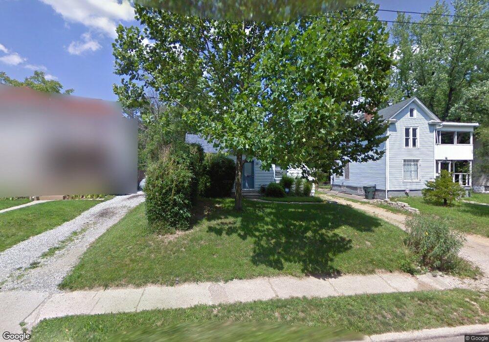
2016 Denune Ave Columbus, OH 43211
East Linden NeighborhoodEstimated Value: $124,000 - $154,000
2
Beds
1
Bath
744
Sq Ft
$180/Sq Ft
Est. Value
About This Home
This home is located at 2016 Denune Ave, Columbus, OH 43211 and is currently estimated at $133,861, approximately $179 per square foot. 2016 Denune Ave is a home located in Franklin County with nearby schools including Linden STEM Academy (K-6), Linden-Mckinley Stem School On Arcadia, and Focus Learning Academy of Central Columbus.
Ownership History
Date
Name
Owned For
Owner Type
Purchase Details
Closed on
Nov 11, 2014
Sold by
Fabbro Mary M
Bought by
Munobe Alex E
Current Estimated Value
Purchase Details
Closed on
Jul 10, 1995
Sold by
Sova Edward R
Bought by
Mary M Fabbro
Home Financials for this Owner
Home Financials are based on the most recent Mortgage that was taken out on this home.
Original Mortgage
$40,286
Interest Rate
7.9%
Mortgage Type
FHA
Purchase Details
Closed on
Oct 5, 1992
Purchase Details
Closed on
May 12, 1992
Create a Home Valuation Report for This Property
The Home Valuation Report is an in-depth analysis detailing your home's value as well as a comparison with similar homes in the area
Home Values in the Area
Average Home Value in this Area
Purchase History
| Date | Buyer | Sale Price | Title Company |
|---|---|---|---|
| Munobe Alex E | $30,000 | None Available | |
| Mary M Fabbro | $40,000 | -- | |
| -- | $39,900 | -- | |
| -- | $14,000 | -- |
Source: Public Records
Mortgage History
| Date | Status | Borrower | Loan Amount |
|---|---|---|---|
| Previous Owner | Mary M Fabbro | $40,286 |
Source: Public Records
Tax History
| Year | Tax Paid | Tax Assessment Tax Assessment Total Assessment is a certain percentage of the fair market value that is determined by local assessors to be the total taxable value of land and additions on the property. | Land | Improvement |
|---|---|---|---|---|
| 2025 | $2,911 | $36,340 | $7,810 | $28,530 |
| 2024 | $2,911 | $36,340 | $7,810 | $28,530 |
| 2023 | $1,610 | $36,330 | $7,805 | $28,525 |
| 2022 | $689 | $12,780 | $2,420 | $10,360 |
| 2021 | $664 | $12,780 | $2,420 | $10,360 |
| 2020 | $665 | $12,780 | $2,420 | $10,360 |
| 2019 | $662 | $10,920 | $2,100 | $8,820 |
| 2018 | $678 | $10,920 | $2,100 | $8,820 |
| 2017 | $662 | $10,920 | $2,100 | $8,820 |
| 2016 | $765 | $11,550 | $2,800 | $8,750 |
| 2015 | $695 | $11,550 | $2,800 | $8,750 |
| 2014 | $169 | $11,550 | $2,800 | $8,750 |
| 2013 | $144 | $13,580 | $3,290 | $10,290 |
Source: Public Records
Map
Nearby Homes
- 2735 Berrell Ave
- 1884 Aberdeen Ave
- 2765 Joyce Ave
- 2475 Parkwood Ave
- 2823 Fern Ave
- 1827 Aberdeen Ave
- 2055 Earl Ave
- 1326 Minnesota Ave
- 1938 Myrtle Ave
- 2699 Woodland Ave
- 2068 Agler Rd
- 1877 Robert St
- 0 Aberdeen Ave Unit 226000728
- 0 Aberdeen Ave Unit 226002456
- 0 Aberdeen Ave Unit 226002459
- 0 Aberdeen Ave Unit 226002457
- 0 Aberdeen Ave Unit 226002458
- 2407 Marcia Dr
- 2861 Woodland Ave
- 1691 E Weber Rd
- 2010 Denune Ave
- 2024 Denune Ave
- 2030 Denune Ave
- 2036 Denune Ave
- 2011 Denune Ave
- 1999 Denune Ave Unit 16
- 2670 Fern Ave
- 2019 Denune Ave
- 2007 Denune Ave
- 2027 Denune Ave
- 2033 Denune Ave
- 2678 Fern Ave
- 2039 Denune Ave
- 2684 Fern Ave
- 1975 Denune Ave
- 2692 Fern Ave
- 1968 Denune Ave
- 1973 Denune Ave
- 1973 E Denune
- 1967 Denune Ave
Your Personal Tour Guide
Ask me questions while you tour the home.