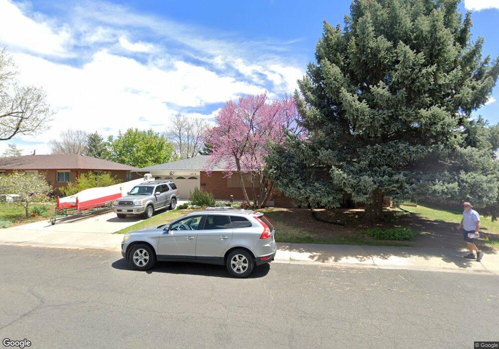
2016 Dotsero Ave Loveland, CO 80538
Estimated Value: $475,000 - $501,795
3
Beds
3
Baths
2,754
Sq Ft
$178/Sq Ft
Est. Value
About This Home
This home is located at 2016 Dotsero Ave, Loveland, CO 80538 and is currently estimated at $490,949, approximately $178 per square foot. 2016 Dotsero Ave is a home located in Larimer County with nearby schools including Van Buren Elementary School, Bill Reed Middle School, and Loveland High School.
Ownership History
Date
Name
Owned For
Owner Type
Purchase Details
Closed on
Nov 20, 2018
Sold by
Wasmuth Donald Michael and Wasmuth Phyllis K
Bought by
Drori Drori Eldad Eldad and Drori Yotvat Rina
Current Estimated Value
Purchase Details
Closed on
Jan 30, 2015
Sold by
Mueller Sharon
Bought by
Wasmuth Donald Michael and Wasmuth Phyllis K
Home Financials for this Owner
Home Financials are based on the most recent Mortgage that was taken out on this home.
Original Mortgage
$185,600
Interest Rate
3.83%
Mortgage Type
New Conventional
Purchase Details
Closed on
Feb 24, 2012
Sold by
Bishop Kenneth
Bought by
Mueller Sharon
Create a Home Valuation Report for This Property
The Home Valuation Report is an in-depth analysis detailing your home's value as well as a comparison with similar homes in the area
Home Values in the Area
Average Home Value in this Area
Purchase History
| Date | Buyer | Sale Price | Title Company |
|---|---|---|---|
| Drori Drori Eldad Eldad | $343,000 | Fidelity National Title | |
| Wasmuth Donald Michael | $232,000 | Stewart Title | |
| Mueller Sharon | $185,000 | None Available |
Source: Public Records
Mortgage History
| Date | Status | Borrower | Loan Amount |
|---|---|---|---|
| Previous Owner | Wasmuth Donald Michael | $185,600 |
Source: Public Records
Tax History Compared to Growth
Tax History
| Year | Tax Paid | Tax Assessment Tax Assessment Total Assessment is a certain percentage of the fair market value that is determined by local assessors to be the total taxable value of land and additions on the property. | Land | Improvement |
|---|---|---|---|---|
| 2025 | $2,430 | $34,137 | $3,216 | $30,921 |
| 2024 | $2,344 | $34,137 | $3,216 | $30,921 |
| 2022 | $2,174 | $27,327 | $3,336 | $23,991 |
| 2021 | $2,234 | $28,114 | $3,432 | $24,682 |
| 2020 | $2,054 | $25,833 | $3,432 | $22,401 |
| 2019 | $2,019 | $25,833 | $3,432 | $22,401 |
| 2018 | $1,771 | $21,514 | $3,456 | $18,058 |
| 2017 | $1,525 | $21,514 | $3,456 | $18,058 |
| 2016 | $1,328 | $18,101 | $3,821 | $14,280 |
| 2015 | $1,317 | $18,100 | $3,820 | $14,280 |
| 2014 | $1,122 | $14,920 | $3,820 | $11,100 |
Source: Public Records
Map
Nearby Homes
- 1812 Van Buren Ave
- 1805 W 22nd St
- 2001 Cameo Ave
- 1718 Dotsero Ave
- 1633 Van Buren Ave Unit 1
- 2306 Cameo Ave
- 2503 N Estrella Ave
- 2030 W 17th St Unit A8
- 2467 Farisita Dr
- 2468 Chama Ct
- 2387 W U S 34
- 1670 Stove Prairie Cir
- 1428 W 25th St
- 1607 W U S 34
- 2628 Hayden Ct
- 1682 Stove Prairie Cir
- 2503 N Taft Ave
- 1534 W 28th St
- 2894 Empire Ave
- 1209 E Broadmoor Dr
- 2012 Dotsero Ave
- 2020 Dotsero Ave
- 2013 Del Norte Ave
- 2017 Del Norte Ave
- 2009 Del Norte Ave
- 2013 Dotsero Ave
- 2008 Dotsero Ave
- 2106 Dotsero Ave
- 2009 Dotsero Ave
- 2017 Dotsero Ave
- 2105 Del Norte Ave
- 2005 Del Norte Ave
- 2103 Dotsero Ave
- 2005 Dotsero Ave
- 2110 Dotsero Ave
- 1914 Dotsero Ave
- 2109 Del Norte Ave
- 2014 Empire Ave
- 2010 Del Norte Ave
- 2014 Del Norte Ave