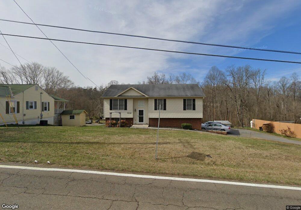
2016 Highway 93 Fall Branch, TN 37656
Estimated Value: $295,000 - $326,000
Studio
3
Baths
1,300
Sq Ft
$235/Sq Ft
Est. Value
About This Home
This home is located at 2016 Highway 93, Fall Branch, TN 37656 and is currently estimated at $306,131, approximately $235 per square foot. 2016 Highway 93 is a home located in Washington County with nearby schools including Fall Branch Elementary School and Daniel Boone High School.
Ownership History
Date
Name
Owned For
Owner Type
Purchase Details
Closed on
Oct 11, 2019
Sold by
Montes Thelma D and Johnson Thelma D
Bought by
Montes Thelma D and Montes Hoos I
Current Estimated Value
Home Financials for this Owner
Home Financials are based on the most recent Mortgage that was taken out on this home.
Original Mortgage
$36,000
Outstanding Balance
$15,571
Interest Rate
3.4%
Mortgage Type
Stand Alone Second
Estimated Equity
$290,560
Purchase Details
Closed on
Apr 12, 2011
Sold by
Hood G H
Bought by
Johnson Thelma D
Home Financials for this Owner
Home Financials are based on the most recent Mortgage that was taken out on this home.
Original Mortgage
$5,000
Interest Rate
4.74%
Mortgage Type
Commercial
Create a Home Valuation Report for This Property
The Home Valuation Report is an in-depth analysis detailing your home's value as well as a comparison with similar homes in the area
Home Values in the Area
Average Home Value in this Area
Purchase History
| Date | Buyer | Sale Price | Title Company |
|---|---|---|---|
| Montes Thelma D | -- | Servicelink | |
| Johnson Thelma D | $143,600 | -- |
Source: Public Records
Mortgage History
| Date | Status | Borrower | Loan Amount |
|---|---|---|---|
| Open | Montes Thelma D | $36,000 | |
| Closed | Johnson Thelma D | $5,000 | |
| Open | Johnson Thelma D | $138,400 |
Source: Public Records
Tax History
| Year | Tax Paid | Tax Assessment Tax Assessment Total Assessment is a certain percentage of the fair market value that is determined by local assessors to be the total taxable value of land and additions on the property. | Land | Improvement |
|---|---|---|---|---|
| 2025 | $1,151 | $67,325 | $5,250 | $62,075 |
| 2024 | $1,151 | $67,325 | $5,250 | $62,075 |
| 2022 | $848 | $39,425 | $3,750 | $35,675 |
| 2021 | $848 | $39,425 | $3,750 | $35,675 |
| 2020 | $848 | $39,425 | $3,750 | $35,675 |
| 2019 | $922 | $39,425 | $3,750 | $35,675 |
| 2018 | $922 | $38,725 | $3,650 | $35,075 |
| 2017 | $922 | $38,725 | $3,650 | $35,075 |
| 2016 | $922 | $38,725 | $3,650 | $35,075 |
| 2015 | $767 | $38,725 | $3,650 | $35,075 |
| 2014 | $767 | $38,725 | $3,650 | $35,075 |
Source: Public Records
Map
Nearby Homes
- 145 Morgan Ln
- 2145 Tennessee 93
- 207 Hermosa Dr
- 211 Sunny Hill Ct
- 238 Cherry Ln
- Lot 6 Tbd Tennessee 93
- Lot 4 Tbd Tennessee 93
- Lot 5 Tbd Tennessee 93
- Lot 2 Tbd Tennessee 93
- Lot 3 Tbd Tennessee 93
- Lot 1 Tbd Tennessee 93
- TBD Tennessee 93
- Tbd Oak Glen Cir
- 137 Crestview Dr
- 176 Moulton Rd
- 901 Old Blairs Gap Rd
- 0 Jearoldstown Rd Unit 40/41
- Lots 3-4 Double Springs Rd
- Lot 2 Double Springs Rd
- 704 Church Hill Dr
- 2016 Tennessee 93
- 2012 Tennessee 93
- 2012 Highway 93
- 2020 Highway 93
- 2023 Highway 93
- 121 Springbrook Dr
- 2004 Highway 93
- 2024 Highway 93
- 119 Kimberly Ln
- 123 Kimberly Ln
- 2027 Highway 93
- 102 Forrest Rd
- 2000 Tennessee 93
- 102 Poore Ln
- 102 Poor Ln
- 118 Poore Ln
- 114 Forrest Rd
- 1914 Highway 93
- 127 Poore Ln
- 116 Forrest Rd
Your Personal Tour Guide
Ask me questions while you tour the home.