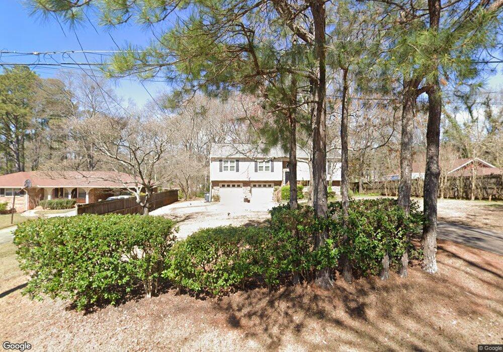
2016 Mcduffie Rd Austell, GA 30106
Estimated Value: $264,776 - $295,000
3
Beds
2
Baths
1,246
Sq Ft
$223/Sq Ft
Est. Value
About This Home
This home is located at 2016 Mcduffie Rd, Austell, GA 30106 and is currently estimated at $277,444, approximately $222 per square foot. 2016 Mcduffie Rd is a home located in Cobb County with nearby schools including Deerwood Elementary School, Clarkdale Elementary School, and Garrett Middle School.
Ownership History
Date
Name
Owned For
Owner Type
Purchase Details
Closed on
Jul 10, 2024
Sold by
West Melissa Bongie
Bought by
Bakari Saidi Ally
Current Estimated Value
Purchase Details
Closed on
Jun 12, 1998
Sold by
Fields Keith E and Fields Patricia
Bought by
Holmes Ellinora
Home Financials for this Owner
Home Financials are based on the most recent Mortgage that was taken out on this home.
Original Mortgage
$88,855
Interest Rate
7.14%
Mortgage Type
FHA
Create a Home Valuation Report for This Property
The Home Valuation Report is an in-depth analysis detailing your home's value as well as a comparison with similar homes in the area
Home Values in the Area
Average Home Value in this Area
Purchase History
| Date | Buyer | Sale Price | Title Company |
|---|---|---|---|
| Bakari Saidi Ally | -- | None Listed On Document | |
| Holmes Ellinora | $92,000 | -- |
Source: Public Records
Mortgage History
| Date | Status | Borrower | Loan Amount |
|---|---|---|---|
| Previous Owner | Holmes Ellinora | $88,855 |
Source: Public Records
Tax History Compared to Growth
Tax History
| Year | Tax Paid | Tax Assessment Tax Assessment Total Assessment is a certain percentage of the fair market value that is determined by local assessors to be the total taxable value of land and additions on the property. | Land | Improvement |
|---|---|---|---|---|
| 2025 | $3,297 | $109,436 | $26,000 | $83,436 |
| 2024 | $604 | $109,436 | $26,000 | $83,436 |
| 2023 | $299 | $76,192 | $15,200 | $60,992 |
| 2022 | $505 | $76,192 | $15,200 | $60,992 |
| 2021 | $505 | $76,192 | $15,200 | $60,992 |
| 2020 | $438 | $53,708 | $14,000 | $39,708 |
| 2019 | $438 | $53,708 | $14,000 | $39,708 |
| 2018 | $430 | $51,220 | $14,000 | $37,220 |
| 2017 | $380 | $51,220 | $14,000 | $37,220 |
| 2016 | $382 | $51,220 | $14,000 | $37,220 |
| 2015 | $276 | $33,060 | $9,600 | $23,460 |
| 2014 | $281 | $33,060 | $0 | $0 |
Source: Public Records
Map
Nearby Homes
- 2024 Mcduffie Rd
- 1992 Mcduffie Rd
- 2032 Mcduffie Rd
- 2015 Mcduffie Rd
- 2023 Mcduffie Rd
- 2023 Mcduffie Rd Unit 27
- 1976 Mcduffie Rd
- 2005 Mcduffie Rd
- 2042 Mcduffie Rd
- 2035 Mcduffie Rd Unit 26
- 2035 Mcduffie Rd
- 1968 Mcduffie Rd
- 2053 Mcduffie Rd
- 2052 Mcduffie Rd
- 1981 Mcduffie Rd
- 1960 Mcduffie Rd
- 2058 Mcduffie Rd
- 2012 Drennon Ave
- 2010 Drennon Ave
- 2010 Drennon Ave Unit 9999