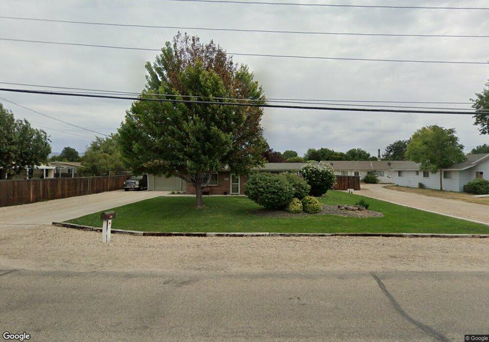
2016 S Curtis Rd Boise, ID 83705
Central Bench NeighborhoodEstimated Value: $397,068 - $441,000
3
Beds
1
Bath
1,097
Sq Ft
$375/Sq Ft
Est. Value
About This Home
This home is located at 2016 S Curtis Rd, Boise, ID 83705 and is currently estimated at $411,017, approximately $374 per square foot. 2016 S Curtis Rd is a home located in Ada County with nearby schools including Hillcrest Elementary School, South Junior High School, and Borah Senior High School.
Ownership History
Date
Name
Owned For
Owner Type
Purchase Details
Closed on
Dec 10, 2022
Sold by
Charters Richard and Charters Sarah
Bought by
Charters Richard and Charters Sarah
Current Estimated Value
Home Financials for this Owner
Home Financials are based on the most recent Mortgage that was taken out on this home.
Original Mortgage
$100,000
Outstanding Balance
$96,999
Interest Rate
6.95%
Mortgage Type
Credit Line Revolving
Estimated Equity
$314,018
Purchase Details
Closed on
Jan 5, 2016
Sold by
Suarez Antioco and Suarez Tera
Bought by
New York Irrigation District
Purchase Details
Closed on
May 30, 2008
Sold by
Queen Robert D and Queen Joann
Bought by
Charters Richard and Lindblom Sarah
Home Financials for this Owner
Home Financials are based on the most recent Mortgage that was taken out on this home.
Original Mortgage
$160,000
Interest Rate
5.87%
Mortgage Type
Seller Take Back
Create a Home Valuation Report for This Property
The Home Valuation Report is an in-depth analysis detailing your home's value as well as a comparison with similar homes in the area
Home Values in the Area
Average Home Value in this Area
Purchase History
| Date | Buyer | Sale Price | Title Company |
|---|---|---|---|
| Charters Richard | -- | -- | |
| New York Irrigation District | -- | None Available | |
| Charters Richard | -- | Stewart Title Company |
Source: Public Records
Mortgage History
| Date | Status | Borrower | Loan Amount |
|---|---|---|---|
| Open | Charters Richard | $100,000 | |
| Previous Owner | Charters Richard | $160,000 |
Source: Public Records
Tax History
| Year | Tax Paid | Tax Assessment Tax Assessment Total Assessment is a certain percentage of the fair market value that is determined by local assessors to be the total taxable value of land and additions on the property. | Land | Improvement |
|---|---|---|---|---|
| 2025 | $2,042 | $384,800 | -- | -- |
| 2024 | $2,120 | $350,000 | -- | -- |
| 2023 | $2,120 | $347,000 | $0 | $0 |
| 2022 | $2,335 | $394,300 | $0 | $0 |
| 2021 | $1,937 | $302,200 | $0 | $0 |
| 2020 | $1,681 | $240,000 | $0 | $0 |
| 2019 | $2,008 | $245,500 | $0 | $0 |
| 2018 | $1,617 | $202,900 | $0 | $0 |
| 2017 | $1,508 | $188,700 | $0 | $0 |
| 2016 | $1,352 | $165,100 | $0 | $0 |
| 2015 | $1,050 | $154,400 | $0 | $0 |
| 2012 | -- | $95,400 | $0 | $0 |
Source: Public Records
Map
Nearby Homes
- 5420 W Targee St
- 2107 S Phillippi St
- 6295 W Grandview Place
- 5339 W Boone Ct
- 4835 W Targee St
- 2623 Fontaine St
- 6701 W Kirkwood Dr
- 4814 W Roberts Rd
- 6726 W Overland Rd
- 952 S Curtis Rd
- 6920 W Grunder St
- 6401 W Victory Rd
- 915 S Curtis Rd Unit 80
- 815 S Curtis Rd Unit 19
- 824 S Curtis Rd
- 6419 W Randolph Dr
- 6414 W Randolph Dr
- 2919 S Pond St
- 4412 W Marvin St
- 4426 W Clark Cir
- 2020 S Curtis Rd
- 2012 Curtis Cir
- 2010 S Curtis Cir
- 2010 S Curtis Rd
- 2010 Curtis Cir
- 2037 S Curtis Rd
- 2008 Curtis Cir
- 2080 S Curtis Rd
- 2029 S Curtis Rd
- 2017 S Curtis Rd
- 2084 S Curtis Rd
- 2006 W Curtis Cir
- 2000 Curtis Cir
- 5820 Oreana Dr
- 5820 W Oreana Dr
- 2002 Curtis Cir
- 2006 Curtis Cir
- 5642 Oreana Ct
- 5803 Oreana Dr
- 2005 N Curtis Rd
Your Personal Tour Guide
Ask me questions while you tour the home.