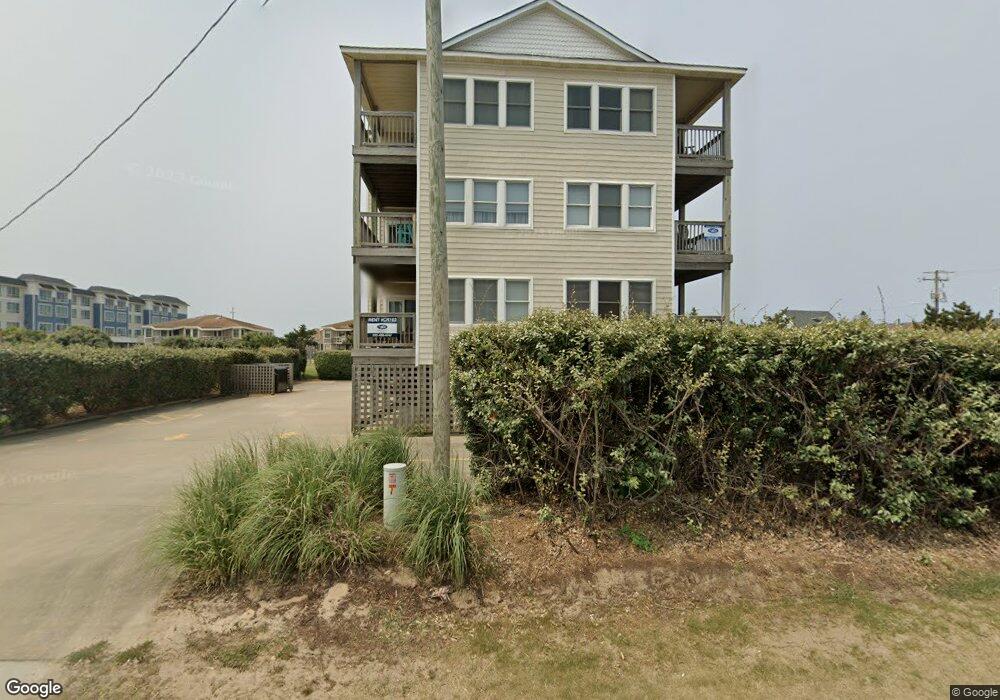
2016 S Virginia Dare Trail Kill Devil Hills, NC 27948
Estimated Value: $664,000 - $1,558,000
3
Beds
2
Baths
6,276
Sq Ft
$178/Sq Ft
Est. Value
About This Home
This home is located at 2016 S Virginia Dare Trail, Kill Devil Hills, NC 27948 and is currently estimated at $1,114,195, approximately $177 per square foot. 2016 S Virginia Dare Trail is a home located in Dare County with nearby schools including Nags Head Elementary School, First Flight Middle School, and First Flight High School.
Create a Home Valuation Report for This Property
The Home Valuation Report is an in-depth analysis detailing your home's value as well as a comparison with similar homes in the area
Home Values in the Area
Average Home Value in this Area
Tax History
| Year | Tax Paid | Tax Assessment Tax Assessment Total Assessment is a certain percentage of the fair market value that is determined by local assessors to be the total taxable value of land and additions on the property. | Land | Improvement |
|---|---|---|---|---|
| 2025 | -- | $600,000 | $571,200 | $28,800 |
| 2024 | -- | $747,000 | $715,300 | $31,700 |
| 2023 | $5,644 | $747,000 | $715,300 | $31,700 |
| 2022 | $0 | $747,000 | $715,300 | $31,700 |
| 2021 | $0 | $747,000 | $715,300 | $31,700 |
| 2020 | $0 | $747,000 | $715,300 | $31,700 |
| 2019 | $0 | $400,000 | $375,300 | $24,700 |
| 2018 | $0 | $400,000 | $375,300 | $24,700 |
| 2017 | $0 | $400,000 | $375,300 | $24,700 |
| 2016 | -- | $400,000 | $375,300 | $24,700 |
| 2014 | -- | $400,000 | $375,300 | $24,700 |
Source: Public Records
Map
Nearby Homes
- 2034 N Virginia Dare Trail Unit Lot 24
- 105 Charlotte St Unit Lot 459
- 102 Greensboro St Unit Lot 504
- 106 W Avalon Dr Unit Lot 88
- 0 W Palmetto St Unit Lot 21R 129908
- 206 E Palmetto St
- 206 E Palmetto St Unit Lot 21-22
- 1317 Devonshire Rd Unit 36
- 700 Skipjack Ln Unit G7
- 702 W Avalon Dr Unit 206
- 225 W Walker St Unit Lot 8-10
- 1817 Sioux St Unit Lot 7
- 1806 Creek St Unit Lot 13
- 705 W 4th St Unit Lot 23
- 1711 Bobby Lee Trail
- 218 W Archdale St Unit Lot 12 & 13
- 1701 N Virginia Dare Trail Unit C3
- 527 W Eden St Unit Lot 7-8
- 1633 N Virginia Dare Trail Unit 3-A
- 1633 N Virginia Dare Trail Unit C2
- 2016 S Virginia Dare Trail Unit 302
- 2016 S Virginia Dare Trail Unit 101
- 2016 S Virginia Dare Trail Unit 202
- 2016 S Virginia Dare Trail Unit 301
- 2016 N Virginia Dare Trail
- 2016 S Virginia Dare Trail Unit 102
- 2016 S Virginia Dare Trail Unit 201
- 2018 N Virginia Dare Trail
- 2014 N Virginia Dare Trail
- 2012 N Virginia Dare Trail
- 2020 N Virginia Dare Trail Unit 38 & A
- 2020 N Virginia Dare Trail
- 2022 N Virginia Dare Trail
- 2015 New Bern St Unit 352
- 2015 New Bern St
- 2019 New Bern St
- 2017 New Bern St
- 2017 N Virginia Dare Trail
- 2021 New Bern St
- 2021 N Virginia Dare Trail Unit 1 /lot37
Your Personal Tour Guide
Ask me questions while you tour the home.