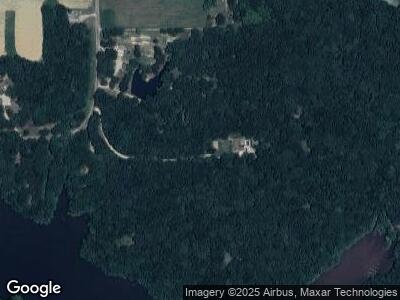
20162 Randi Ln Staunton, IL 62088
Estimated Value: $168,667 - $362,000
--
Bed
--
Bath
--
Sq Ft
2.85
Acres
About This Home
This home is located at 20162 Randi Ln, Staunton, IL 62088 and is currently estimated at $242,917. 20162 Randi Ln is a home with nearby schools including Mt. Olive Elementary School and Mt. Olive High School.
Ownership History
Date
Name
Owned For
Owner Type
Purchase Details
Closed on
Mar 31, 2020
Sold by
Weindel Melissa Jo and Weinel Schuette Kenneth
Bought by
Booth Jeffrey D and Booth Robin S
Current Estimated Value
Create a Home Valuation Report for This Property
The Home Valuation Report is an in-depth analysis detailing your home's value as well as a comparison with similar homes in the area
Home Values in the Area
Average Home Value in this Area
Purchase History
| Date | Buyer | Sale Price | Title Company |
|---|---|---|---|
| Booth Jeffrey D | $195,000 | Community Title & Escrow | |
| Martintoni David | -- | Community Title & Escrow |
Source: Public Records
Mortgage History
| Date | Status | Borrower | Loan Amount |
|---|---|---|---|
| Open | Booth Jeffrey D | $148,000 | |
| Closed | Booth Jeffrey D | $101,750 | |
| Previous Owner | Weindel Schuette Kenneth | $177,400 | |
| Previous Owner | Weindel Melissa Jo | $156,000 |
Source: Public Records
Tax History Compared to Growth
Tax History
| Year | Tax Paid | Tax Assessment Tax Assessment Total Assessment is a certain percentage of the fair market value that is determined by local assessors to be the total taxable value of land and additions on the property. | Land | Improvement |
|---|---|---|---|---|
| 2023 | $2,145 | $36,970 | $5,136 | $31,834 |
| 2022 | $2,145 | $34,551 | $4,800 | $29,751 |
| 2021 | $1,930 | $38,291 | $4,486 | $33,805 |
| 2020 | $1,866 | $36,463 | $4,232 | $32,231 |
| 2019 | $1,872 | $30,686 | $4,455 | $26,231 |
| 2018 | $1,819 | $29,792 | $0 | $0 |
| 2017 | $1,755 | $28,292 | $4,107 | $24,185 |
| 2016 | $1,767 | $28,292 | $4,107 | $24,185 |
| 2015 | $1,757 | $28,292 | $4,107 | $24,185 |
| 2014 | $1,722 | $28,292 | $4,107 | $24,185 |
| 2013 | $325 | $4,457 | $4,457 | $0 |
Source: Public Records
Map
Nearby Homes
- 491 Daisy St
- 315 W 3rd St S
- 304 W 3rd St S
- 519 Bunker Hill Rd
- 311 W Prairie St
- 714 Montgomery St
- 205 Fisher Ave
- 315 W 2nd St N
- 403 W 3rd St N
- 730 E Pennsylvania St
- 807 N Franklin St
- 605 N Union St
- 111 N Poplar St
- 102 Fisher Ave
- 211 E Olive St
- 125 N Wood St
- 515 N Edwardsville St
- 723 Stonecreek Dr
- 105 E MacOupin St
- 1059 Wolf Creek Ct