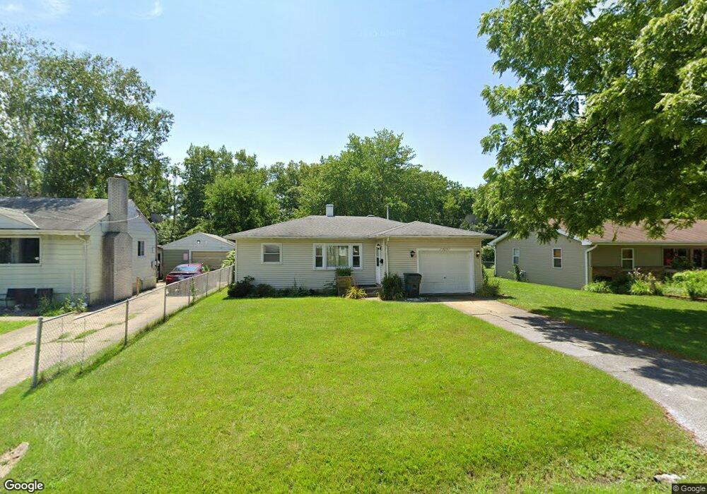
2017 11th St Winthrop Harbor, IL 60096
Shore Acres NeighborhoodEstimated Value: $170,000 - $209,000
2
Beds
1
Bath
816
Sq Ft
$228/Sq Ft
Est. Value
About This Home
This home is located at 2017 11th St, Winthrop Harbor, IL 60096 and is currently estimated at $185,648, approximately $227 per square foot. 2017 11th St is a home located in Lake County with nearby schools including Westfield School, North Prairie Junior High School, and Zion-Benton Township High School.
Ownership History
Date
Name
Owned For
Owner Type
Purchase Details
Closed on
Jun 4, 2025
Sold by
Clarke Neil
Bought by
Neil Clarke Living Trust and Clarke
Current Estimated Value
Purchase Details
Closed on
Mar 9, 2007
Sold by
Cenni Lance L and Cenni Susan M
Bought by
Clarke Neil J
Home Financials for this Owner
Home Financials are based on the most recent Mortgage that was taken out on this home.
Original Mortgage
$128,000
Interest Rate
6.4%
Mortgage Type
Purchase Money Mortgage
Purchase Details
Closed on
Aug 31, 2001
Sold by
Jenkins Robert Stephen
Bought by
Cenni Lance L and Cennis Susan M
Home Financials for this Owner
Home Financials are based on the most recent Mortgage that was taken out on this home.
Original Mortgage
$73,600
Interest Rate
6.99%
Create a Home Valuation Report for This Property
The Home Valuation Report is an in-depth analysis detailing your home's value as well as a comparison with similar homes in the area
Home Values in the Area
Average Home Value in this Area
Purchase History
| Date | Buyer | Sale Price | Title Company |
|---|---|---|---|
| Neil Clarke Living Trust | -- | None Listed On Document | |
| Clarke Neil J | $128,000 | Greater Illinois Title Co | |
| Cenni Lance L | $92,000 | First American Title |
Source: Public Records
Mortgage History
| Date | Status | Borrower | Loan Amount |
|---|---|---|---|
| Previous Owner | Clarke Neil J | $128,000 | |
| Previous Owner | Cenni Lance L | $73,600 |
Source: Public Records
Tax History Compared to Growth
Tax History
| Year | Tax Paid | Tax Assessment Tax Assessment Total Assessment is a certain percentage of the fair market value that is determined by local assessors to be the total taxable value of land and additions on the property. | Land | Improvement |
|---|---|---|---|---|
| 2024 | $2,915 | $40,934 | $4,091 | $36,843 |
| 2023 | $2,981 | $35,197 | $3,949 | $31,248 |
| 2022 | $2,981 | $33,238 | $3,858 | $29,380 |
| 2021 | $2,586 | $28,444 | $3,760 | $24,684 |
| 2020 | $2,486 | $27,144 | $3,588 | $23,556 |
| 2019 | $2,406 | $25,753 | $3,404 | $22,349 |
| 2018 | $2,473 | $26,385 | $4,057 | $22,328 |
| 2017 | $2,438 | $24,822 | $3,817 | $21,005 |
| 2016 | $2,349 | $23,631 | $3,634 | $19,997 |
| 2015 | $2,258 | $21,672 | $3,333 | $18,339 |
| 2014 | $2,266 | $22,210 | $4,035 | $18,175 |
| 2012 | $2,289 | $23,080 | $4,193 | $18,887 |
Source: Public Records
Map
Nearby Homes
- 1120 Fulton Ave
- 1808 13th St
- 2404 13th St
- 830 Russell Ave
- 832 Fulton Ave
- 1206 Landon Ave
- 0 14th St Unit MRD12502206
- 1400 Sheridan Rd
- 1414 Sheridan Rd
- 1426 Sheridan Rd
- 1228 Pennsylvania Ave
- 737 Franklin Ave
- 0 13th St Unit MRD12432014
- 3015 13th St
- 630 Whitney Ave
- 1339 Park Ave
- 3109 11th St
- 3106 13th St
- 1810 5th St
- 0 Garnett Ave