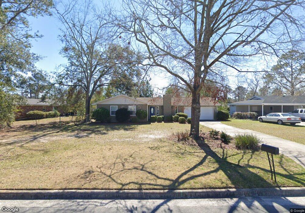
2017 Northside Dr Valdosta, GA 31602
Estimated Value: $143,000 - $154,000
3
Beds
2
Baths
1,232
Sq Ft
$120/Sq Ft
Est. Value
About This Home
This home is located at 2017 Northside Dr, Valdosta, GA 31602 and is currently estimated at $148,076, approximately $120 per square foot. 2017 Northside Dr is a home located in Lowndes County with nearby schools including W.G. Nunn Elementary School, Newbern Middle School, and Valdosta High School.
Ownership History
Date
Name
Owned For
Owner Type
Purchase Details
Closed on
Oct 12, 2011
Sold by
Nelson Darrin
Bought by
Dixon Frederick W
Current Estimated Value
Home Financials for this Owner
Home Financials are based on the most recent Mortgage that was taken out on this home.
Original Mortgage
$76,022
Outstanding Balance
$52,594
Interest Rate
4.4%
Mortgage Type
FHA
Estimated Equity
$95,482
Purchase Details
Closed on
Mar 10, 2006
Sold by
Flannery Michelle
Bought by
Nelson Jeffrey J and Nelson Darrin
Purchase Details
Closed on
Apr 22, 1988
Bought by
Flannery Barry R
Purchase Details
Closed on
Nov 21, 1985
Bought by
Doane Robert W and Doane Leone
Purchase Details
Closed on
Jul 31, 1980
Bought by
Goodson Ruth T
Purchase Details
Closed on
Oct 19, 1977
Bought by
Gamett William F
Purchase Details
Closed on
Mar 22, 1977
Bought by
Huff Aline A
Create a Home Valuation Report for This Property
The Home Valuation Report is an in-depth analysis detailing your home's value as well as a comparison with similar homes in the area
Home Values in the Area
Average Home Value in this Area
Purchase History
| Date | Buyer | Sale Price | Title Company |
|---|---|---|---|
| Dixon Frederick W | $78,000 | -- | |
| Nelson Jeffrey J | $195,000 | -- | |
| Flannery Barry R | $18,100 | -- | |
| Doane Robert W | $16,500 | -- | |
| Goodson Ruth T | $14,500 | -- | |
| Gamett William F | $35,500 | -- | |
| Huff Aline A | $6,000 | -- |
Source: Public Records
Mortgage History
| Date | Status | Borrower | Loan Amount |
|---|---|---|---|
| Open | Dixon Frederick W | $76,022 |
Source: Public Records
Tax History Compared to Growth
Tax History
| Year | Tax Paid | Tax Assessment Tax Assessment Total Assessment is a certain percentage of the fair market value that is determined by local assessors to be the total taxable value of land and additions on the property. | Land | Improvement |
|---|---|---|---|---|
| 2024 | $972 | $40,789 | $4,800 | $35,989 |
| 2023 | $972 | $40,789 | $4,800 | $35,989 |
| 2022 | $824 | $30,397 | $4,800 | $25,597 |
| 2021 | $848 | $30,397 | $4,800 | $25,597 |
| 2020 | $866 | $30,397 | $4,800 | $25,597 |
| 2019 | $866 | $30,397 | $4,800 | $25,597 |
| 2018 | $601 | $22,718 | $4,800 | $17,918 |
| 2017 | $605 | $22,718 | $4,800 | $17,918 |
| 2016 | $604 | $22,718 | $4,800 | $17,918 |
| 2015 | $555 | $22,718 | $4,800 | $17,918 |
| 2014 | $691 | $37,597 | $12,000 | $25,597 |
Source: Public Records
Map
Nearby Homes
- 1750 Almond Tree Place Unit A & B
- 11 Crestwood Cir
- 2570 Marathon Dr
- 1703 Largo Cir
- 1852 Chestnut Dr
- 1724 Eli Place
- 2713 Pineview Dr Unit A&B
- 1739 Eli Place
- 1761 Hyssop Crossing
- TBD Jaycee Shack Rd
- 1647 Fresno St
- 7.63 AC Tyndall Dr
- 1763 Eli Place
- 1 Pomona Cir
- 2400 Lowndes Dr
- 2311 Lowndes Dr
- 2517 Deborah Dr
- 2737 Dogwood Cir
- 2414 Deborah Dr
- 1703 Leone Ave
- 2015 Northside Dr
- 2034 Bancroft Rd
- 2616 Quincy Cir
- 2032 Bancroft Rd
- 2013 Northside Dr
- 2614 Quincy Cir
- 2016 Northside Dr
- 2014 Northside Dr
- 2612 Quincy Cir
- 2012 Northside Dr
- 2011 Northside Dr
- 2037 Bancroft Rd
- 2035 Bancroft Rd
- 2010 Northside Dr
- 2610 Quincy Cir
- 2615 Quincy Cir
- 2033 Bancroft Rd
- 2028 Bancroft Rd
- 2613 Quincy Cir
- 2009 Northside Dr