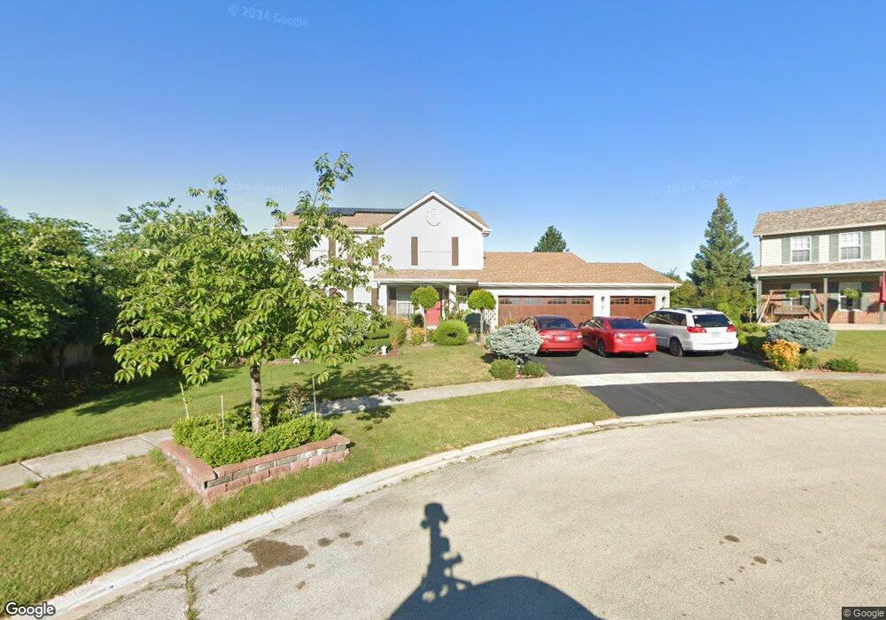
2017 Scotch Pine Ct Lockport, IL 60441
South Lockport NeighborhoodEstimated Value: $348,028 - $418,000
--
Bed
1
Bath
2,184
Sq Ft
$178/Sq Ft
Est. Value
About This Home
This home is located at 2017 Scotch Pine Ct, Lockport, IL 60441 and is currently estimated at $389,257, approximately $178 per square foot. 2017 Scotch Pine Ct is a home located in Will County with nearby schools including Taft Grade School, Lockport Township High School East, and Saint Dennis School.
Ownership History
Date
Name
Owned For
Owner Type
Purchase Details
Closed on
May 25, 2005
Sold by
Abrogar Maycel
Bought by
Olegario John E and Abrogar Maycel
Current Estimated Value
Home Financials for this Owner
Home Financials are based on the most recent Mortgage that was taken out on this home.
Original Mortgage
$222,000
Interest Rate
5.91%
Mortgage Type
New Conventional
Create a Home Valuation Report for This Property
The Home Valuation Report is an in-depth analysis detailing your home's value as well as a comparison with similar homes in the area
Home Values in the Area
Average Home Value in this Area
Purchase History
| Date | Buyer | Sale Price | Title Company |
|---|---|---|---|
| Olegario John E | -- | Law Title Pick Up |
Source: Public Records
Mortgage History
| Date | Status | Borrower | Loan Amount |
|---|---|---|---|
| Closed | Olegario John E | $222,000 |
Source: Public Records
Tax History Compared to Growth
Tax History
| Year | Tax Paid | Tax Assessment Tax Assessment Total Assessment is a certain percentage of the fair market value that is determined by local assessors to be the total taxable value of land and additions on the property. | Land | Improvement |
|---|---|---|---|---|
| 2024 | $8,790 | $117,407 | $26,261 | $91,146 |
| 2023 | $8,790 | $105,402 | $23,576 | $81,826 |
| 2022 | $8,368 | $99,293 | $22,209 | $77,084 |
| 2021 | $7,721 | $93,312 | $20,871 | $72,441 |
| 2020 | $7,539 | $98,082 | $20,185 | $77,897 |
| 2019 | $7,882 | $92,969 | $19,133 | $73,836 |
| 2018 | $8,063 | $92,969 | $19,133 | $73,836 |
| 2017 | $7,825 | $87,765 | $18,062 | $69,703 |
| 2016 | $7,479 | $82,254 | $16,928 | $65,326 |
| 2015 | $6,225 | $73,833 | $15,195 | $58,638 |
| 2014 | $6,225 | $69,003 | $14,201 | $54,802 |
| 2013 | $6,225 | $69,003 | $14,201 | $54,802 |
Source: Public Records
Map
Nearby Homes
- 1914 S Austrian Pine St Unit 2
- 17045 Sterling Dr
- 2005 Princess Ct
- 2009 Princess Ct
- 2021 Princess Ct
- 1623 East St
- 516 Whelan St
- 1513 Connor Ave
- 17340 Lucerne Ct
- 1212 Grandview Ave
- 1525 Peachtree Ln Unit 2
- 818 E 11th St
- 1526 Peachtree Ln
- 2004 Boehme St
- 202 E 14th St
- 17228 Como Ave
- 17120 Carlislie Ln
- 1105 E Division St Unit 1B
- Lots 57, 58, 59 & 60 Green Garden Place
- 302 Hughes Ave
- 2000 S East St
- 642 Parkview Ln
- 2025 Scotch Pine Ct
- 2009 Scotch Pine Ct
- 1908 S East St
- 634 Parkview Ln
- 2000 Scotch Pine Ct
- 1900 S East St
- 2008 Scotch Pine Ct
- 2016 Scotch Pine Ct
- 706 Parkview Ln
- 2104 Lone Star Dr
- 2001 S East St
- 2009 S East St
- 1808 S East St
- 1909 S East St
- 714 Parkview Ln
- 1913 Sequoia Way
- 1921 Sequoia Way
- 2103 Fir Ct