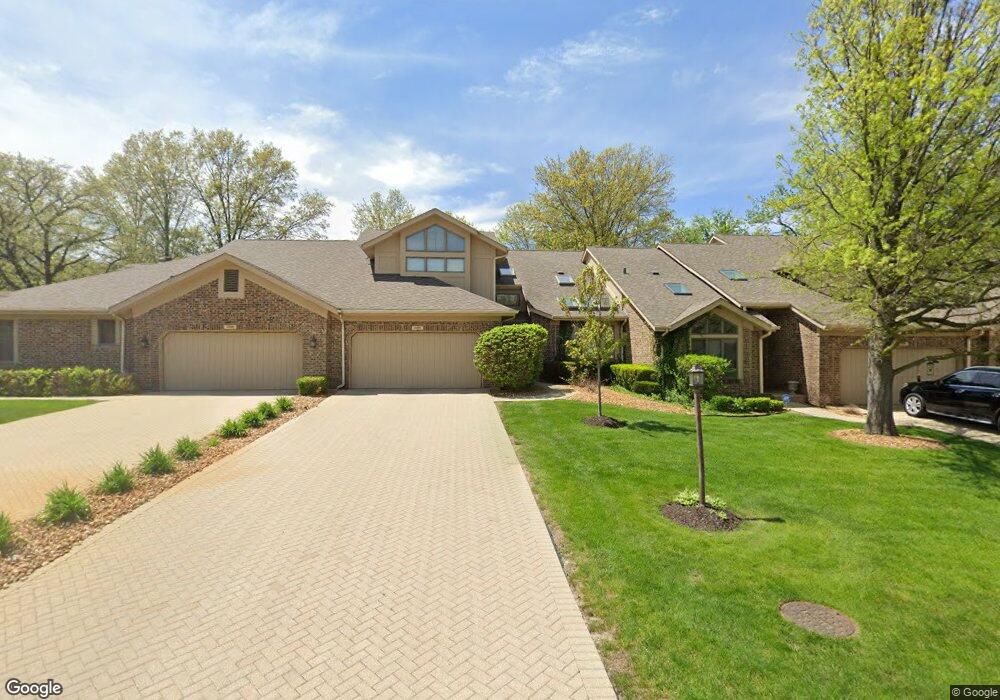
20170 Saint Andrews Dr Olympia Fields, IL 60461
Estimated Value: $316,452 - $344,000
3
Beds
3
Baths
2,405
Sq Ft
$135/Sq Ft
Est. Value
About This Home
This home is located at 20170 Saint Andrews Dr, Olympia Fields, IL 60461 and is currently estimated at $324,363, approximately $134 per square foot. 20170 Saint Andrews Dr is a home located in Cook County with nearby schools including Western Avenue Elementary School, Parker Junior High School, and Infant Jesus of Prague School.
Ownership History
Date
Name
Owned For
Owner Type
Purchase Details
Closed on
Mar 27, 2007
Sold by
Hansen Claire V and Hansen Renee C
Bought by
Williams Elliott and Williams Billie L
Current Estimated Value
Home Financials for this Owner
Home Financials are based on the most recent Mortgage that was taken out on this home.
Original Mortgage
$276,250
Outstanding Balance
$243,956
Interest Rate
9.35%
Mortgage Type
New Conventional
Estimated Equity
$80,407
Purchase Details
Closed on
Aug 21, 1998
Sold by
Proffitt Md Morris M and Proffitt Mary Ann
Bought by
Hansen Claire V and Hansen Renee C
Create a Home Valuation Report for This Property
The Home Valuation Report is an in-depth analysis detailing your home's value as well as a comparison with similar homes in the area
Home Values in the Area
Average Home Value in this Area
Purchase History
| Date | Buyer | Sale Price | Title Company |
|---|---|---|---|
| Williams Elliott | $325,000 | Baird & Warner Title Service | |
| Hansen Claire V | $200,000 | -- |
Source: Public Records
Mortgage History
| Date | Status | Borrower | Loan Amount |
|---|---|---|---|
| Open | Williams Elliott | $276,250 |
Source: Public Records
Tax History
| Year | Tax Paid | Tax Assessment Tax Assessment Total Assessment is a certain percentage of the fair market value that is determined by local assessors to be the total taxable value of land and additions on the property. | Land | Improvement |
|---|---|---|---|---|
| 2025 | $7,775 | $24,749 | $2,124 | $22,625 |
| 2024 | $7,775 | $24,749 | $2,124 | $22,625 |
| 2023 | $8,277 | $24,749 | $2,124 | $22,625 |
| 2022 | $8,277 | $21,645 | $3,894 | $17,751 |
| 2021 | $8,378 | $21,645 | $3,894 | $17,751 |
| 2020 | $8,642 | $23,117 | $3,894 | $19,223 |
| 2019 | $6,467 | $18,967 | $3,540 | $15,427 |
| 2018 | $5,949 | $18,967 | $3,540 | $15,427 |
| 2017 | $6,191 | $18,967 | $3,540 | $15,427 |
| 2016 | $8,861 | $18,215 | $3,186 | $15,029 |
| 2015 | $8,856 | $18,215 | $3,186 | $15,029 |
| 2014 | $7,656 | $20,552 | $3,186 | $17,366 |
| 2013 | $10,171 | $23,442 | $3,186 | $20,256 |
Source: Public Records
Map
Nearby Homes
- 31 Graymoor Ln
- 136 Graymoor Ln
- 20015 Delphi Dr
- 634 Lexington Dr
- 2724 Chariot Ln
- 2904 Athena Ct
- 2908 Athena Ct
- 2700 Chariot Ln
- 2509 207th St
- 1723 Oak Lane Rd
- 1816 Quail Ct
- 542 Winston Ln
- 2925 Dartmouth Ln
- 531 W Winchester Rd
- 2935 Dartmouth Ln
- 823 Bradoc St
- 2433 Athens Rd
- 505 W Joe Orr Rd
- 2937 Kathleen Ln
- 523 8th St
- 20180 Saint Andrews Dr
- 20160 St Andrews Dr Unit 3
- 20150 Saint Andrews Dr
- 20212 Saint Andrews Dr
- 20140 Saint Andrews Dr
- 2529 Saint Andrews Dr
- 20130 Saint Andrews Dr
- 20130 St Andrews Dr
- 20203 Saint Andrews Dr
- 2525 Saint Andrews Dr
- 20120 Saint Andrews Dr
- 20222 Saint Andrews Dr
- 20222 St Andrews Dr
- 20213 Saint Andrews Dr
- 2521 Saint Andrews Dr
- 20223 Saint Andrews Dr
- 20232 Saint Andrews Dr
- 20082 Tam o Shanter Ct
- 2617 Oakwood Dr
- 20200 Saint Andrews Ct
Your Personal Tour Guide
Ask me questions while you tour the home.