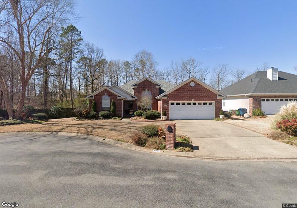
2018 Brookford Dr Little Rock, AR 72211
Western Little Rock NeighborhoodEstimated Value: $278,962 - $301,000
--
Bed
2
Baths
1,949
Sq Ft
$150/Sq Ft
Est. Value
About This Home
This home is located at 2018 Brookford Dr, Little Rock, AR 72211 and is currently estimated at $292,241, approximately $149 per square foot. 2018 Brookford Dr is a home located in Pulaski County with nearby schools including Terry Elementary School, Pinnacle View Middle School, and LISA Academy West Elementary School.
Ownership History
Date
Name
Owned For
Owner Type
Purchase Details
Closed on
Jan 24, 2005
Sold by
Hodges Joseph R and Hodges Janice K
Bought by
Ron & Janice Hodges Revocable Trust
Current Estimated Value
Purchase Details
Closed on
Aug 13, 1999
Sold by
Alizzeo Mark D and Alizzeo Donna Michelle
Bought by
Hodges Joseph R and Hodges Janice K
Purchase Details
Closed on
May 27, 1998
Sold by
Nunn Gloria S and Nunn W
Bought by
Alizzeo Mark D
Home Financials for this Owner
Home Financials are based on the most recent Mortgage that was taken out on this home.
Original Mortgage
$136,300
Interest Rate
7.2%
Mortgage Type
Purchase Money Mortgage
Purchase Details
Closed on
Jan 22, 1997
Sold by
Coker & Gammill Inc
Bought by
Nunn Gloria S and Nunn W
Home Financials for this Owner
Home Financials are based on the most recent Mortgage that was taken out on this home.
Original Mortgage
$125,700
Interest Rate
7.57%
Mortgage Type
Purchase Money Mortgage
Create a Home Valuation Report for This Property
The Home Valuation Report is an in-depth analysis detailing your home's value as well as a comparison with similar homes in the area
Home Values in the Area
Average Home Value in this Area
Purchase History
| Date | Buyer | Sale Price | Title Company |
|---|---|---|---|
| Ron & Janice Hodges Revocable Trust | -- | -- | |
| Hodges Joseph R | $153,000 | American Abstract & Title Co | |
| Alizzeo Mark D | $144,000 | American Abstract & Title Co | |
| Nunn Gloria S | $140,000 | Beach Abstract & Guaranty Co |
Source: Public Records
Mortgage History
| Date | Status | Borrower | Loan Amount |
|---|---|---|---|
| Previous Owner | Alizzeo Mark D | $136,300 | |
| Previous Owner | Nunn Gloria S | $125,700 |
Source: Public Records
Tax History Compared to Growth
Tax History
| Year | Tax Paid | Tax Assessment Tax Assessment Total Assessment is a certain percentage of the fair market value that is determined by local assessors to be the total taxable value of land and additions on the property. | Land | Improvement |
|---|---|---|---|---|
| 2025 | $2,370 | $49,099 | $5,800 | $43,299 |
| 2024 | $2,370 | $49,099 | $5,800 | $43,299 |
| 2023 | $2,370 | $49,099 | $5,800 | $43,299 |
| 2022 | $2,370 | $49,099 | $5,800 | $43,299 |
| 2021 | $2,386 | $41,370 | $7,200 | $34,170 |
| 2020 | $1,995 | $41,370 | $7,200 | $34,170 |
| 2019 | $1,995 | $41,370 | $7,200 | $34,170 |
| 2018 | $2,020 | $41,370 | $7,200 | $34,170 |
| 2017 | $2,020 | $41,370 | $7,200 | $34,170 |
| 2016 | $2,020 | $40,240 | $5,000 | $35,240 |
| 2015 | -- | $33,851 | $5,000 | $28,851 |
| 2014 | -- | $33,851 | $5,000 | $28,851 |
Source: Public Records
Map
Nearby Homes
- 2001 Brookford Dr
- 12601 Misty Creek Dr
- 12400 Cherry Laurel Dr
- 1707 Point Dr W
- 2623 Bowman Rd
- 11701 Shady Creek Dr
- 2806 Woodsgate Dr
- 1505 Point Dr W
- 2905 Woodsgate Dr
- 11612 Shady Creek Dr
- 28 Elkrun Cove
- 3015 Woodsgate Dr
- 2820 Mossy Creek Dr
- 12425 Brodie Creek Trail
- 1409 Mesquite Dr
- 1408 S Bowman Rd
- 12 Summer Ridge Ct
- 2815 Mossy Creek Dr
- 2825 Mossy Creek Dr
- 1509 Gamble Rd
- 2014 Brookford Dr
- 2010 Brookford Dr
- 2105 Stoney Creek Dr
- 2015 Brookford Dr
- 2011 Brookford Dr
- 2019 Brookford Dr
- 2101 Stoney Creek Dr
- 2007 Brookford Dr
- 2006 Brookford Dr
- 4 Cherry Shade Ct
- 2019 Stoney Creek Dr
- 2115 Stoney Creek Dr
- 1912 Cherrybend Dr
- 1910 Cherrybend Dr
- 2000 Brookford Dr
- 1906 Cherrybend Dr
- 1914 Cherrybend Dr
- 2011 Stoney Creek Dr
- 1904 Cherrybend Dr
- 5 Cherry Shade Ct