
Seller's Agent in 2015
GABRIEL MIZRAHI
R New York
(718) 974-0031
Estimated Value: $4,119,429 - $6,137,000
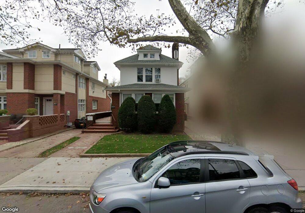
RARE OPPORTUNITY!!! To buy in prime location. EAST 4TH STREET BETWEEN S and T, 2 story single family 4 bedrooms 2 baths with large basement over 2400sf, with private garage and backyard. On a 40x100 lot All the extra space needed? bring in your contractor and design your dream home. PRICE TO SELL!!!Call or email Gabriel Mizrahi for a private showing.
Last Agent to Sell the Property
R New York License #40MI1162703 Listed on: 06/26/2014
| Date | Buyer | Sale Price | Title Company |
|---|---|---|---|
| 2018 E 4 Llc | $8,600,000 | -- | |
| Thor 2018 East 4Th Street Llc | $6,040,000 | -- | |
| Bd 2018 East 4Th Llc | $3,850,000 | -- |
| Date | Status | Borrower | Loan Amount |
|---|---|---|---|
| Open | 2018 E 4 Llc | $5,338,750 | |
| Previous Owner | Bd 2018 East 4Th Llc | $2,000,000 |
| Date | Event | Price | List to Sale | Price per Sq Ft |
|---|---|---|---|---|
| 02/11/2015 02/11/15 | Sold | -- | -- | -- |
| 11/04/2014 11/04/14 | Pending | -- | -- | -- |
| 06/26/2014 06/26/14 | For Sale | -- | -- | -- |
| Year | Tax Paid | Tax Assessment Tax Assessment Total Assessment is a certain percentage of the fair market value that is determined by local assessors to be the total taxable value of land and additions on the property. | Land | Improvement |
|---|---|---|---|---|
| 2025 | $11,188 | $238,740 | $36,120 | $202,620 |
| 2024 | $11,188 | $280,860 | $36,120 | $244,740 |
| 2023 | $10,672 | $248,220 | $36,120 | $212,100 |
| 2022 | $9,586 | $203,160 | $36,120 | $167,040 |
| 2021 | $10,623 | $156,840 | $36,120 | $120,720 |
| 2019 | $9,710 | $160,440 | $36,120 | $124,320 |
| 2018 | $8,927 | $43,792 | $7,364 | $36,428 |
| 2017 | $8,623 | $42,301 | $5,740 | $36,561 |
| 2016 | $8,456 | $42,301 | $6,086 | $36,215 |
| 2015 | $1,968 | $41,003 | $8,851 | $32,152 |
| 2014 | $1,968 | $38,683 | $7,852 | $30,831 |
Seller's Agent in 2015
GABRIEL MIZRAHI
R New York
(718) 974-0031
Source: Real Estate Board of New York (REBNY)
MLS Number: RLS10060296
APN: 07106-0176
Disclaimer: Certain information contained herein is derived from information provided by parties other than Homes.com. All information provided is deemed reliable, but is not guaranteed to be accurate and should be independently verified.
![]() This information is not verified for authenticity or accuracy and is not guaranteed and may not reflect all real estate activity in the market. ©2026 The Real Estate Board of New York, Inc., All rights reserved.
This information is not verified for authenticity or accuracy and is not guaranteed and may not reflect all real estate activity in the market. ©2026 The Real Estate Board of New York, Inc., All rights reserved.
RLS Data display by Homes.com LLC
Ask me questions while you tour the home.