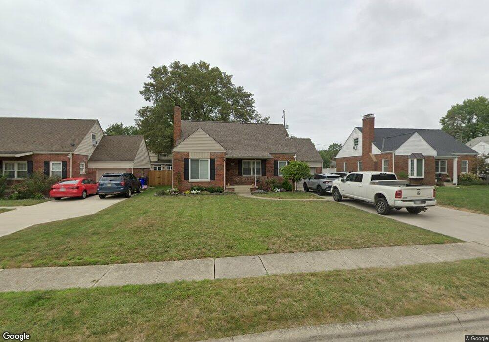
2018 Jervis Rd Columbus, OH 43221
Estimated Value: $404,818 - $524,000
3
Beds
1
Bath
1,326
Sq Ft
$354/Sq Ft
Est. Value
About This Home
This home is located at 2018 Jervis Rd, Columbus, OH 43221 and is currently estimated at $469,705, approximately $354 per square foot. 2018 Jervis Rd is a home located in Franklin County with nearby schools including Tremont Elementary School, Jones Middle School, and Upper Arlington High School.
Ownership History
Date
Name
Owned For
Owner Type
Purchase Details
Closed on
Apr 8, 2008
Sold by
Conie Anthony P
Bought by
Conie Anthony P and Conie Kimberly S
Current Estimated Value
Purchase Details
Closed on
Jul 7, 1994
Sold by
Conie John J
Bought by
Conie Anthony P and Conie John J
Home Financials for this Owner
Home Financials are based on the most recent Mortgage that was taken out on this home.
Original Mortgage
$60,000
Interest Rate
7.75%
Mortgage Type
New Conventional
Purchase Details
Closed on
Aug 16, 1991
Create a Home Valuation Report for This Property
The Home Valuation Report is an in-depth analysis detailing your home's value as well as a comparison with similar homes in the area
Home Values in the Area
Average Home Value in this Area
Purchase History
| Date | Buyer | Sale Price | Title Company |
|---|---|---|---|
| Conie Anthony P | -- | None Available | |
| Conie Anthony P | $20,000 | -- | |
| -- | -- | -- |
Source: Public Records
Mortgage History
| Date | Status | Borrower | Loan Amount |
|---|---|---|---|
| Closed | Conie Anthony P | $60,000 |
Source: Public Records
Tax History Compared to Growth
Tax History
| Year | Tax Paid | Tax Assessment Tax Assessment Total Assessment is a certain percentage of the fair market value that is determined by local assessors to be the total taxable value of land and additions on the property. | Land | Improvement |
|---|---|---|---|---|
| 2024 | $6,978 | $117,250 | $48,020 | $69,230 |
| 2023 | $7,103 | $117,250 | $48,020 | $69,230 |
| 2022 | $6,937 | $94,780 | $30,870 | $63,910 |
| 2021 | $6,177 | $94,780 | $30,870 | $63,910 |
| 2020 | $5,811 | $94,780 | $30,870 | $63,910 |
| 2019 | $5,719 | $77,950 | $30,870 | $47,080 |
| 2018 | $5,216 | $77,950 | $30,870 | $47,080 |
| 2017 | $5,132 | $77,950 | $30,870 | $47,080 |
| 2016 | $4,774 | $70,320 | $28,880 | $41,440 |
| 2015 | $4,744 | $70,320 | $28,880 | $41,440 |
| 2014 | $4,651 | $70,320 | $28,880 | $41,440 |
| 2013 | $2,269 | $63,910 | $26,250 | $37,660 |
Source: Public Records
Map
Nearby Homes
- 3106 Somerford Rd
- 2047 Langham Rd
- 3296 Leighton Rd
- 1842 Ridgecliff Rd
- 3175 Tremont Rd Unit 504
- 3175 Tremont Rd Unit 313
- 2227 Zollinger Rd
- 3015 Welsford Rd
- 3161 Avalon Rd
- 1743 Ardleigh Rd Unit 1743
- 2979 Avalon Rd
- 2225 Swansea Rd
- 2370 Zollinger Rd
- 3509 Redding Rd
- 2438 Sherwood Villa Unit 5
- 2583 Wexford Rd
- 3444 Sunningdale Way
- 3156 Mt Holyoke Rd
- 3163 S Dorchester Rd
- 2401 Shrewsbury Rd
- 2026 Jervis Rd
- 2010 Jervis Rd
- 2032 Jervis Rd
- 2017 Zollinger Rd
- 2002 Jervis Rd
- 2001 Zollinger Rd
- 2025 Zollinger Rd
- 2017 Jervis Rd
- 2025 Jervis Rd
- 2040 Jervis Rd
- 1995 Zollinger Rd
- 1994 Jervis Rd
- 1999 Jervis Rd
- 2033 Jervis Rd
- 1985 Zollinger Rd
- 2048 Jervis Rd
- 2041 Jervis Rd
- 1991 Jervis Rd
- 2041 Zollinger Rd
- 1988 Jervis Rd