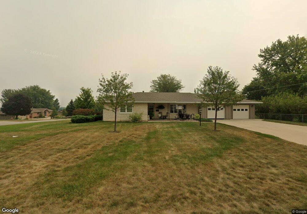
2018 Quint Ave Carroll, IA 51401
Estimated Value: $243,000 - $268,186
2
Beds
2
Baths
1,384
Sq Ft
$186/Sq Ft
Est. Value
About This Home
This home is located at 2018 Quint Ave, Carroll, IA 51401 and is currently estimated at $257,797, approximately $186 per square foot. 2018 Quint Ave is a home with nearby schools including Fairview Elementary School, Adams Elementary School, and Carroll Middle School.
Ownership History
Date
Name
Owned For
Owner Type
Purchase Details
Closed on
May 16, 2022
Sold by
Koster Marian T
Bought by
Marian T Koster Revocable Trust
Current Estimated Value
Purchase Details
Closed on
Feb 26, 2009
Sold by
Timmerman Richard L
Bought by
Koster Marian T
Home Financials for this Owner
Home Financials are based on the most recent Mortgage that was taken out on this home.
Original Mortgage
$95,310
Interest Rate
5.14%
Mortgage Type
Future Advance Clause Open End Mortgage
Create a Home Valuation Report for This Property
The Home Valuation Report is an in-depth analysis detailing your home's value as well as a comparison with similar homes in the area
Home Values in the Area
Average Home Value in this Area
Purchase History
| Date | Buyer | Sale Price | Title Company |
|---|---|---|---|
| Marian T Koster Revocable Trust | -- | None Listed On Document | |
| Koster Marian T | $106,000 | None Available |
Source: Public Records
Mortgage History
| Date | Status | Borrower | Loan Amount |
|---|---|---|---|
| Previous Owner | Koster Marian T | $95,310 |
Source: Public Records
Tax History Compared to Growth
Tax History
| Year | Tax Paid | Tax Assessment Tax Assessment Total Assessment is a certain percentage of the fair market value that is determined by local assessors to be the total taxable value of land and additions on the property. | Land | Improvement |
|---|---|---|---|---|
| 2025 | $3,240 | $280,410 | $35,410 | $245,000 |
| 2024 | $3,176 | $247,070 | $35,410 | $211,660 |
| 2023 | $2,433 | $247,070 | $35,410 | $211,660 |
| 2022 | $2,306 | $159,120 | $30,350 | $128,770 |
| 2021 | $2,306 | $159,120 | $30,350 | $128,770 |
| 2020 | $2,362 | $159,120 | $30,350 | $128,770 |
| 2019 | $2,420 | $159,120 | $30,350 | $128,770 |
| 2018 | $2,278 | $159,120 | $30,350 | $128,770 |
| 2017 | $2,278 | $159,056 | $31,394 | $127,662 |
| 2016 | $2,128 | $148,650 | $0 | $0 |
| 2015 | $2,128 | $141,910 | $0 | $0 |
| 2014 | $2,008 | $140,820 | $0 | $0 |
Source: Public Records
Map
Nearby Homes
- 611 W 21st St
- 711 W 21st St
- 1852 Quint Ave
- 1810 Crestview Dr
- 219 Windwood Dr
- 631 W 17th St
- 1608 Salinger Ave
- 1509 Birch St
- 1601 N Main St
- 1515 N Main St
- 1320 N Adams St
- 907 Salinger Ave
- 265 Perch St
- 0 E 10th St Unit 5423085
- 0 E 10th St Unit 6324630
- 0 E 10th St Unit 6319081
- 260 Bass St
- 1015 N Adams St
- 1108 N Main St
- 1102 N Main St