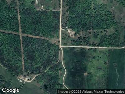
2018 Stone Ridge Dr Mountain Grove, MO 65711
Estimated Value: $411,000 - $429,083
--
Bed
--
Bath
2,211
Sq Ft
$190/Sq Ft
Est. Value
About This Home
This home is located at 2018 Stone Ridge Dr, Mountain Grove, MO 65711 and is currently estimated at $420,042, approximately $189 per square foot. 2018 Stone Ridge Dr is a home located in Texas County with nearby schools including Mountain Grove Elementary School, Mountain Grove Middle School, and Ozark Mountain Technical Center.
Ownership History
Date
Name
Owned For
Owner Type
Purchase Details
Closed on
Jul 12, 2016
Sold by
Record Gary H and Record Mary Anne
Bought by
Record Gary H and Record Mary Anne
Current Estimated Value
Home Financials for this Owner
Home Financials are based on the most recent Mortgage that was taken out on this home.
Original Mortgage
$154,997
Outstanding Balance
$127,736
Interest Rate
3.6%
Mortgage Type
VA
Purchase Details
Closed on
Apr 15, 2008
Sold by
Rogers Donnie Ray and Seccombe Janice Leann
Bought by
Record Gary H and Record Mary Anne
Home Financials for this Owner
Home Financials are based on the most recent Mortgage that was taken out on this home.
Original Mortgage
$300,000
Outstanding Balance
$201,236
Interest Rate
6.11%
Mortgage Type
New Conventional
Create a Home Valuation Report for This Property
The Home Valuation Report is an in-depth analysis detailing your home's value as well as a comparison with similar homes in the area
Home Values in the Area
Average Home Value in this Area
Purchase History
| Date | Buyer | Sale Price | Title Company |
|---|---|---|---|
| Record Gary H | -- | None Available | |
| Record Gary H | -- | None Available | |
| Record Gary H | -- | None Available |
Source: Public Records
Mortgage History
| Date | Status | Borrower | Loan Amount |
|---|---|---|---|
| Open | Record Gary H | $84,500 | |
| Open | Record Gary H | $154,997 | |
| Closed | Record Gary H | $25,000 | |
| Closed | Record Gary H | $152,000 | |
| Closed | Record Gary H | $300,000 |
Source: Public Records
Tax History Compared to Growth
Tax History
| Year | Tax Paid | Tax Assessment Tax Assessment Total Assessment is a certain percentage of the fair market value that is determined by local assessors to be the total taxable value of land and additions on the property. | Land | Improvement |
|---|---|---|---|---|
| 2024 | $1,249 | $33,510 | $0 | $0 |
| 2023 | $1,265 | $33,510 | $0 | $0 |
| 2022 | $1,152 | $30,700 | $0 | $0 |
| 2021 | $1,087 | $30,700 | $0 | $0 |
| 2020 | $1,087 | $29,580 | $0 | $0 |
| 2019 | $1,087 | $29,580 | $0 | $0 |
| 2018 | $1,020 | $27,550 | $0 | $0 |
| 2017 | $1,019 | $27,550 | $0 | $0 |
| 2016 | $1,016 | $27,550 | $0 | $0 |
| 2015 | -- | $27,550 | $0 | $0 |
| 2014 | -- | $27,550 | $0 | $0 |
| 2013 | -- | $27,490 | $0 | $0 |
Source: Public Records
Map
Nearby Homes
- 10477 M- Am Hwy
- 10477 Am Hwy
- 000 King Rd
- 000 E Business 60 Option 1
- 2305 King Rd
- 11498 Weatherman Dr
- 10465 9th Rd
- 000 E Business 60
- 2675 Main Ln
- 000 Sunshine St
- 10506 Dogwood Rd
- 000 Dogwood Rd
- 12397 State Highway Ad
- 11263 Oak Hill Ln
- 826 E Dorris Ave
- 11397 Stave Mill Rd
- 11397
- 1208 N Hubbard Ave
- 1203 N Hubbard Ave
- 730 E Dorris Ave
- 2018 Stone Ridge Dr
- 2009 Stone Ridge Dr
- 1970 Stone Ridge Dr
- 2174 Stone Ridge Dr
- 10437 10437 Hwy
- 1950 Stone Ridge Dr
- Tbd Stone Ridge Dr
- 0 Stone Ridge Dr
- 1900 Stone Ridge Dr
- 1900 Stone Ridge Dr
- 1680 Pointer Rd
- 2704 Town Dr
- 10437 Highway Am
- 10437 Highway Am
- 2110 Hidden Valley Rd
- 10473 Highway Am
- 10445 Highway Am
- 10475 Highway Am
- 2060 Hidden Valley Dr
- 10405 Highway Am
