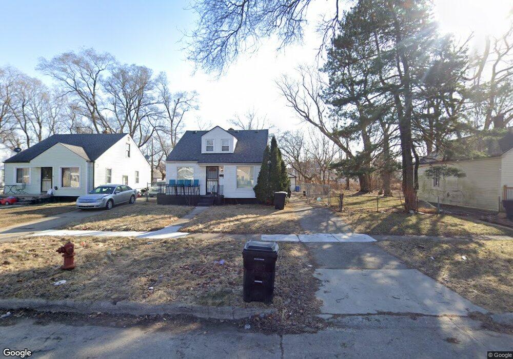
20186 Anglin St Detroit, MI 48234
Butler NeighborhoodEstimated Value: $60,000 - $115,000
3
Beds
1
Bath
1,000
Sq Ft
$83/Sq Ft
Est. Value
About This Home
This home is located at 20186 Anglin St, Detroit, MI 48234 and is currently estimated at $82,721, approximately $82 per square foot. 20186 Anglin St is a home located in Wayne County with nearby schools including Nolan Elementary/Middle School, Edward 'Duke' Ellington Conservatory of Music and Art, and Charles L. Spain Elementary-Middle School.
Ownership History
Date
Name
Owned For
Owner Type
Purchase Details
Closed on
May 17, 2006
Sold by
Rose Ronald A
Bought by
Deutsche Bank National Trust Co and Morgan Stanley Abs Capital I Inc Trust 2
Current Estimated Value
Purchase Details
Closed on
Aug 6, 2003
Sold by
Henderson Robert and Farris Henderson Audria D
Bought by
Rose Ronald A
Purchase Details
Closed on
Feb 6, 2003
Sold by
Farris Henderson Audria D and Henderson Robert
Bought by
U S Bank Na and First Bank Na Trust
Create a Home Valuation Report for This Property
The Home Valuation Report is an in-depth analysis detailing your home's value as well as a comparison with similar homes in the area
Home Values in the Area
Average Home Value in this Area
Purchase History
| Date | Buyer | Sale Price | Title Company |
|---|---|---|---|
| Deutsche Bank National Trust Co | $71,795 | None Available | |
| Rose Ronald A | $85,000 | Progressive Title Insurance | |
| U S Bank Na | $37,972 | -- |
Source: Public Records
Tax History Compared to Growth
Tax History
| Year | Tax Paid | Tax Assessment Tax Assessment Total Assessment is a certain percentage of the fair market value that is determined by local assessors to be the total taxable value of land and additions on the property. | Land | Improvement |
|---|---|---|---|---|
| 2025 | $991 | $30,200 | $0 | $0 |
| 2024 | $991 | $25,800 | $0 | $0 |
| 2023 | $961 | $20,700 | $0 | $0 |
| 2022 | $1,020 | $17,300 | $0 | $0 |
| 2021 | $994 | $13,900 | $0 | $0 |
| 2020 | $994 | $11,900 | $0 | $0 |
| 2019 | $980 | $9,500 | $0 | $0 |
| 2018 | $869 | $8,200 | $0 | $0 |
| 2017 | $152 | $8,000 | $0 | $0 |
| 2016 | $1,236 | $22,700 | $0 | $0 |
| 2015 | $140 | $1,400 | $0 | $0 |
| 2013 | $1,574 | $15,744 | $0 | $0 |
| 2010 | -- | $23,081 | $1,378 | $21,703 |
Source: Public Records
Map
Nearby Homes
- 20021 Mackay St
- 20121 Mitchell St
- 20048 Fleming St
- 19951 Mackay St
- 19958 Harned St
- 20021 Fleming St
- 19948 Mitchell St
- 23421 Harned St Unit 4
- 23429 Harned St Unit 5
- 23485 Harned St Unit 10
- 20037 Gallagher St
- 23420 Harned St Unit 1
- 20156 Gallagher St
- 20181 Lumpkin St
- 20028 Gallagher St
- 20209 Revere St
- 20491 Klinger St
- 19626 Mackay St
- 19624 Anglin St
- 19629 Harned St
- 20196 Anglin St
- 20174 Anglin St
- 20206 Anglin St
- 20191 Harned St
- 20197 Harned St
- 20214 Anglin St
- 20179 Harned St
- 20160 Anglin St
- 20207 Harned St
- 20169 Harned St
- 20224 Anglin St
- 20152 Anglin St
- 20217 Harned St
- 20185 Anglin St
- 20191 Anglin St
- 20157 Harned St
- 20201 Anglin St
- 20169 Anglin St
- 20225 Harned St
- 20140 Anglin St