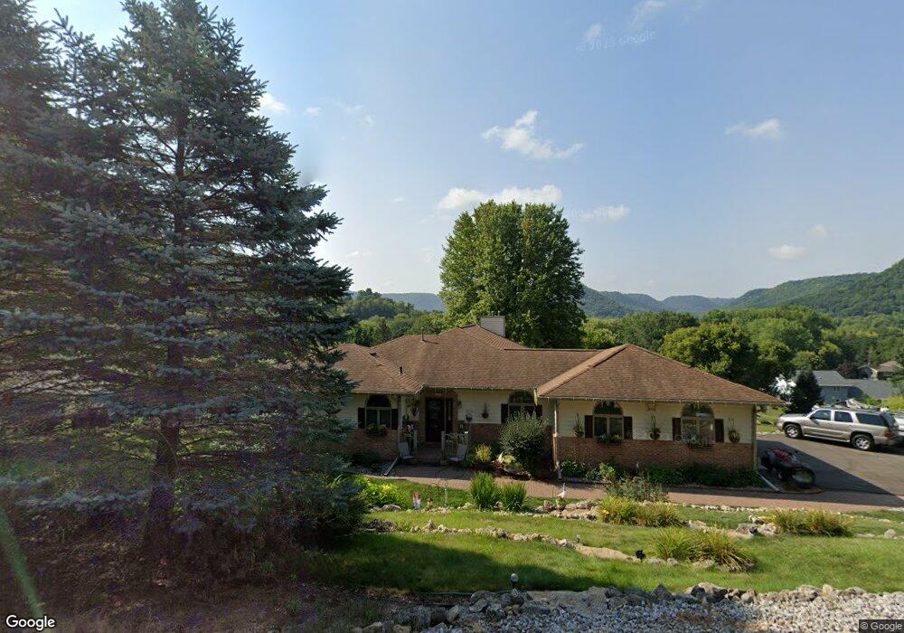
2019 Clinton Dr Winona, MN 55987
Estimated Value: $460,000 - $628,000
4
Beds
3
Baths
1,972
Sq Ft
$274/Sq Ft
Est. Value
About This Home
This home is located at 2019 Clinton Dr, Winona, MN 55987 and is currently estimated at $539,625, approximately $273 per square foot. 2019 Clinton Dr is a home located in Winona County with nearby schools including Washington-Kosciusko Elementary School, Winona Middle School, and Winona Senior High School.
Ownership History
Date
Name
Owned For
Owner Type
Purchase Details
Closed on
Aug 6, 2010
Sold by
Bernard David M and Berbard Joan E
Bought by
Forst Randall L and Forst Sharon R
Current Estimated Value
Home Financials for this Owner
Home Financials are based on the most recent Mortgage that was taken out on this home.
Original Mortgage
$224,000
Interest Rate
4.58%
Mortgage Type
Unknown
Create a Home Valuation Report for This Property
The Home Valuation Report is an in-depth analysis detailing your home's value as well as a comparison with similar homes in the area
Home Values in the Area
Average Home Value in this Area
Purchase History
| Date | Buyer | Sale Price | Title Company |
|---|---|---|---|
| Forst Randall L | -- | -- |
Source: Public Records
Mortgage History
| Date | Status | Borrower | Loan Amount |
|---|---|---|---|
| Closed | Forst Randall L | $224,000 |
Source: Public Records
Tax History Compared to Growth
Tax History
| Year | Tax Paid | Tax Assessment Tax Assessment Total Assessment is a certain percentage of the fair market value that is determined by local assessors to be the total taxable value of land and additions on the property. | Land | Improvement |
|---|---|---|---|---|
| 2025 | $3,684 | $479,000 | $61,500 | $417,500 |
| 2024 | $3,684 | $459,600 | $61,500 | $398,100 |
| 2023 | $3,324 | $429,500 | $61,500 | $368,000 |
| 2022 | $3,246 | $416,400 | $57,500 | $358,900 |
| 2021 | $3,166 | $362,900 | $51,500 | $311,400 |
| 2020 | $3,234 | $327,500 | $49,500 | $278,000 |
| 2019 | $3,268 | $327,500 | $49,500 | $278,000 |
| 2018 | $3,178 | $314,200 | $47,500 | $266,700 |
| 2017 | $3,138 | $0 | $0 | $0 |
| 2016 | $2,972 | $0 | $0 | $0 |
| 2015 | $2,972 | $0 | $0 | $0 |
| 2014 | $3,032 | $0 | $0 | $0 |
Source: Public Records
Map
Nearby Homes
- 851 6th St W
- 169 Cobblestone Ln
- 68 Links Ln
- 68 Links Ln Unit 3
- 53 Rodeo Dr
- 182 Treetops Ln
- 1370 Mcnally Dr
- 953 W Burns Valley Rd
- 36415 Homer Valley Ln
- 1031 Highway 43
- 1031 Minnesota 43
- 863 W Burns Valley Rd
- 24242 Pfeiffer Hill Rd
- TBD E Burns Valley Rd
- 75 Debi Lei Dr
- 1010 7th St
- 473 Chatfield St
- 616 E Sarnia St
- 26283 Meadowbrook Ln
- 415 Mankato Ave
- 2019 Clinton Dr
- 2021 Clinton Dr
- 2020 Clinton Dr
- 2017 Clinton Dr
- 2188 Clinton Dr
- 2198 Clinton Dr
- 2024 Clinton Dr
- 2178 Clinton Dr
- 2018 Cheryl Ct
- 2016 Clinton Dr
- 2370 Meadow Ln
- 2199 Clinton Dr
- 2197 Clinton Dr
- 2021 Cheryl Ct
- 2382 Meadow Ln
- 2416 Carolyn Place
- 2012 Clinton Dr
- 2012 Clinton Dr
- 2187 Clinton Dr
- 2177 Clinton Dr