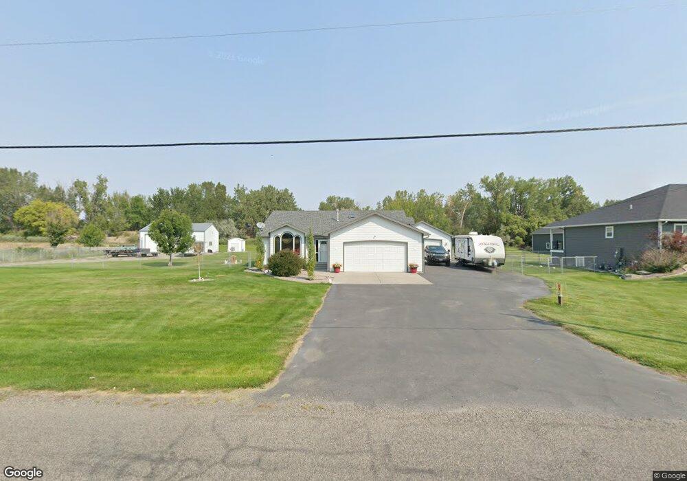
2019 E Maryland Ln Laurel, MT 59044
Estimated Value: $499,000 - $599,000
3
Beds
3
Baths
1,849
Sq Ft
$293/Sq Ft
Est. Value
About This Home
This home is located at 2019 E Maryland Ln, Laurel, MT 59044 and is currently estimated at $541,339, approximately $292 per square foot. 2019 E Maryland Ln is a home located in Yellowstone County with nearby schools including Fred W. Graff School, West School, and Laurel Middle School.
Ownership History
Date
Name
Owned For
Owner Type
Purchase Details
Closed on
Feb 14, 2023
Sold by
Marty Don
Bought by
Baumann Lane and Baumann Trinity
Current Estimated Value
Home Financials for this Owner
Home Financials are based on the most recent Mortgage that was taken out on this home.
Original Mortgage
$517,750
Outstanding Balance
$501,940
Interest Rate
6.48%
Mortgage Type
New Conventional
Estimated Equity
$39,399
Purchase Details
Closed on
Dec 15, 2008
Sold by
Zard Tonya D
Bought by
Zard Kevin
Home Financials for this Owner
Home Financials are based on the most recent Mortgage that was taken out on this home.
Original Mortgage
$162,000
Interest Rate
6.16%
Mortgage Type
Unknown
Create a Home Valuation Report for This Property
The Home Valuation Report is an in-depth analysis detailing your home's value as well as a comparison with similar homes in the area
Home Values in the Area
Average Home Value in this Area
Purchase History
| Date | Buyer | Sale Price | Title Company |
|---|---|---|---|
| Baumann Lane | -- | Chicago Title | |
| Zard Kevin | -- | None Available |
Source: Public Records
Mortgage History
| Date | Status | Borrower | Loan Amount |
|---|---|---|---|
| Open | Baumann Lane | $517,750 | |
| Previous Owner | Zard Kevin | $162,000 |
Source: Public Records
Tax History
| Year | Tax Paid | Tax Assessment Tax Assessment Total Assessment is a certain percentage of the fair market value that is determined by local assessors to be the total taxable value of land and additions on the property. | Land | Improvement |
|---|---|---|---|---|
| 2025 | $2,591 | $462,600 | $115,108 | $347,492 |
| 2024 | $2,591 | $355,000 | $75,683 | $279,317 |
| 2023 | $2,515 | $355,000 | $75,683 | $279,317 |
| 2022 | $2,197 | $302,000 | $0 | $0 |
| 2021 | $2,190 | $302,000 | $0 | $0 |
| 2020 | $2,015 | $270,500 | $0 | $0 |
| 2019 | $1,942 | $270,500 | $0 | $0 |
| 2018 | $2,114 | $249,100 | $0 | $0 |
| 2017 | $1,938 | $249,100 | $0 | $0 |
| 2016 | $1,840 | $240,900 | $0 | $0 |
| 2015 | $1,814 | $240,900 | $0 | $0 |
| 2014 | $1,623 | $114,268 | $0 | $0 |
Source: Public Records
Map
Nearby Homes
- 1031 Fir Ave
- 1108 E 8th St
- 1104 E 8th St
- 605 Date Ave
- 1665 Wild Lupine Ln
- 1321 E Railroad St
- 1627 Brookway Cir
- 717 E 5th, 506 Alder Ave
- 717 E 5th St
- 801 E 4th St
- 809 Pennsylvania Ave
- 1906 Waterwood Dr
- 414 Wyoming Ave
- 516 Pennsylvania Ave
- 110 E 5th St
- 310 1st Ave
- 1319 Valley Dr
- 603 5th Ave
- 1631 Valley Dr
- 116 4th Ave
- 2029 E Maryland Ln
- 2024 E Maryland Ln
- 2057 E Maryland Ln
- 2034 E Maryland Ln
- 1919 E Maryland Ln
- TBD Yard Office Rd
- 2105 E Maryland Ln
- 2113 Atchison Dr
- 2102 E Maryland Ln
- 2115 Atchison Dr
- 2109 Atchison Dr
- 2104 E Maryland Ln
- 2117 Atchison Dr
- 1906 E Maryland Ln
- 2106 E Maryland Ln
- 1825 E Maryland Ln
- 2203 Atchison Dr
- 2108 E Maryland Ln
- 2106 Atchison Dr
- 2108 Atchison Dr
Your Personal Tour Guide
Ask me questions while you tour the home.