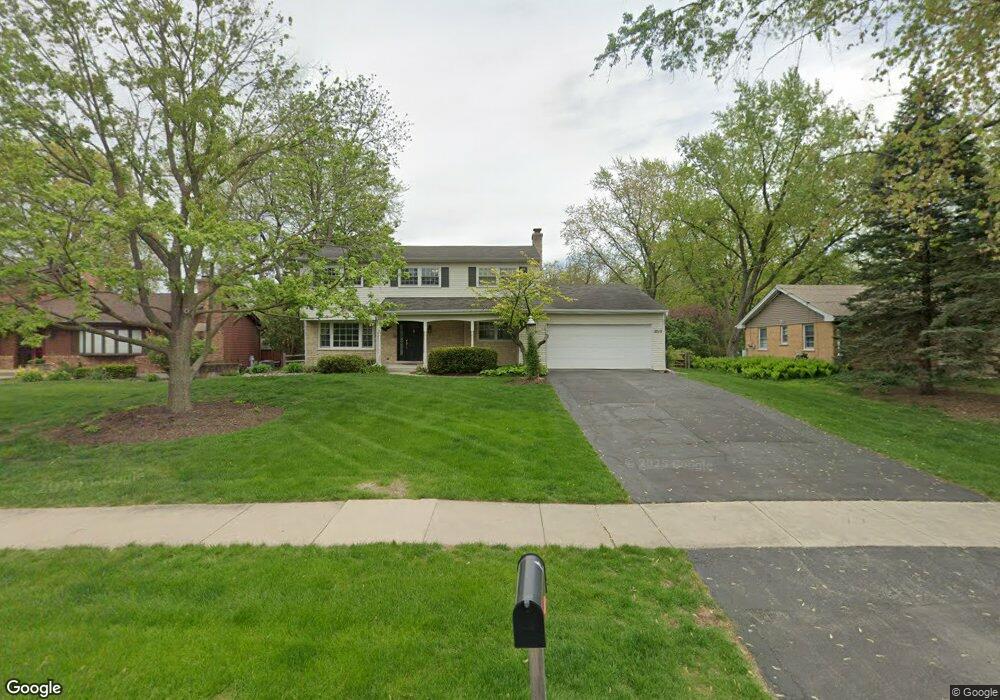
2019 Glencoe St Wheaton, IL 60187
Hawthorne NeighborhoodEstimated Value: $640,363 - $703,000
4
Beds
3
Baths
2,404
Sq Ft
$278/Sq Ft
Est. Value
About This Home
This home is located at 2019 Glencoe St, Wheaton, IL 60187 and is currently estimated at $667,591, approximately $277 per square foot. 2019 Glencoe St is a home located in DuPage County with nearby schools including Churchill Elementary School, Hadley Junior High School, and Glenbard West High School.
Ownership History
Date
Name
Owned For
Owner Type
Purchase Details
Closed on
Nov 6, 2007
Sold by
Ellis Andrew B and Ellis Suzanne J
Bought by
Ellis Andrew B and Ellis Suzanne J
Current Estimated Value
Purchase Details
Closed on
Nov 18, 2005
Sold by
White Alan R and White Victoria A
Bought by
Ellis Andrew B and Ellis Suzanne J
Home Financials for this Owner
Home Financials are based on the most recent Mortgage that was taken out on this home.
Original Mortgage
$359,650
Outstanding Balance
$200,893
Interest Rate
6.36%
Mortgage Type
Fannie Mae Freddie Mac
Estimated Equity
$466,698
Create a Home Valuation Report for This Property
The Home Valuation Report is an in-depth analysis detailing your home's value as well as a comparison with similar homes in the area
Home Values in the Area
Average Home Value in this Area
Purchase History
| Date | Buyer | Sale Price | Title Company |
|---|---|---|---|
| Ellis Andrew B | -- | None Available | |
| Ellis Andrew B | $460,000 | Atg |
Source: Public Records
Mortgage History
| Date | Status | Borrower | Loan Amount |
|---|---|---|---|
| Open | Ellis Andrew B | $359,650 |
Source: Public Records
Tax History
| Year | Tax Paid | Tax Assessment Tax Assessment Total Assessment is a certain percentage of the fair market value that is determined by local assessors to be the total taxable value of land and additions on the property. | Land | Improvement |
|---|---|---|---|---|
| 2024 | $12,577 | $184,862 | $44,412 | $140,450 |
| 2023 | $12,070 | $170,160 | $40,880 | $129,280 |
| 2022 | $11,639 | $160,810 | $38,630 | $122,180 |
| 2021 | $11,259 | $156,990 | $37,710 | $119,280 |
| 2020 | $11,092 | $155,530 | $37,360 | $118,170 |
| 2019 | $10,830 | $151,420 | $36,370 | $115,050 |
| 2018 | $10,294 | $142,670 | $34,270 | $108,400 |
| 2017 | $10,145 | $137,410 | $33,010 | $104,400 |
| 2016 | $10,281 | $131,920 | $31,690 | $100,230 |
| 2015 | $10,248 | $125,850 | $30,230 | $95,620 |
| 2014 | $10,469 | $124,540 | $29,540 | $95,000 |
| 2013 | $10,733 | $130,950 | $29,630 | $101,320 |
Source: Public Records
Map
Nearby Homes
- 831 Avon Ct
- 1906 N Summit St
- 835 Avon Ct
- 1603 Ashton Ct
- 2009 Mackenzie Place
- 300 Geneva Rd
- 1017 Tartan Ct
- 333 Elm St
- 1607 Stoddard Ave
- 511 Timber Ridge Dr Unit 202A
- 491 Timber Ridge Dr Unit 102
- 462 S President St Unit 302
- 464 S President St Unit 204
- 731 Western Ave
- 671 Prairie Ave
- 488 Newton Ave
- 412 Lawrence Ave
- 404 Lawrence Ave
- 465 Cottage Ave
- 266 Shorewood Dr Unit 2A
Your Personal Tour Guide
Ask me questions while you tour the home.