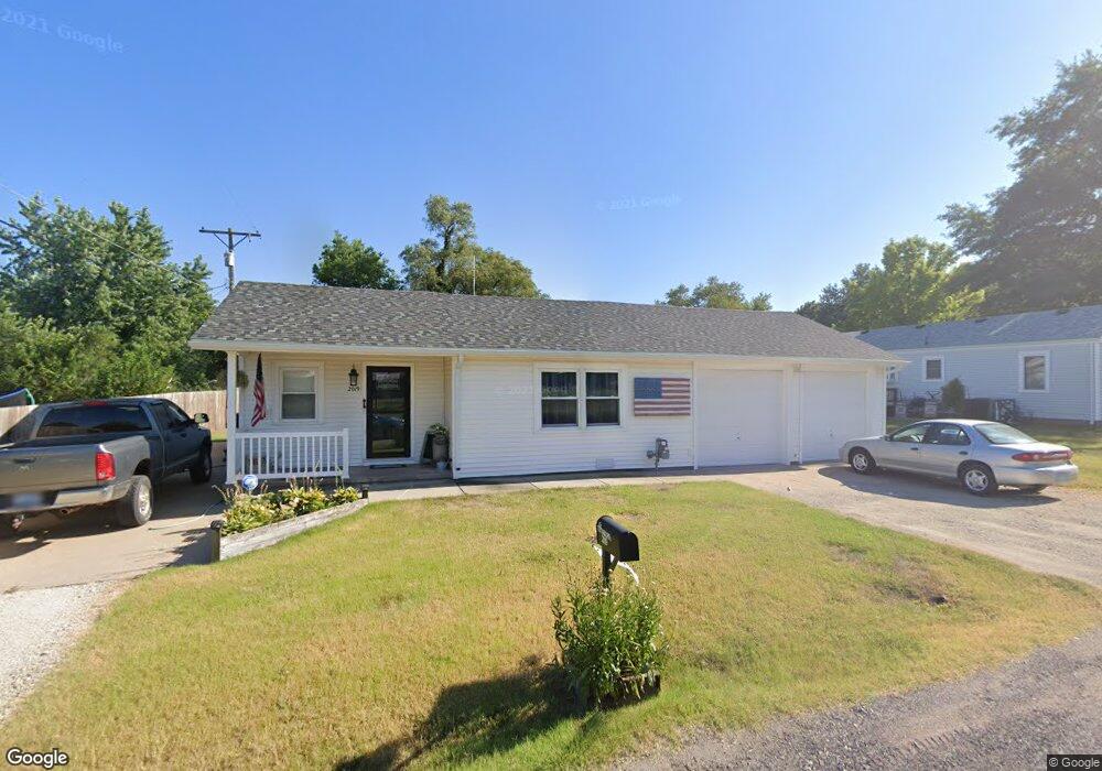
2019 W 4th Ave El Dorado, KS 67042
Estimated Value: $80,000 - $138,000
2
Beds
1
Bath
1,036
Sq Ft
$113/Sq Ft
Est. Value
About This Home
This home is located at 2019 W 4th Ave, El Dorado, KS 67042 and is currently estimated at $117,123, approximately $113 per square foot. 2019 W 4th Ave is a home located in Butler County with nearby schools including El Dorado High School.
Ownership History
Date
Name
Owned For
Owner Type
Purchase Details
Closed on
Nov 10, 2022
Sold by
Stoskopf Sheldon and Stoskopf Trina S
Bought by
Zeak Enterprises Llc
Current Estimated Value
Home Financials for this Owner
Home Financials are based on the most recent Mortgage that was taken out on this home.
Original Mortgage
$88,000
Outstanding Balance
$76,176
Interest Rate
0.61%
Mortgage Type
New Conventional
Estimated Equity
$40,947
Purchase Details
Closed on
Jun 27, 2014
Sold by
Sheldon Sheldon and Stoskopf Trina S
Bought by
Stoskopf Sheldon and Stoskopf Trina S
Create a Home Valuation Report for This Property
The Home Valuation Report is an in-depth analysis detailing your home's value as well as a comparison with similar homes in the area
Home Values in the Area
Average Home Value in this Area
Purchase History
| Date | Buyer | Sale Price | Title Company |
|---|---|---|---|
| Zeak Enterprises Llc | $110,000 | Kansas Secured Title | |
| Stoskopf Sheldon | -- | Security 1St Title |
Source: Public Records
Mortgage History
| Date | Status | Borrower | Loan Amount |
|---|---|---|---|
| Open | Zeak Enterprises Llc | $88,000 |
Source: Public Records
Tax History Compared to Growth
Tax History
| Year | Tax Paid | Tax Assessment Tax Assessment Total Assessment is a certain percentage of the fair market value that is determined by local assessors to be the total taxable value of land and additions on the property. | Land | Improvement |
|---|---|---|---|---|
| 2025 | $20 | $13,846 | $1,227 | $12,619 |
| 2024 | $20 | $13,005 | $920 | $12,085 |
| 2023 | $1,968 | $12,250 | $920 | $11,330 |
| 2022 | $0 | $8,809 | $920 | $7,889 |
| 2021 | $1,451 | $8,584 | $920 | $7,664 |
| 2020 | $1,592 | $9,183 | $920 | $8,263 |
| 2019 | $1,487 | $8,611 | $920 | $7,691 |
| 2018 | $1,393 | $8,050 | $920 | $7,130 |
| 2017 | $1,341 | $7,731 | $920 | $6,811 |
| 2014 | -- | $66,000 | $8,000 | $58,000 |
Source: Public Records
Map
Nearby Homes
- 229 Oil Hill Rd
- 240 State St
- 1727 W 5th Ave
- 153 Eunice St
- 424 N Arthur St
- 116 N Arthur St
- 1304 W 1st Ave
- 222 Millheisler Rd
- 1503 W Ash Ave
- 510 N Alleghany St
- 208 S Orchard St
- 728 Audrey Dr
- 620 Frazier St
- 503 N Summit St
- 629 N Summit St
- 323 Race St
- 111 S Summit St
- 525 Marmaton Rd
- 425 Race St
- 409 Houser Dr
- 436 Hillcrest St
- 429 Oil Hill Rd
- 425 Oil Hill Rd
- 423 Oil Hill Rd
- 410 Hillcrest St
- 437 Hillcrest St
- 431 Hillcrest St
- 423 Hillcrest St
- 406 Hillcrest St
- 415 Oil Hill Rd
- 501 Hillcrest St
- 507 Hillcrest St
- 415 Hillcrest St
- 2022 W 3rd Ave
- 525 Oil Hill Rd
- 405 Oil Hill Rd
- 517 Hillcrest St
- 442 State St
- 405 Hillcrest St
- 424 State St