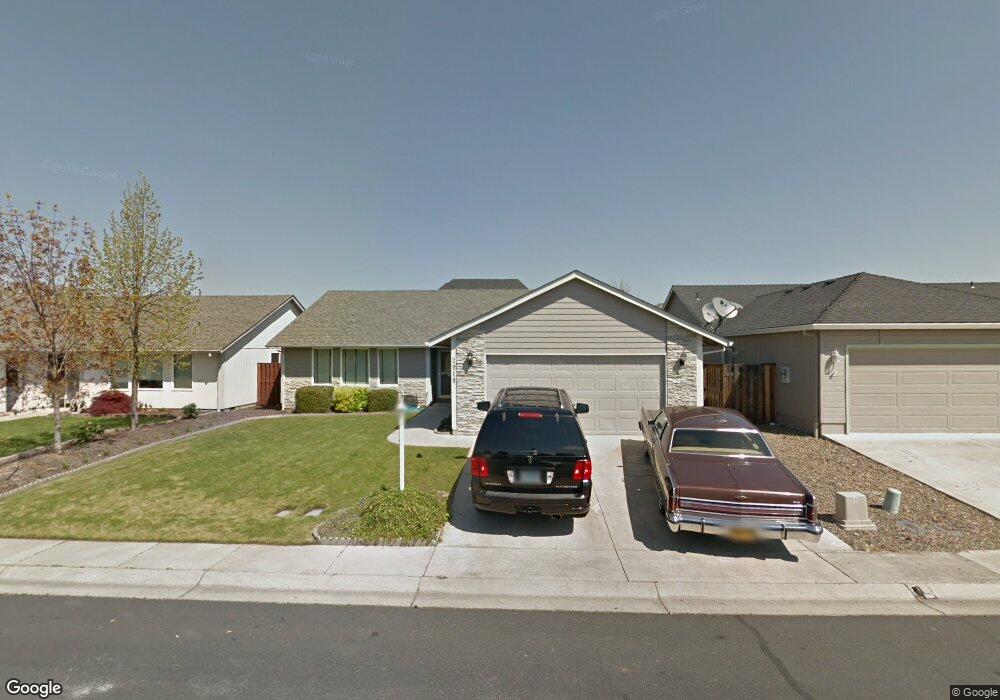
2019 Walnut Grove Ln Central Point, OR 97502
Estimated Value: $361,000 - $410,000
3
Beds
2
Baths
1,704
Sq Ft
$230/Sq Ft
Est. Value
About This Home
This home is located at 2019 Walnut Grove Ln, Central Point, OR 97502 and is currently estimated at $391,297, approximately $229 per square foot. 2019 Walnut Grove Ln is a home located in Jackson County with nearby schools including Jewett Elementary School, Scenic Middle School, and Crater High School.
Ownership History
Date
Name
Owned For
Owner Type
Purchase Details
Closed on
Nov 10, 2011
Sold by
Lusk Cindi L
Bought by
Cala Thomas C and Cala Patricia M
Current Estimated Value
Purchase Details
Closed on
Jan 15, 2003
Sold by
Duncan Development Llc
Bought by
Lusk Cindi L
Home Financials for this Owner
Home Financials are based on the most recent Mortgage that was taken out on this home.
Original Mortgage
$117,000
Interest Rate
5.96%
Create a Home Valuation Report for This Property
The Home Valuation Report is an in-depth analysis detailing your home's value as well as a comparison with similar homes in the area
Home Values in the Area
Average Home Value in this Area
Purchase History
| Date | Buyer | Sale Price | Title Company |
|---|---|---|---|
| Cala Thomas C | $146,500 | Ticor Title Company Oregon | |
| Lusk Cindi L | $158,000 | Amerititle |
Source: Public Records
Mortgage History
| Date | Status | Borrower | Loan Amount |
|---|---|---|---|
| Previous Owner | Lusk Cindi L | $117,000 |
Source: Public Records
Tax History Compared to Growth
Tax History
| Year | Tax Paid | Tax Assessment Tax Assessment Total Assessment is a certain percentage of the fair market value that is determined by local assessors to be the total taxable value of land and additions on the property. | Land | Improvement |
|---|---|---|---|---|
| 2025 | $3,724 | $223,960 | $79,640 | $144,320 |
| 2024 | $3,724 | $217,440 | $77,320 | $140,120 |
| 2023 | $3,604 | $211,110 | $75,070 | $136,040 |
| 2022 | $3,520 | $211,110 | $75,070 | $136,040 |
| 2021 | $3,419 | $204,970 | $72,880 | $132,090 |
| 2020 | $3,319 | $199,000 | $70,760 | $128,240 |
| 2019 | $3,238 | $187,590 | $66,700 | $120,890 |
| 2018 | $3,139 | $182,130 | $64,760 | $117,370 |
| 2017 | $3,060 | $182,130 | $64,760 | $117,370 |
| 2016 | $2,971 | $171,680 | $61,050 | $110,630 |
| 2015 | $2,846 | $171,680 | $61,050 | $110,630 |
| 2014 | -- | $161,830 | $57,540 | $104,290 |
Source: Public Records
Map
Nearby Homes
- 1409 Twin Rocks Dr
- 2225 New Haven Dr
- 2248 Evan Way
- 4922 Gebhard Rd
- 2035 Rabun Way
- 2330 Savannah Dr
- 4730 Gebhard Rd
- 1121 Annalise St
- 2598 St James Way
- 1113 Annalise St
- 705 Mountain Ave
- 446 Beebe Rd
- 225 Wilson Rd
- 2770 Parkwood Village Ln
- 4595 Table Rock Rd
- 4286 Hamrick Rd
- 0 Peninger Rd
- 1600 E Pine St
- 201 Orchardview Cir
- 1840 E Pine St
- 2023 Walnut Grove Ln
- 2015 Walnut Grove Ln
- 2023 Walnut Creek
- 2027 Walnut Grove Ln
- 1939 Walnut Grove Ln
- 2000 Bluegrass Dr
- 2010 Bluegrass Dr
- 1990 Bluegrass Dr
- 1918 Walnut Grove Ln
- 2031 Walnut Grove Ln Unit 35
- 2031 Walnut Grove Ln
- 1935 Walnut Grove Ln
- 2020 Bluegrass Dr
- 1916 Walnut Grove Ln
- 1980 Bluegrass Dr
- 1414 Pheasant Way
- 1323 Twin Rocks Dr
- 1912 Walnut Grove Ln
- 2035 Walnut Grove Ln
- 1931 Walnut Grove Ln