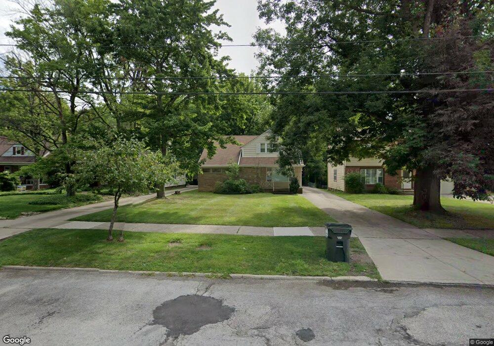
2019 Wrenford Rd Cleveland, OH 44121
Estimated Value: $208,611 - $239,000
4
Beds
2
Baths
2,013
Sq Ft
$112/Sq Ft
Est. Value
About This Home
This home is located at 2019 Wrenford Rd, Cleveland, OH 44121 and is currently estimated at $224,653, approximately $111 per square foot. 2019 Wrenford Rd is a home located in Cuyahoga County with nearby schools including Rowland Elementary School, Greenview Upper Elementary School, and Memorial Junior High School.
Ownership History
Date
Name
Owned For
Owner Type
Purchase Details
Closed on
Jan 23, 2006
Sold by
Fishman Sherry R
Bought by
Fishman Sherry R
Current Estimated Value
Purchase Details
Closed on
Nov 5, 1997
Sold by
Millstein Marc
Bought by
Fishman Sherry R
Purchase Details
Closed on
Feb 9, 1993
Sold by
Millstein Bernard H
Bought by
Millstein Bernard Htrustee
Purchase Details
Closed on
Jan 17, 1989
Bought by
Millstein Bernard H
Purchase Details
Closed on
Nov 24, 1987
Sold by
Millstein Celia
Bought by
Millstein Norman, Trs
Purchase Details
Closed on
Jun 7, 1985
Sold by
Millstein Celia
Bought by
Millstein Celia
Purchase Details
Closed on
Jan 1, 1975
Bought by
Millstein Celia
Create a Home Valuation Report for This Property
The Home Valuation Report is an in-depth analysis detailing your home's value as well as a comparison with similar homes in the area
Home Values in the Area
Average Home Value in this Area
Purchase History
| Date | Buyer | Sale Price | Title Company |
|---|---|---|---|
| Fishman Sherry R | -- | None Available | |
| Fishman Sherry R | $115,000 | -- | |
| Millstein Bernard Htrustee | -- | -- | |
| Millstein Bernard H | -- | -- | |
| Millstein Norman, Trs | -- | -- | |
| Millstein Celia | -- | -- | |
| Millstein Celia | -- | -- |
Source: Public Records
Tax History Compared to Growth
Tax History
| Year | Tax Paid | Tax Assessment Tax Assessment Total Assessment is a certain percentage of the fair market value that is determined by local assessors to be the total taxable value of land and additions on the property. | Land | Improvement |
|---|---|---|---|---|
| 2024 | $4,050 | $62,370 | $11,550 | $50,820 |
| 2023 | $3,286 | $43,230 | $8,400 | $34,830 |
| 2022 | $3,306 | $43,225 | $8,400 | $34,825 |
| 2021 | $3,280 | $43,230 | $8,400 | $34,830 |
| 2020 | $2,908 | $35,140 | $6,830 | $28,320 |
| 2019 | $2,661 | $100,400 | $19,500 | $80,900 |
| 2018 | $2,555 | $35,140 | $6,830 | $28,320 |
| 2017 | $2,536 | $31,820 | $5,570 | $26,250 |
| 2016 | $2,521 | $31,820 | $5,570 | $26,250 |
| 2015 | $2,606 | $31,820 | $5,570 | $26,250 |
| 2014 | $2,606 | $33,500 | $5,850 | $27,650 |
Source: Public Records
Map
Nearby Homes
- 4249 Wyncote Rd
- 4237 Verona Rd
- 4206 Verona Rd
- 2108 S Belvoir Blvd
- 2091 S Belvoir Blvd
- 4197 Okalona Rd
- 4158 Wyncote Rd
- 4194 Stilmore Rd
- 1940 Temblethurst Rd
- 14213 Cedar Rd
- 4210 Stonehaven Rd
- 1895 Temblethurst Rd
- 2015 S Green Rd
- 4084 Okalona Rd
- 4233 Bayard Rd
- 2243 Wrenford Rd
- 4124 Bayard Rd
- 4019 Okalona Rd
- 4532 Mackall Rd
- 4121 Hinsdale Rd
- 2015 Wrenford Rd
- 2025 Wrenford Rd
- 2011 Wrenford Rd
- 2031 Wrenford Rd
- 2005 Wrenford Rd
- 2035 Wrenford Rd
- 4253 Eastway Rd
- 1999 Wrenford Rd
- 4247 Eastway Rd
- 2024 S Belvoir Blvd
- 4250 Wyncote Rd
- 2014 S Belvoir Blvd
- 1995 Wrenford Rd
- 2047 Wrenford Rd
- 2034 S Belvoir Blvd
- 4241 Eastway Rd
- 4254 Eastway Rd
- 4246 Wyncote Rd
- 2004 S Belvoir Blvd
- 4250 Eastway Rd