Estimated payment $1,500/month
About This Home
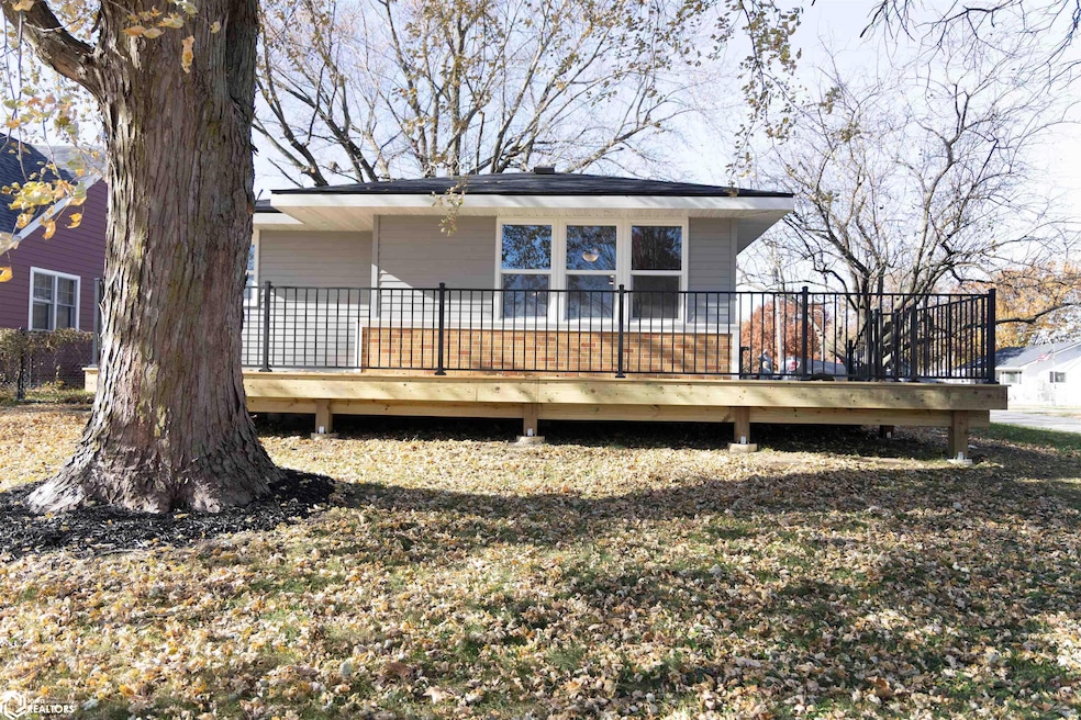
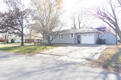
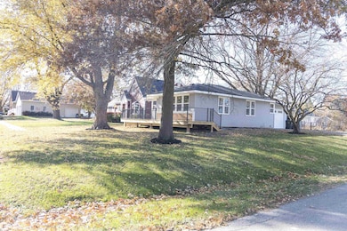
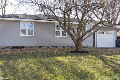
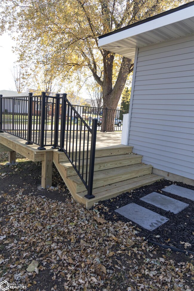
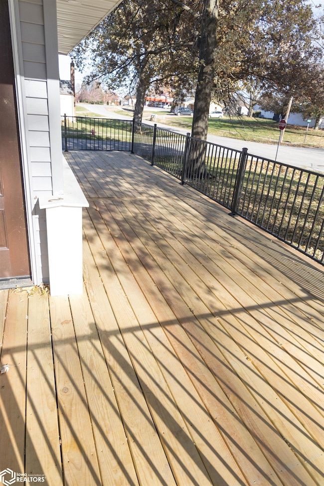
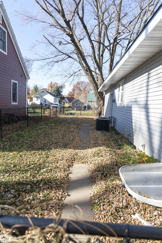
This beautifully renovated home offers modern comfort and turnkey convenience. Every detail has been thoughtfully upgraded, including a brand-new central heating and air system for year-round climate control. The exterior features a new roof, gutters, windows, siding, and doors, enhancing both curb appeal and energy efficiency. Inside, you'll find stylish new flooring throughout and an updated kitchen with fresh cabinetry and fixtures, perfect for cooking and entertaining. The bathroom and basement have been completely remodeled to provide a sleek, contemporary feel. Electrical upgrades include a new 200 amp panel for improved power capacity and safety. Step outside to a spacious, newly built deck ideal for relaxing or hosting gatherings, plus a fully fenced yard that makes a safe, fun space for pets. This house effortlessly combines modern upgrades with a comfortable, inviting layout — ready for you to make it your new home.
Home Details
Home Type
- Single Family
Year Built
- Built in 1962
Parking
- 1
Additional Features
- Lot Dimensions are 66.00 x 132.00
- Forced Air Heating System
- Basement
Map
Tax History
| Year | Tax Paid | Tax Assessment Tax Assessment Total Assessment is a certain percentage of the fair market value that is determined by local assessors to be the total taxable value of land and additions on the property. | Land | Improvement |
|---|---|---|---|---|
| 2025 | $1,520 | $139,200 | $16,500 | $122,700 |
| 2024 | $1,520 | $119,120 | $16,500 | $102,620 |
| 2023 | $1,592 | $119,120 | $16,500 | $102,620 |
| 2022 | $1,472 | $97,200 | $16,500 | $80,700 |
| 2021 | $1,348 | $90,180 | $16,500 | $73,680 |
| 2020 | $1,348 | $78,000 | $10,390 | $67,610 |
| 2019 | $1,214 | $0 | $0 | $0 |
| 2018 | $1,214 | $0 | $0 | $0 |
| 2017 | $1,234 | $0 | $0 | $0 |
| 2016 | $1,234 | $0 | $0 | $0 |
| 2015 | $1,186 | $0 | $0 | $0 |
| 2014 | $1,190 | $0 | $0 | $0 |
Property History
| Date | Event | Price | List to Sale | Price per Sq Ft |
|---|---|---|---|---|
| 03/26/2026 03/26/26 | Pending | -- | -- | -- |
| 11/17/2025 11/17/25 | For Sale | $255,000 | -- | $155 / Sq Ft |
Purchase History
| Date | Type | Sale Price | Title Company |
|---|---|---|---|
| Warranty Deed | $140,000 | None Listed On Document |
Mortgage History
| Date | Status | Loan Amount | Loan Type |
|---|---|---|---|
| Open | $207,000 | Credit Line Revolving |
Source: NoCoast MLS
MLS Number: NOC6333770
APN: 20-08-132-003
Disclaimer: Certain information contained herein is derived from information provided by parties other than Homes.com. All information provided is deemed reliable, but is not guaranteed to be accurate and should be independently verified.
![]() Based on information submitted to the MLS GRID. All data is obtained from various sources and may not have been verified by broker or MLS GRID. Supplied Open House Information is subject to change without notice. All information should be independently reviewed and verified for accuracy. Properties may or may not be listed by the office/agent presenting the information. Some IDX listings have been excluded from this website. IDX information is provided exclusively for personal, non-commercial use, and may not be used for any purpose other than to identify prospective properties consumers may be interested in purchasing.
Based on information submitted to the MLS GRID. All data is obtained from various sources and may not have been verified by broker or MLS GRID. Supplied Open House Information is subject to change without notice. All information should be independently reviewed and verified for accuracy. Properties may or may not be listed by the office/agent presenting the information. Some IDX listings have been excluded from this website. IDX information is provided exclusively for personal, non-commercial use, and may not be used for any purpose other than to identify prospective properties consumers may be interested in purchasing.
Information is deemed reliable but not guaranteed.
Based on information submitted to the MLS GRID
- 707 4th St
- 705 N 2nd St
- 205 N 8th Ave
- 702 10th Ave
- 11790 Highway F62 E
- 13590 Highway F 62 None E
- 13214 S 112th Ave E
- 504 Cross St
- 207 East St
- 700 Highway T38 S
- 309 Hillside Dr
- 7340 E 156th St S
- 11422 S 44th Ave E
- Parcel B None
- 5029 E 156th St S
- 7404 Sioux Ave
- 6657 E 78th St S
- 5122 E 84th St S
- 304 3rd St
- 300 Center St

Ask me questions while you tour the home.