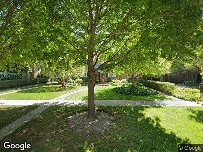
202 Abingdon Ave Kenilworth, IL 60043
Kenilworth NeighborhoodEstimated Value: $1,797,000 - $1,910,000
4
Beds
3
Baths
3,204
Sq Ft
$582/Sq Ft
Est. Value
About This Home
This home is located at 202 Abingdon Ave, Kenilworth, IL 60043 and is currently estimated at $1,864,788, approximately $582 per square foot. 202 Abingdon Ave is a home located in Cook County with nearby schools including The Joseph Sears School, New Trier Township High School, and New Trier Township High School - Northfield.
Ownership History
Date
Name
Owned For
Owner Type
Purchase Details
Closed on
Feb 27, 2004
Sold by
Lasalle Bank Na
Bought by
Mcmenamin J Robert and Mcmenamin Patricia A
Current Estimated Value
Purchase Details
Closed on
Aug 22, 1995
Sold by
Taylor Robert and Taylor Charlene
Bought by
Lasalle National Trust Na
Create a Home Valuation Report for This Property
The Home Valuation Report is an in-depth analysis detailing your home's value as well as a comparison with similar homes in the area
Home Values in the Area
Average Home Value in this Area
Purchase History
| Date | Buyer | Sale Price | Title Company |
|---|---|---|---|
| Mcmenamin J Robert | -- | -- | |
| Lasalle National Trust Na | $575,000 | -- |
Source: Public Records
Mortgage History
| Date | Status | Borrower | Loan Amount |
|---|---|---|---|
| Open | Mcmenamin J Robert | $600,000 | |
| Closed | Mcmenamin J Robert | $460,000 |
Source: Public Records
Tax History Compared to Growth
Tax History
| Year | Tax Paid | Tax Assessment Tax Assessment Total Assessment is a certain percentage of the fair market value that is determined by local assessors to be the total taxable value of land and additions on the property. | Land | Improvement |
|---|---|---|---|---|
| 2024 | $27,544 | $122,725 | $32,340 | $90,385 |
| 2023 | $27,544 | $122,725 | $32,340 | $90,385 |
| 2022 | $27,544 | $122,725 | $32,340 | $90,385 |
| 2021 | $27,747 | $99,971 | $23,716 | $76,255 |
| 2020 | $27,032 | $99,971 | $23,716 | $76,255 |
| 2019 | $29,624 | $123,457 | $23,716 | $99,741 |
| 2018 | $23,135 | $95,968 | $20,482 | $75,486 |
| 2017 | $22,478 | $95,968 | $20,482 | $75,486 |
| 2016 | $24,500 | $108,240 | $20,482 | $87,758 |
| 2015 | $23,669 | $92,964 | $16,709 | $76,255 |
| 2014 | $23,074 | $92,964 | $16,709 | $76,255 |
| 2013 | $27,273 | $115,552 | $16,709 | $98,843 |
Source: Public Records
Map
Nearby Homes
- 159 Abingdon Ave
- 139 Abingdon Ave
- 132 Tudor Place
- 81 Robsart Rd
- 1222 Chestnut Ave
- 111 Oxford Rd
- 306 Oxford Rd
- 1630 Sheridan Rd Unit 8K
- 1630 Sheridan Rd Unit 4M
- 1630 Sheridan Rd Unit 5K
- 1616 Sheridan Rd Unit 2E
- 1500 Sheridan Rd Unit 1G
- 1500 Sheridan Rd Unit 9B
- 338 Woodstock Ave
- 329 Raleigh Rd
- 1420 Sheridan Rd Unit 8A
- 1410 Sheridan Rd Unit 7B
- 1410 Sheridan Rd Unit 2B
- 1321 Sheridan Rd
- 1118 Forest Ave
- 202 Abingdon Ave
- 166 Abingdon Ave
- 210 Abingdon Ave
- 121 Robsart Rd
- 162 Abingdon Ave
- 127 Robsart Rd
- 115 Robsart Rd
- 156 Abingdon Ave
- 211 Abingdon Ave
- 111 Robsart Rd
- 163 Abingdon Ave
- 148 Tudor Place
- 150 Abingdon Ave
- 154 Warwick Ln
- 107 Robsart Rd
- 124 Robsart Rd
- 120 Robsart Rd
- 128 Robsart Rd
- 141 Robsart Place
- 116 Robsart Rd
