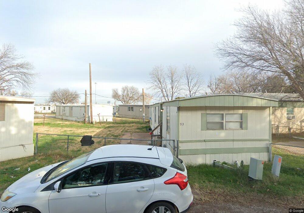
202 Arnold Blvd Unit 36 Abilene, TX 79605
Dyess Air Force Base NeighborhoodEstimated Value: $46,000
2
Beds
1
Bath
750
Sq Ft
$61/Sq Ft
Est. Value
About This Home
This home is located at 202 Arnold Blvd Unit 36, Abilene, TX 79605 and is currently estimated at $46,000, approximately $61 per square foot. 202 Arnold Blvd Unit 36 is a home located in Taylor County with nearby schools including Dyess Elementary School, Clack Middle School, and Cooper High School.
Ownership History
Date
Name
Owned For
Owner Type
Purchase Details
Closed on
Oct 12, 2006
Sold by
Beitscher Seymour
Bought by
Mize Tommy R
Current Estimated Value
Home Financials for this Owner
Home Financials are based on the most recent Mortgage that was taken out on this home.
Original Mortgage
$30,600
Outstanding Balance
$18,239
Interest Rate
6.44%
Mortgage Type
Seller Take Back
Estimated Equity
$27,761
Create a Home Valuation Report for This Property
The Home Valuation Report is an in-depth analysis detailing your home's value as well as a comparison with similar homes in the area
Home Values in the Area
Average Home Value in this Area
Purchase History
| Date | Buyer | Sale Price | Title Company |
|---|---|---|---|
| Mize Tommy R | -- | None Available |
Source: Public Records
Mortgage History
| Date | Status | Borrower | Loan Amount |
|---|---|---|---|
| Open | Mize Tommy R | $30,600 |
Source: Public Records
Tax History
| Year | Tax Paid | Tax Assessment Tax Assessment Total Assessment is a certain percentage of the fair market value that is determined by local assessors to be the total taxable value of land and additions on the property. | Land | Improvement |
|---|---|---|---|---|
| 2025 | $14,051 | $626,076 | $83,962 | $542,114 |
| 2023 | $14,051 | $598,536 | $83,962 | $514,574 |
| 2022 | $8,647 | $340,578 | $83,962 | $256,616 |
| 2021 | $8,469 | $313,956 | $83,962 | $229,994 |
| 2020 | $8,562 | $312,120 | $83,962 | $228,158 |
| 2019 | $7,471 | $289,170 | $83,962 | $205,208 |
| 2018 | $6,150 | $238,677 | $83,962 | $154,715 |
| 2017 | $5,620 | $226,095 | $83,962 | $142,133 |
| 2016 | $4,497 | $180,913 | $83,962 | $96,951 |
| 2015 | $4,113 | $169,721 | $72,770 | $96,951 |
| 2014 | $4,113 | $169,721 | $0 | $0 |
Source: Public Records
Map
Nearby Homes
- 5417 Encino Rd
- 6216 Waldemar St
- 5349 Encino Rd
- 6164 Hartford St
- 5281 Taos Dr
- 5850 Hartford St Unit LOT 79
- 5250 Taos Dr
- 34 Shady Brook Cir
- 5131 Durango Dr
- 5348 Fairmont St
- 5301 N 10th St
- 5333 Fairmont St
- 5226 N 9th St
- 5317 Fairmont St
- 4918 S 5th St
- 4802 S 6th St
- 4809 State St
- 218 N San Jose Dr
- 617 S San Jose Dr
- 625 S San Jose Dr
- 202 Arnold Blvd Unit 75
- 202 Arnold Blvd Unit 226
- 202 Arnold Blvd Unit 85
- 202 Arnold Blvd Unit 22
- 202 Arnold Blvd Unit 308
- 202 Arnold Blvd Unit 223
- 202 Arnold Blvd Unit 107
- 202 Arnold Blvd Unit 34
- 202 Arnold Blvd Unit 206
- 202 Arnold Blvd Unit 214
- 202 Arnold Blvd Unit 306
- 202 Arnold Blvd Unit 303
- 202 Arnold Blvd Unit 72
- 202 Arnold Blvd Unit 216
- 202 Arnold Blvd Unit 403
- 202 Arnold Blvd Unit 21
- 202 Arnold Blvd Unit 311
- 202 Arnold Blvd Unit 406
- 202 Arnold Blvd Unit 79
- 202 Arnold Blvd Unit 213
Your Personal Tour Guide
Ask me questions while you tour the home.